Home
States
Colorado
Connecticut
Maine
Massachusetts
New Hampshire
New York
Rhode Island
Utah
Vermont
View All
Lists
NE 4,000 Footers
NE 100 Highest
NH 4,000 Footers
NH 100 Highest
NH 52 With A View
NH Belknap Range
NH Ossipee 10
Links
Trail Conditions
Trip Log
Sunrises
Sunsets
About
|
Todd Mountain
Clark Mountain
Charlemont, MA, and Florida, MA
Trailheads, measurements, times, distances, and maps are all approximate and relative to the hike(s) as shown below.

Indian Trail to Todd Mountain Summit
The Mohawk Trail State Forest, located mostly in Charlemont, MA, is an active operation with a variety of hiking trails.
In trying to find the trailhead to the Indian Trail, I made the bad decision of deviating from the map and going where lots of hikers were coming from. I ended up pretty far out of my way on some flat, lame 'Nature Trail' (apparently this leads to the Mahican-Mohawk Trail on the north side of Todd Mountain).
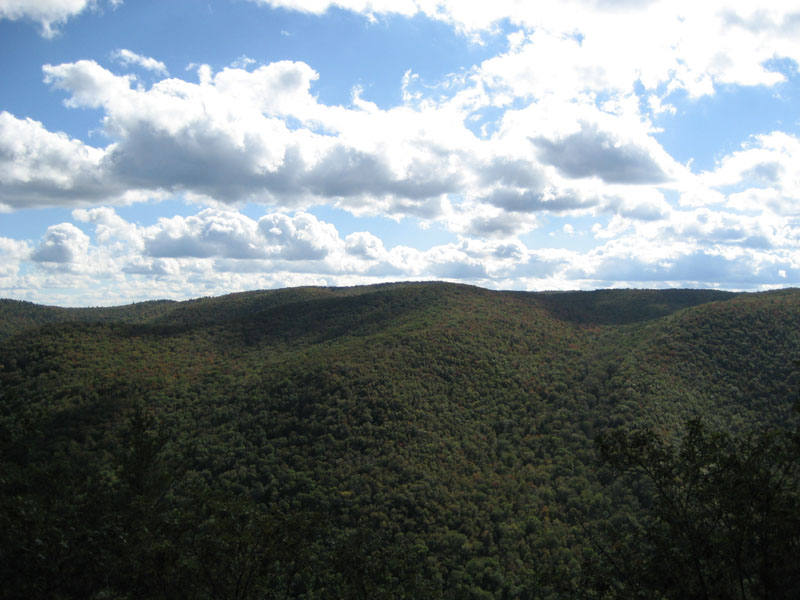
From the Indian Trail, Todd Mountain is a fairly steep climb at first, leveling off signifcantly when the trail merges with the Mahican-Mohawk Trail on the ridge. The trail to Todd Mountain has numerous southernly views - nice because, other than a distant tower (Borden Mountain), there is absolutely no sign of human life on the mountains to the south.
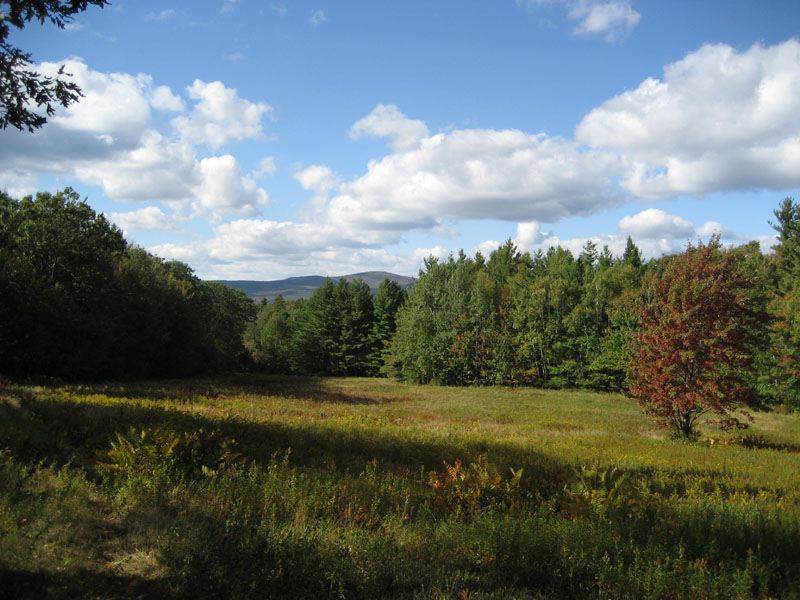
Clark Mountain stands west of Todd Mountain. While maps show trails leading to its summit, it's not true. The summit is all natural and has no views. There is, however, a halfway decent view northwest of Clark Mountain where the Mahican-Mohawk Trail goes into a set of fields.
| Hike Ratings |
|
Getting To Trailhead: |
Easy |
| Destination: |
Todd Mountain |
|
Length: |
Moderate |
|
Steepness: |
Difficult |
|
Navigation: |
Easy |
|
Views: |
Excellent |
|
Crowds: |
Minimal |
| Destination: |
Clark Mountain |
|
Length: |
Difficult |
|
Steepness: |
Easy |
|
Navigation: |
Moderate |
|
Views: |
Minimal |
|
Crowds: |
Minimal |
|
| Hike Stats |
|
Date Hiked: |
Tuesday, September 26, 2006 |
| Hike Commenced: |
1:26 PM |
| Parking Elevation: |
696' |
| Destination: |
Todd Mountain |
| Ascent Commenced: |
2:13 PM at Indian Trail trailhead |
| Summit Reached: |
2:44 PM |
| Trailhead Elevation: |
780' |
| Summit Elevation: |
1,711' |
| Vertical Gain: |
981' |
| Destination: |
Clark Mountain |
| Ascent Commenced: |
2:53 PM at Todd Mountain |
| Summit Reached: |
3:43 PM |
| Trailhead Elevation: |
1,711' |
| Summit Elevation: |
1,920' |
| Vertical Gain: |
585' |
| Hike Ended: |
4:49 PM |
| Hike Vertical Gain: |
2,130' |
|

Sign for the Indian Trail to Todd Mountain

Looking south from the Todd Mountain summit

Mahican-Mohawk Trail to Clark Mountain

Looking northwest at Crum Hill (highest point in Franklin County), northwest of Clark Mountain summit along the Mahican-Mohawk Trail


Directions to trailhead: Park at in the dirt parking lot next to the main entrance to Mohawk Trail State Forest (to avoid paying the $5 entrance fee). Walk straight up the paved road, following the signs to the campground. There's a sign for the trail on the right side of the road just before it wraps back around, about 10 minutes from the parking lot.
Back to Todd Mountain profile
Back to Clark Mountain profile
|