Home
States
Colorado
Connecticut
Maine
Massachusetts
New Hampshire
New York
Rhode Island
Utah
Vermont
View All
Lists
NE 4,000 Footers
NE 100 Highest
NH 4,000 Footers
NH 100 Highest
NH 52 With A View
NH Belknap Range
NH Ossipee 10
Links
Trail Conditions
Trip Log
Sunrises
Sunsets
About
|
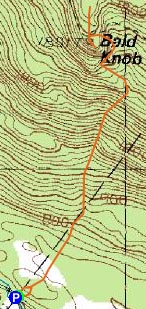
Bald Knob
Moultonborough, NH, Tuftonboro, NH
Trailheads, measurements, times, distances, and maps are all approximate and relative to the hike(s) as shown below.
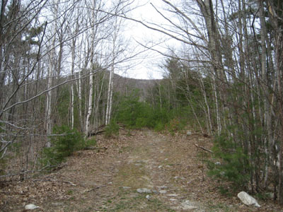
Looking down the Bald Knob Trail
Route: Bald Knob Trail
With not too much time to spare, I decided to try a quick hike up Bald Knob in the Ossipee Mountains.
I found this trailhead by accident one day when I was scouting out the Castle in the Clouds hiking trailhead. Located on the Moultonboro/Tuftonboro border, the Bald Knob Trail trailhead does not have a sign for itself - rather, it begins at the Welcome to Moultonboro sign.
From here, it coasts over some gentle terrain for awhile - though lacking signage and consistant blazes, I was able to follow a well-worn footpath.
After crossing a brook, things steepen up. Though nothing overly scary, portions of the Bald Knob Trail from Route 171 are steep. Also, again due to the lack of signage and pronounced blazes, as well as some big blow downs, the trail was hard to follow in a few places.
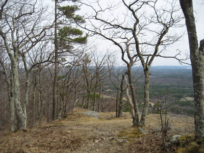
After reaching the conservation property border and a nice view point, the trail levels out for a bit, before a steep ascent to the actual Bald Knob area.
Knowing there was a lower knob, I decided to continue up the hill a bit more, but eventually turned around upon seeing a bench down below. While there were nice views up here, the real Bald Knob awaited me down below.
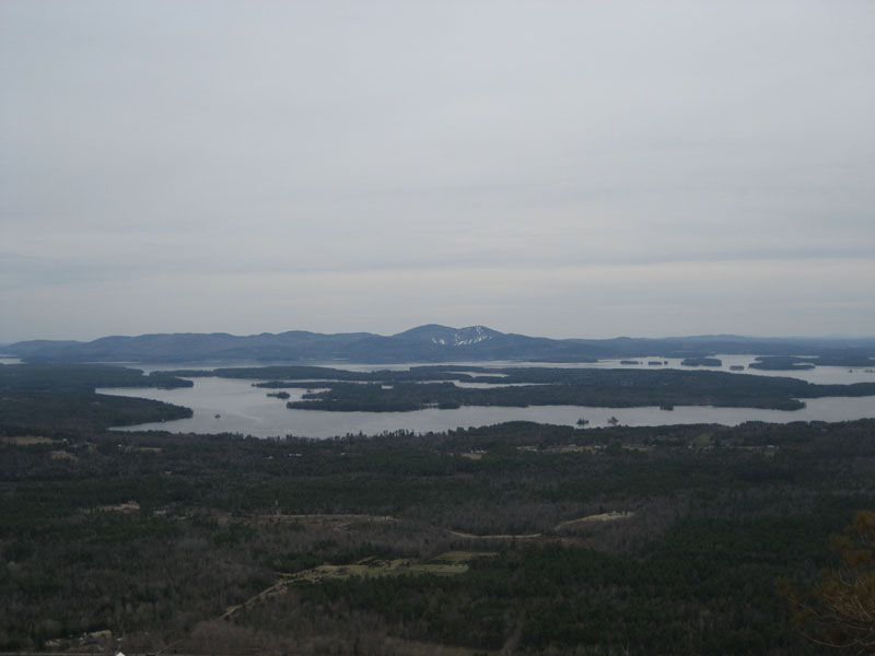
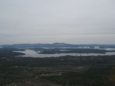
Bald Knob offers excellent views of the Lake Winnipesaukee, the Belknap rage, and some of the southern White Mountains.
All in all, it was a nice quick but worthwhile workout. There was no sign of snow or any sizable amount of mud on the trail. Though cloudy (contrary to that party sunny forecast), the views were still rather strong. Definitely worth another visit.
| Hike Ratings |
|
Getting To Trailhead: |
Easy |
| Destination: |
Bald Knob |
|
Length: |
Moderate |
|
Steepness: |
Difficult |
|
Navigation: |
Moderate |
|
Views: |
Excellent |
|
Crowds: |
Minimal |
|
| Hike Stats |
|
Date Hiked: |
Thursday, April 26, 2007 |
| Parking Elevation: |
710' |
| Destination: |
Bald Knob |
| Time Elapsed: |
00:31 |
| Trailhead Elevation: |
710' |
| Summit Elevation: |
1,801' |
| Distance: |
1.1 miles |
| Vertical Gain: |
1,221' |
|
|
| Hike Time Elapsed: |
01:20 |
| Hike Vertical Gain: |
1,281' |
|
Bald Knob Trail trailhead
Looking southwest at Belknap Mountain and Gunstock Mountain from Bald Knob.

Directions to trailhead: Take Route 109 South from Route 25. Bear left onto Route 171. Shortly after the main Castle in the Clouds entrance, you will arrive at the Moultonboro/Tuftonboro border. The trailhead is next to the Welcome to Moultonboro sign.
Back to Bald Knob Profile
|