Home
States
Colorado
Connecticut
Maine
Massachusetts
New Hampshire
New York
Rhode Island
Utah
Vermont
View All
Lists
NE 4,000 Footers
NE 100 Highest
NH 4,000 Footers
NH 100 Highest
NH 52 With A View
NH Belknap Range
NH Ossipee 10
Links
Trail Conditions
Trip Log
Sunrises
Sunsets
About
|
Bald Knob
Moultonborough, NH, Tuftonboro, NH
Trailheads, measurements, times, distances, and maps are all approximate and relative to the hike(s) as shown below.

Looking up the Bald Knob Trail
Route: Bald Knob Trail
Getting out of work a little bit late, I decided to stay somewhat local and do a shorter hike. Wanting lake views, I originally considered Red Hill, but soon turned onto 171 and headed to the Bald Knob Trail.
Other than the traditionally wet lowpoint of the trail, the Bald Knob Trail was fairly dry. Though there were a few blowdowns, I was able to clean up a few. Hiking in new shoes, I felt like I was walking like Herman Munster.
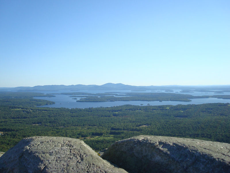
The views from the top were tremendous - the Lake Winnipesaukee had a great blue glow. After spending awhile enjoying the scenery, I headed down.
Another nice Bald Knob hike.
| Hike Ratings |
|
Getting To Trailhead: |
Easy |
| Destination: |
Bald Knob |
|
Length: |
Moderate |
|
Steepness: |
Difficult |
|
Navigation: |
Moderate |
|
Views: |
Excellent |
|
Crowds: |
Minimal |
|
| Hike Stats |
|
Date Hiked: |
Wednesday, September 10, 2008 |
| Parking Elevation: |
710' |
| Destination: |
Bald Knob |
| Time Elapsed: |
00:35 |
| Trailhead Elevation: |
710' |
| Summit Elevation: |
1,801' |
| Distance: |
1.1 miles |
| Vertical Gain: |
1,116' |
|
|
| Hike Time Elapsed: |
01:33 |
| Hike Vertical Gain: |
1,141' |
|

Bald Knob Trail trailhead

A colorful Gentian on the side of the Bald Knob Trail

Looking southwest at Belknap Mountain and Gunstock Mountain from Bald Knob.


Directions to trailhead: Take Route 109 South from Route 25. Bear left onto Route 171. Shortly after the main Castle in the Clouds entrance, you will arrive at the Moultonboro/Tuftonboro border. The trailhead is next to the Welcome to Moultonboro sign.
Back to Bald Knob Profile
|