Home
States
Colorado
Connecticut
Maine
Massachusetts
New Hampshire
New York
Rhode Island
Utah
Vermont
View All
Lists
NE 4,000 Footers
NE 100 Highest
NH 4,000 Footers
NH 100 Highest
NH 52 With A View
NH Belknap Range
NH Ossipee 10
Links
Trail Conditions
Trip Log
Sunrises
Sunsets
About
|
Bald Knob
Moultonborough, NH
Trailheads, measurements, times, distances, and maps are all approximate and relative to the hike(s) as shown below.
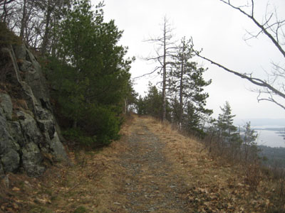
Looking up the Bald Knob Trail
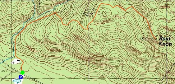
Route: Shannon Brook Trail, Bald Knob Cutoff, Bald Knob Trail, (Bald Knob), Bald Knob Trail, Bald Knob Cutoff, Shannon Brook Trail
With limited time between rain storms, I decided to do a jog up Bald Knob. Not only would it be my first trail jog in a few weeks, but it would also be the longest one I've attempted in quite some time. Nonetheless, the prospect of snow free trail, along with not having to carry a pack, was appealing.
Arriving at the Shannon Brook Trail parking area, I quickly set foot up the trail at a very relaxed pace. Three tiny patches of ice in a shaded portion of the trail would be the only form of frozen water I'd see the whole day.
I saw my first wildflowers of the year along the Bald Knob Cutoff, near the first viewpoint.
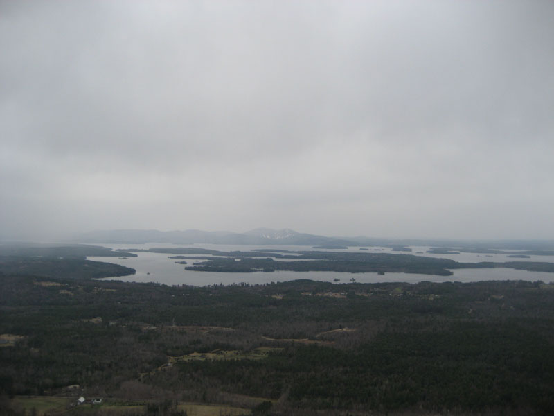
The Bald Knob Trail provided a easy final piece of the ascent, as the grassy carriage road was gentle. The views from the top were decent, though an oncoming rain storm was increasingly obscuring those to the south. Fortunately, it only sprinkled as I descended.
Not a bad route for a trail jog!
| Hike Ratings |
|
Getting To Trailhead: |
Easy |
| Destination: |
Bald Knob |
|
Length: |
Moderate |
|
Steepness: |
Moderate |
|
Navigation: |
Easy |
|
Views: |
Excellent |
|
Crowds: |
Minimal |
|
| Hike Stats |
|
Date Hiked: |
Wednesday, April 22, 2009 |
| Hike Commenced: |
3:40 PM |
| Parking Elevation: |
720' |
| Destination: |
Bald Knob |
| Ascent Commenced: |
3:40 PM |
| Summit Reached: |
4:14 PM |
| Time Elapsed: |
00:34 |
| Trailhead Elevation: |
730' |
| Summit Elevation: |
1,801' |
| Distance: |
2 miles |
| Vertical Gain: |
1,171' |
|
|
| Hike Ended: |
4:43 PM |
| Hike Time Elapsed: |
01:03 |
| Hike Distance: |
4 miles |
| Hike Vertical Gain: |
1,281' |
|
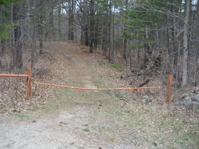
Shannon Brook Trail trailhead
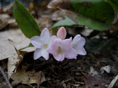
Wildflowers along the Bald Knob Cutoff
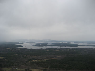
The Belknaps becoming obscured by rain, as seen from Bald Knob
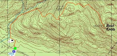

Directions to trailhead: Take Route 109 South from Route 25. Bear left onto Route 171. Shortly after the main Castle in the Clouds entrance, there will be a hiker parking lot on the right side of the road. Trailhead is directly across from it.
Back to Bald Knob Profile
|