Home
States
Colorado
Connecticut
Maine
Massachusetts
New Hampshire
New York
Rhode Island
Utah
Vermont
View All
Lists
NE 4,000 Footers
NE 100 Highest
NH 4,000 Footers
NH 100 Highest
NH 52 With A View
NH Belknap Range
NH Ossipee 10
Links
Trail Conditions
Trip Log
Sunrises
Sunsets
About
|
Bald Knob
Moultonborough, NH, Tuftonboro, NH
Trailheads, measurements, times, distances, and maps are all approximate and relative to the hike(s) as shown below.
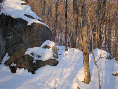
Looking up the Bald Knob Trail
Route: Bald Knob Trail
With some clouds in the sky, it looked like a nice day for a Bald Knob sunset hike. The side of Route 171 was plowed a bit, allowing for some parking.
After dealing with multiple feet of snow in the Whites for a few weeks, it was surprising to see such small amounts of snow on the Bald Knob Trail - much of it was covered with 1-3". Thus, we donned Microspikes for the hike.
The views from the windy summit were quite good - though the Whites were in the clouds, everything else was visible - even Mt. Monadnock was easily seen. Awhile later, it was a nice sunset - unfortunately, the wind made taking steady photos a bit challenging.
The descent went smoothly without headlamps - the night skiing lights for Gunstock, Pat's Peak, and Crotched Mountain were all easily seen.
| Hike Ratings |
|
Getting To Trailhead: |
Easy |
| Destination: |
Bald Knob |
|
Length: |
Moderate |
|
Steepness: |
Difficult |
|
Navigation: |
Easy |
|
Views: |
Excellent |
|
Crowds: |
Minimal |
|
| Hike Stats |
|
Date Hiked: |
Thursday, January 7, 2010 |
| Hike Commenced: |
3:29 PM |
| Parking Elevation: |
710' |
| Destination: |
Bald Knob |
| Ascent Commenced: |
3:29 PM |
| Summit Reached: |
4:03 PM |
| Time Elapsed: |
00:34 |
| Trailhead Elevation: |
710' |
| Summit Elevation: |
1,801' |
| Distance: |
1.1 miles |
| Vertical Gain: |
1,116' |
|
|
| Hike Ended: |
5:15 PM |
| Hike Time Elapsed: |
01:46 |
| Hike Vertical Gain: |
1,141' |
|
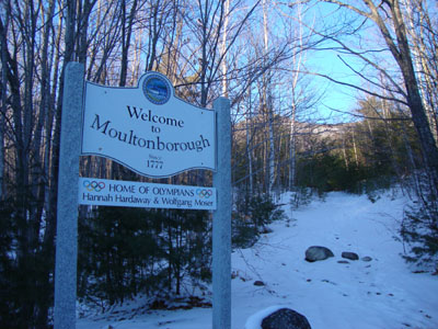
Bald Knob Trail trailhead
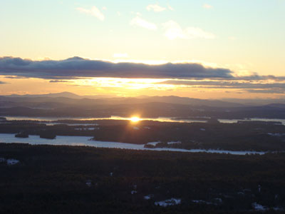
Looking at Lake Winnipesaukee from Bald Knob
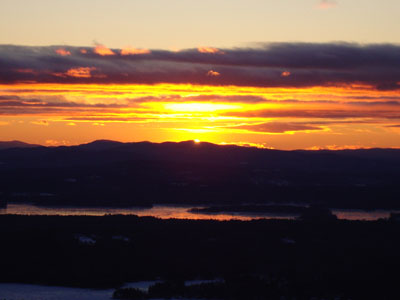
Sunset colors as seen from Bald Knob
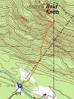

Directions to trailhead: Take Route 109 South from Route 25. Bear left onto Route 171. Shortly after the main Castle in the Clouds entrance, you will arrive at the Moultonboro/Tuftonboro border. The trailhead is next to the Welcome to Moultonboro sign.
Back to Bald Knob Profile
|


