Home
States
Colorado
Connecticut
Maine
Massachusetts
New Hampshire
New York
Rhode Island
Utah
Vermont
View All
Lists
NE 4,000 Footers
NE 100 Highest
NH 4,000 Footers
NH 100 Highest
NH 52 With A View
NH Belknap Range
NH Ossipee 10
Links
Trail Conditions
Trip Log
Sunrises
Sunsets
About
|
Bald Mountain
Franconia, NH
Trailheads, measurements, times, distances, and maps are all approximate and relative to the hike(s) as shown below.
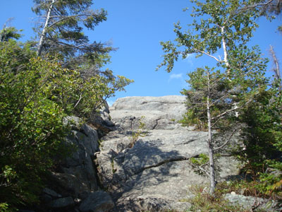
Looking up the spur trail to Bald Mountain
Route: Bald Mountain-Artist's Bluff Path, spur trail, (Bald Mountain), spur trail, Bald Mountain-Artist's Bluff Path
After hiking Mt. Flume and Mt. Liberty, I was heading north on I-93 so that I could reverse direction and head back south. As I approached the first turn around exit, I decided to go to the next exit and do a quick hike up to Bald Mountain.
After walking across the ski area parking lot, I quickly set foot up the Bald Mountain-Artist's Bluff Path, which was really more of an old road. Soon reaching the col, I took a left onto the spur path to Bald Mountain. While the grades had been easy to moderate at this point, there were a few short, very minor scrambles necessary to get up to teh top of Bald Mountain.
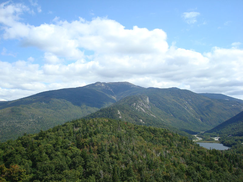
The views from the top were great, ranging from the northeast to the west. Particularly on display were the Cannon and Mittersill ski areas.
I didn't really feel like doing the full loop, so I returned the same way and called it a day.
| Hike Ratings |
|
Getting To Trailhead: |
Easy |
| Destination: |
Bald Mountain |
|
Length: |
Easy |
|
Steepness: |
Difficult |
|
Navigation: |
Easy |
|
Views: |
Excellent |
|
Crowds: |
Minimal |
|
| Hike Stats |
|
Date Hiked: |
Thursday, September 11, 2008 |
| Hike Commenced: |
1:43 PM |
| Parking Elevation: |
2,000' |
| Destination: |
Bald Mountain |
| Ascent Commenced: |
1:44 PM |
| Summit Reached: |
1:53 PM |
| Time Elapsed: |
00:09 |
| Trailhead Elevation: |
2,000' |
| Summit Elevation: |
2,340' |
| Distance: |
.4 mile |
| Vertical Gain: |
345' |
|
|
| Hike Ended: |
2:07 PM |
| Hike Time Elapsed: |
00:24 |
| Hike Distance: |
.8 mile |
| Hike Vertical Gain: |
350' |
|
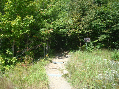
The Bald Mountain-Artist's Bluff Path trailhead

Looking at Mt. Lafayette from the Bald Mountain summit
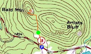

Directions to trailhead: Take I-93 North to the Cannon Mountain (Peabody Slopes, not the Tramway) exit. Directly across from the main Cannon entrance, there is an off-season hiker parking area along the road. The trailhead is at the back of the (fenced off in the off-season) large parking lot.
Back to Bald Mountain Profile
|