Home
States
Colorado
Connecticut
Maine
Massachusetts
New Hampshire
New York
Rhode Island
Utah
Vermont
View All
Lists
NE 4,000 Footers
NE 100 Highest
NH 4,000 Footers
NH 100 Highest
NH 52 With A View
NH Belknap Range
NH Ossipee 10
Links
Trail Conditions
Trip Log
Sunrises
Sunsets
About
|
Bald Mountain
Stark, NH
Trailheads, measurements, times, distances, and maps are all approximate and relative to the hike(s) as shown below.
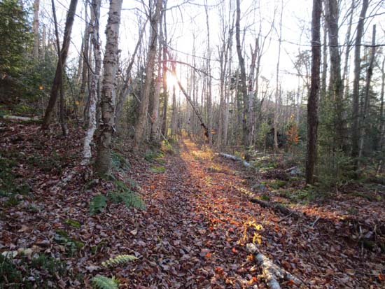
The Bald Mountain Notch Trail
Route: Bald Mountain Notch Trail, herd path
First portion of trail, on snowmobile corridor, was generally dry and in good shape. Grassy, but not tall.
Next portion, more of a logging road, was also generally in good shape, but there were a few avoidable muddy sections at and past the height of land. Turned back at Rowell Link (no sign at junction with the logging road that returns down to that side).
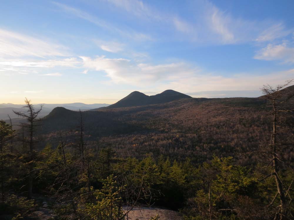
Between the mudpit reroute (trail goes left of mudpit) and the old logging camp (field at right, shortly before end of trail), found the herd path to Bald Mountain (CT blazes on birch tree where it starts). The first few hundred feet are vague due to open woods and leaves, however once it enters the spruce and climbs steeply up the mountain, it's very easily to follow. Very nice views toward Vermont and the Percy Peaks from the quasi-ledgy near summit area. Highpoint required a short, somewhat thick, bushwhack with no redeeming quality. Herd path wraps around the summit, but I didn't have the daylight to explore much (to see if there was a chance at views to the south off the far side of the loop).
In terms of foliage, pretty much all of the leaves are down. The rickety bridge mentioned in the WMG has been replaced with a new snowmobile bridge.
No snow, ice, or frozen ground encountered.
| Hike Ratings |
|
Getting To Trailhead: |
Easy |
| Destination: |
Bald Mountain |
|
Length: |
Moderate |
|
Steepness: |
Difficult |
|
Navigation: |
Difficult |
|
Views: |
Excellent |
|
Crowds: |
Minimal |
|
| Hike Stats |
|
Date Hiked: |
Wednesday, October 24, 2012 |
| Parking Elevation: |
990' |
| Destination: |
Bald Mountain |
| Time Elapsed: |
00:58 |
| Trailhead Elevation: |
990' |
| Summit Elevation: |
2,378' |
| Vertical Gain: |
1,488' |
|
|
| Hike Time Elapsed: |
01:49 |
| Hike Vertical Gain: |
1,488' |
|
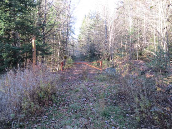
The Bald Mountain Notch Trail trailhead
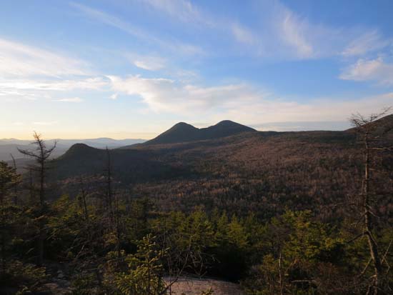
Looking at Victor Head and the Percy Peaks from near the summit of Bald Mountain
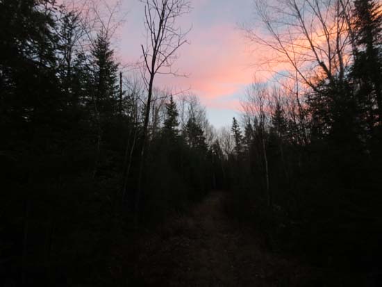
The Bald Mountain Notch Trail
Directions to trailhead: From Berlin, take Route 110 West. Shortly after passing by South Pond Road, take a right onto Bell Hill Road. After crossing railroad tracks, take a left onto Percy Road. The Bald Mountain Notch Trail will be on the right, just after passing by an old landfill on the left. There is limited room to park roadside.
Back to Bald Mountain Profile
|