Home
States
Colorado
Connecticut
Maine
Massachusetts
New Hampshire
New York
Rhode Island
Utah
Vermont
View All
Lists
NE 4,000 Footers
NE 100 Highest
NH 4,000 Footers
NH 100 Highest
NH 52 With A View
NH Belknap Range
NH Ossipee 10
Links
Trail Conditions
Trip Log
Sunrises
Sunsets
About
|
Bartlett Haystack, Bartlett Haystack - Northeast Peak
Bartlett, NH
Trailheads, measurements, times, distances, and maps are all approximate and relative to the hike(s) as shown below.

Bushwhacking to Bartlett Haystack
Route: Bear Notch Road, snowmobile trail, bushwhack
The gated portion of Bear Notch Road was well packed by snowmobiles and groomers. We snowshoed it to just north of the height of land, then took a left onto the snowmobile trail that corresponds with an experimental forest road. We hopped into the woods soon thereafter and ascended northwest on the ridge to Bartlett Haystack, occasionally dropping a bit north to avoid blowdown/spruce. Generally about 2-3" of powder on top of a frozen granular base. Nice directional views from the top, including the Sandwich Range, Carrigain Notch, and Mt. Washington.
We then descended southeast, then hooked around and north into the col in generally open woods.
From the col, we then ascended northeast, finding reasonable woods passing between cliffs (main northeast peak and east spur) up to the recognized summit of the northeast peak (which may be a few dozen feet from slightly higher ground). We found a viewpoint on the southwest side, looking at Bartlett Haystack and Tremont. We then returned to the highpoint and descended east to the eastern spur (a little scrappy near the top), from where there were excellent ledge views ranging from Doublehead to Passaconaway.
| Hike Ratings |
|
Getting To Trailhead: |
Difficult |
| Destination: |
Bartlett Haystack |
|
Length: |
Moderate |
|
Steepness: |
Difficult |
|
Navigation: |
Difficult |
|
Views: |
Excellent |
|
Crowds: |
Minimal |
| Destination: |
Bartlett Haystack - Northeast Peak |
|
Length: |
Moderate |
|
Steepness: |
Difficult |
|
Navigation: |
Difficult |
|
Views: |
Excellent |
|
Crowds: |
Minimal |
|
| Hike Stats |
|
Date Hiked: |
Saturday, January 23, 2016 |
| Parking Elevation: |
1,338' |
| Time to Trailhead: |
01:11 |
| Destination: |
Bartlett Haystack |
| Time Elapsed: |
01:19 |
| Trailhead Elevation: |
1,760' |
| Summit Elevation: |
2,995' |
| Vertical Gain: |
1,235' |
| Destination: |
Bartlett Haystack - Northeast Peak |
| Time Elapsed: |
01:05 |
| Trailhead Elevation: |
2,995' |
| Summit Elevation: |
2,620' |
| Vertical Gain: |
250' |
|
|
| Hike Time Elapsed: |
07:10 |
| Hike Vertical Gain: |
2,157' |
|

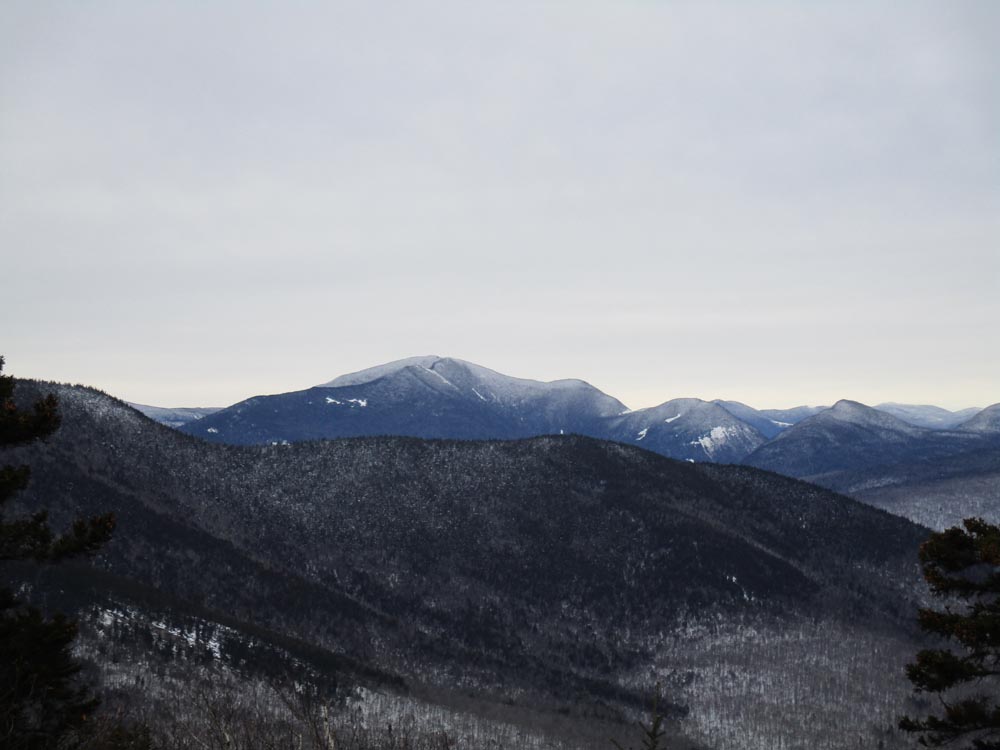
Mt. Carrigain as seen from the Bartlett Haystack ledge

Bushwhacking between the peaks

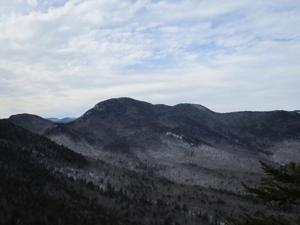
Mt. Tremont as seen from near the summit of the Northeast Peak of Bartlett Haystack


Directions to trailhead: In winter, Bear Notch Road is gated a bit north of Route 112. There tends to be plowed room to park along the shoulder of the road prior to the gate.
Back to Bartlett Haystack Profile
Back to Bartlett Haystack - Northeast Peak Profile
|