Home
States
Colorado
Connecticut
Maine
Massachusetts
New Hampshire
New York
Rhode Island
Utah
Vermont
View All
Lists
NE 4,000 Footers
NE 100 Highest
NH 4,000 Footers
NH 100 Highest
NH 52 With A View
NH Belknap Range
NH Ossipee 10
Links
Trail Conditions
Trip Log
Sunrises
Sunsets
About
|
Black Mountain
Haverhill, NH, Benton, NH
Trailheads, measurements, times, distances, and maps are all approximate and relative to the hike(s) as shown below.

Looking down the Black Mountain Trail
Route: Black Mountain Trail
I found the trailhead to be a bit confusing, as the first sign showed parking and the trail in different directions. As such, I parked a bit down the road, then walked past the sign, only to find out that indeed both the trail and the parking area were straight ahead.
The first portion of the trail was basically a wood road walk. After crossing a brook, the trail eventually became more interesting, passing through some nice hardwoods. The footing was generally quite good.
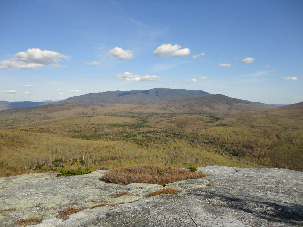
I took extra time to explore the summit ledges, including following a faint herdpath to the north that emptied into even nicer ledges.
| Hike Ratings |
|
Getting To Trailhead: |
Easy |
| Destination: |
Black Mountain |
|
Length: |
Moderate |
|
Steepness: |
Moderate |
|
Navigation: |
Easy |
|
Views: |
Excellent |
|
Crowds: |
Minimal |
|
| Hike Stats |
|
Date Hiked: |
Friday, May 13, 2010 |
| Parking Elevation: |
1,530' |
| Time to Trailhead: |
00:05 |
| Destination: |
Black Mountain |
| Time Elapsed: |
00:50 |
| Trailhead Elevation: |
1,560' |
| Summit Elevation: |
2,830' |
| Distance: |
2.4 miles |
| Vertical Gain: |
1,604' |
|
|
| Hike Time Elapsed: |
02:19 |
| Hike Vertical Gain: |
1,679' |
|
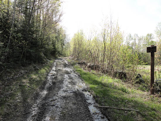
The Black Mountain Trail trailhead

Trout lily

Looking at Mt. Moosilauke from the Black Mountain summit ledges


Directions to trailhead: From Route 116 in Benton, take Howe Hill Road south. The Black Mountain Trail trailhead and parking area are located just beyond the last house on the road.
Back to Black Mountain Profile
|