Home
States
Colorado
Connecticut
Maine
Massachusetts
New Hampshire
New York
Rhode Island
Utah
Vermont
View All
Lists
NE 4,000 Footers
NE 100 Highest
NH 4,000 Footers
NH 100 Highest
NH 52 With A View
NH Belknap Range
NH Ossipee 10
Links
Trail Conditions
Trip Log
Sunrises
Sunsets
About
|
Blue Job Mountain
Strafford, NH, Farmington, NH
Trailheads, measurements, times, distances, and maps are all approximate and relative to the hike(s) as shown below.
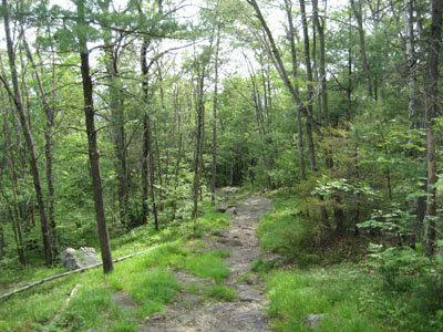
The looking down the trail near the Blue Job Mountain summit
Stop number two on this edition of the knee rehab story was Blue Job Mountain. Having previously hiked Great Hill, I decided to take a day off then add a few more vertical feet.
The Blue Job Mountain trailhead looks to have been recently relocated, as there is a new parking lot just past what looks to be the old trailhead.
The hike itself started off rather gently, as the trail meanders back to the original trailhead. I was amazed (maybe disturbed is a better word for it) by the number of either beetles or cockroaches all over the sides of the trail - mounting each other and making a lot of noise. The numbers were greatest at the base, but they were in abundance almost the entire way to the summit. Pretty disgusting.
The trail follows a very gradual grade, before picking up a bit in pitch as it navigates around some ledge. While there are some southeast views along the way, the haze didn't make them worthwhile enough for a pause.
I arrived at the summit at just about the same time a youth group did from another path. The views from the fire tower were decent, despite the haze - one can imagine what they're like on a clear day (my guess is that the White Mountains and the ocean are both visible). Nonetheless, the Belknap Range was easily seen, as well as the various smaller hills and mountains in the southeastern part of New Hampshire.
The knee was fine, once again, for the entire ascent. Though certainly experiencing some atrophy in the leg from keeping the knee wrapped and iced for weeks, I was able to get by without a brace. The descent was relatively pain free until just near the end, when I started feeling a very slight amount of discomfort. I paused for about 15 seconds and was able to resume without the discomfort - note to self, stop more often.
All in all, a good hike. It's nice to be out on the trails.
| Hike Ratings |
|
Getting To Trailhead: |
Easy |
| Destination: |
Blue Job Mountain |
|
Length: |
Easy |
|
Steepness: |
Easy |
|
Navigation: |
Easy |
|
Views: |
Excellent |
|
Crowds: |
Heavy |
|
| Hike Stats |
|
Date Hiked: |
Friday, June 8, 2007 |
| Hike Commenced: |
4:27 PM |
| Parking Elevation: |
980' |
| Destination: |
Blue Job Mountain |
| Ascent Commenced: |
4:27 PM |
| Summit Reached: |
4:38 PM |
| Time Elapsed: |
00:11 |
| Trailhead Elevation: |
985' |
| Summit Elevation: |
1,357' |
| Vertical Gain: |
375' |
|
|
| Hike Ended: |
4:56 PM |
| Hike Time Elapsed: |
00:29 |
| Hike Vertical Gain: |
380' |
|
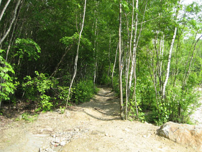
Trailhead to the Blue Job Mountain summit
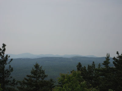
Looking northwest from the Blue Job Mountain summit at the Belknap Range
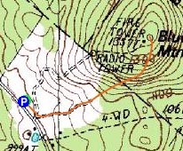

Directions to trailhead: Take Route 202A from Rochester to First Crown Point Road. This road will merge with Crown Point Road. The new trailhead and parking area is on the right.
Back to Blue Job Mountain Profile
|

