Home
States
Colorado
Connecticut
Maine
Massachusetts
New Hampshire
New York
Rhode Island
Utah
Vermont
View All
Lists
NE 4,000 Footers
NE 100 Highest
NH 4,000 Footers
NH 100 Highest
NH 52 With A View
NH Belknap Range
NH Ossipee 10
Links
Trail Conditions
Trip Log
Sunrises
Sunsets
About
|
Bondcliff, Mt. Bond, Mt. Bond (West Peak), Mt. Guyot, Zealand Mountain
Lincoln, NH, Bethlehem, NH, Livermore, NH
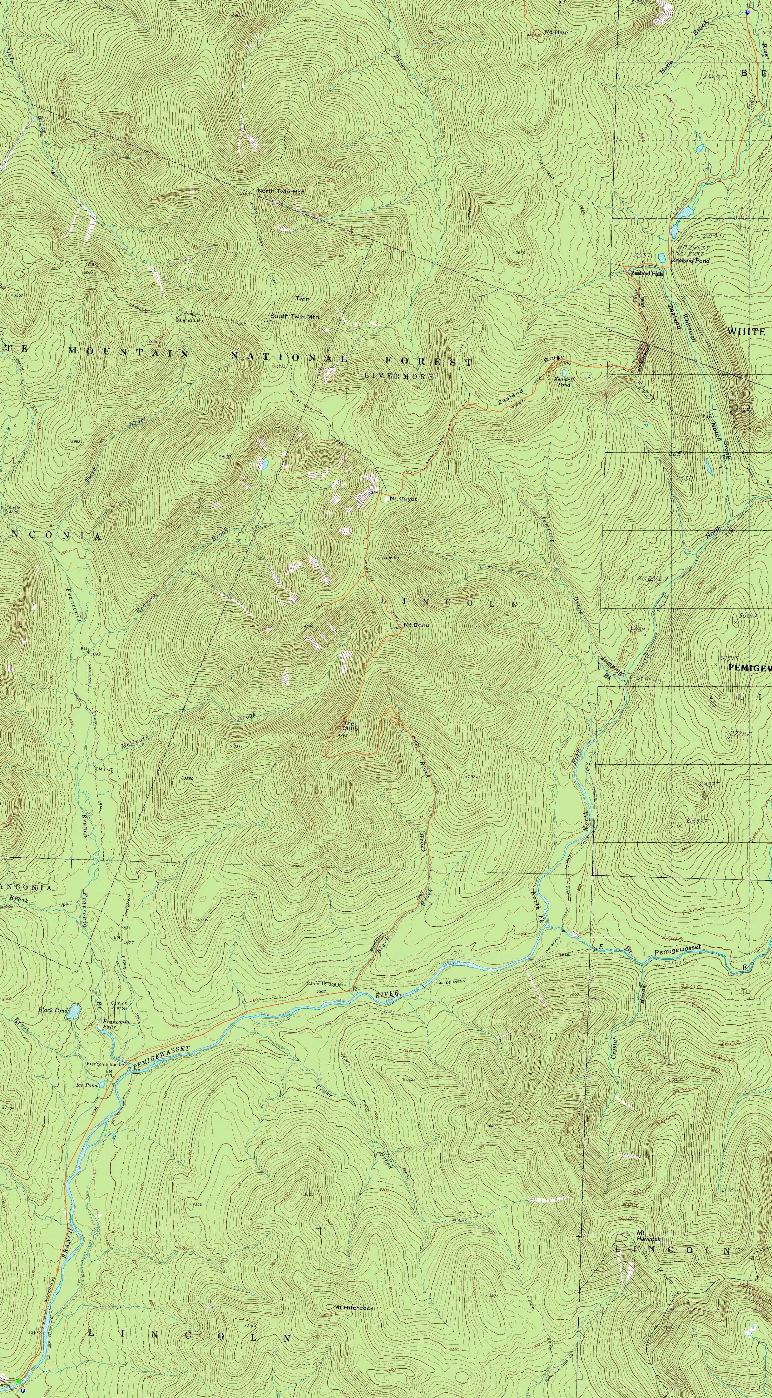
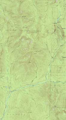
Trailheads, measurements, times, distances, and maps are all approximate and relative to the hike(s) as shown below.
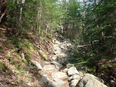
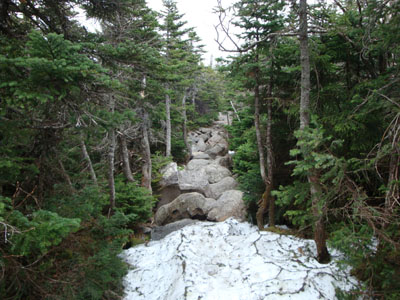
Looking up the Bondcliff Trail
Route: Lincoln Woods Trail, Wilderness Trail, Bondcliff Trail, (Bondcliff), Bondcliff Trail, (Mt. Bond), Bondcliff Trail, West Bond Trail, (West Bond), West Bond Trail, Bondcliff Trail, Twinway, (Mt. Guyot), Twinway, spur trail, (Zealand Mountain), spur trail, Twinway, Zealand Trail
Choosing to take the day off from work as to ensure decent weather, we set out in the wee hours of the morning from Lincoln Woods. Making decent time on the long, fairly flat Lincoln Woods Trail to Wilderness Trail trek, we soon reached the Bondcliff Trail junction. After a brief break, we were on our way up the mostly dry trail (with very few patches of snow).
Reaching Bondcliff, we were greeted with nice views and decent winds. After a break, we continued to Mt. Bond up a mostly snow-free Bondcliff Trail. Though the views were also good here, clouds were moving in.
There were still decent sized patches of snow between Mt. Bond and West Bond. Reaching West Bond, somewhat dark clouds were starting to from to the north.
After passing through more snow near the Guyot camping area, we crossed over the bare peaks of Mt. Guyot, finally ducking into the woods on the Twinway. Hoards of snow patches later, we reached the final summit of the day, Zealand Mountain.
Not long after passing Zealand, the trail became snow free. After a break at the hut, we headed out to Zealand Road along the flat Zealand Trail. A long but rewarding day!
| Hike Ratings |
|
Getting To Trailhead: |
Easy |
| Destination: |
Bondcliff |
|
Length: |
Very Difficult |
|
Steepness: |
Difficult |
|
Navigation: |
Easy |
|
Views: |
Excellent |
|
Crowds: |
Heavy |
| Destination: |
Mt. Bond |
|
Length: |
Very Difficult |
|
Steepness: |
Difficult |
|
Navigation: |
Easy |
|
Views: |
Excellent |
|
Crowds: |
Minimal |
| Destination: |
Mt. Bond (West Peak) |
|
Length: |
Very Difficult |
|
Steepness: |
Difficult |
|
Navigation: |
Easy |
|
Views: |
Excellent |
|
Crowds: |
Minimal |
| Destination: |
Mt. Guyot |
|
Length: |
Very Difficult |
|
Steepness: |
Difficult |
|
Navigation: |
Easy |
|
Views: |
Excellent |
|
Crowds: |
Minimal |
| Destination: |
Zealand Mountain |
|
Length: |
Very Difficult |
|
Steepness: |
Difficult |
|
Navigation: |
Easy |
|
Views: |
Minimal |
|
Crowds: |
Minimal |
|
| Hike Stats |
|
Date Hiked: |
Friday, May 22, 2009 |
| Hike Commenced: |
6:41 AM |
| Parking Elevation: |
1,170' |
| Destination: |
Bondcliff |
| Ascent Commenced: |
6:43 AM |
| Summit Reached: |
10:23 AM |
| Time Elapsed: |
03:40 |
| Trailhead Elevation: |
1,170' |
| Summit Elevation: |
4,265' |
| Distance: |
9.1 miles |
| Vertical Gain: |
3,245' |
| Destination: |
Mt. Bond |
| Ascent Commenced: |
10:38 AM |
| Summit Reached: |
11:19 AM |
| Time Elapsed: |
00:41 |
| Trailhead Elevation: |
4,265' |
| Summit Elevation: |
4,698' |
| Distance: |
1.2 miles |
| Vertical Gain: |
718' |
| Destination: |
Mt. Bond (West Peak) |
| Ascent Commenced: |
11:34 AM |
| Summit Reached: |
12:06 PM |
| Time Elapsed: |
00:32 |
| Trailhead Elevation: |
4,698' |
| Summit Elevation: |
4,540' |
| Distance: |
1 mile |
| Vertical Gain: |
420' |
| Destination: |
Mt. Guyot |
| Ascent Commenced: |
12:13 PM |
| Summit Reached: |
1:04 PM |
| Time Elapsed: |
00:51 |
| Trailhead Elevation: |
4,540' |
| Summit Elevation: |
4,580' |
| Distance: |
1.3 miles |
| Vertical Gain: |
510' |
| Destination: |
Zealand Mountain |
| Ascent Commenced: |
1:05 PM |
| Summit Reached: |
1:47 PM |
| Time Elapsed: |
00:42 |
| Trailhead Elevation: |
1,170' |
| Summit Elevation: |
4,260' |
| Vertical Gain: |
320' |
|
|
| Hike Ended: |
4:21 PM |
| Hike Time Elapsed: |
9:40 |
| Hike Vertical Gain: |
5,259' |
|
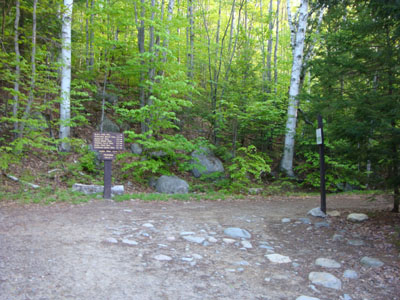
The Lincoln Woods Trail trailhead
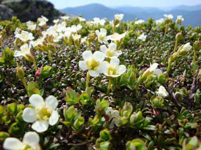
Alpine flowers near Bondcliff

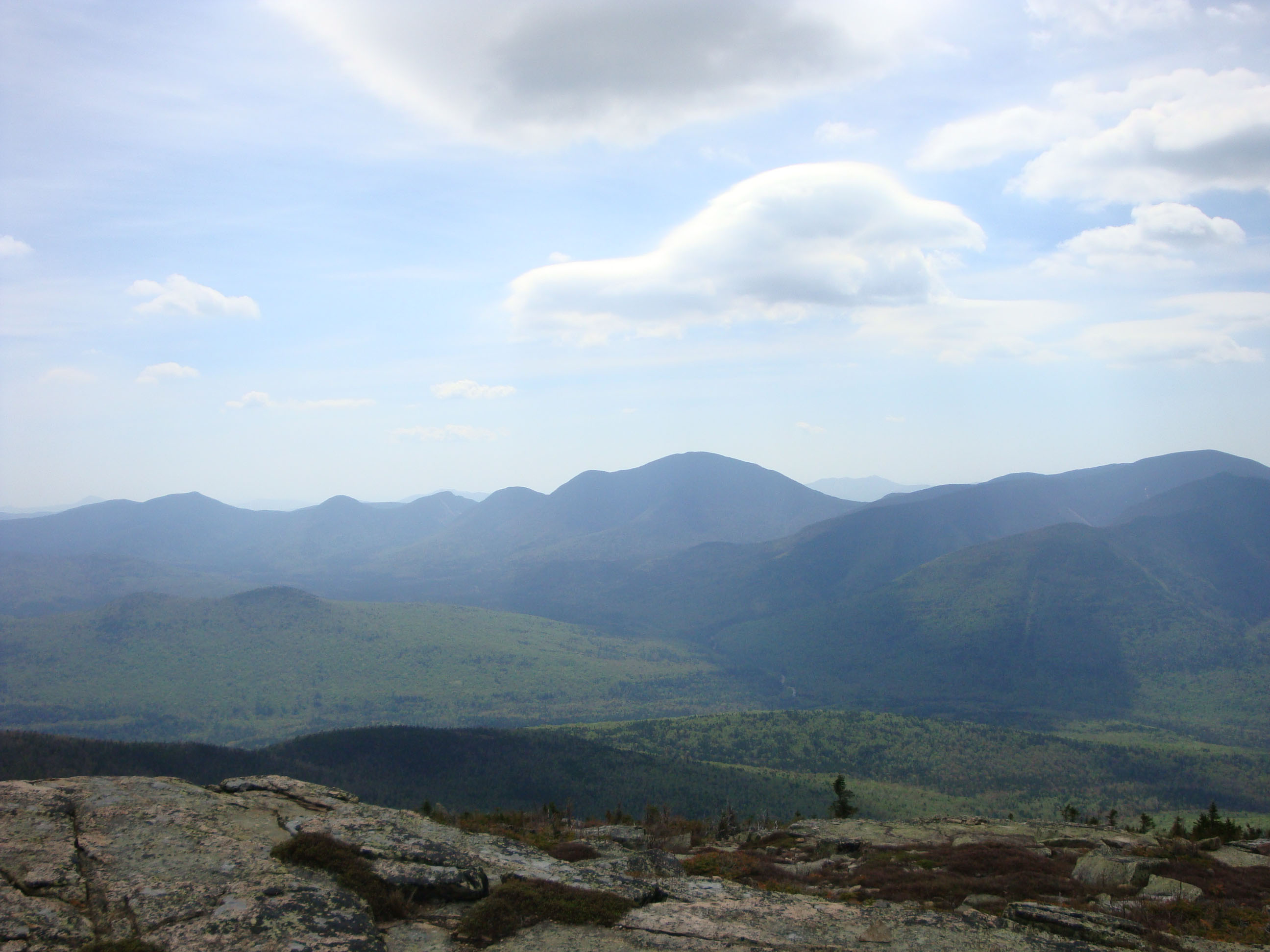
Looking at Mt. Carrigain from near the Bondcliff summit

Looking up the Bondcliff Trail on the way to Mt. Bond
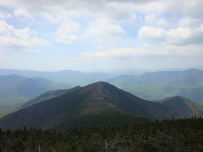
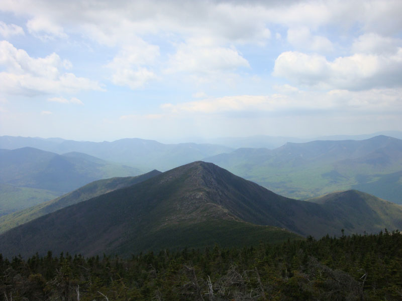
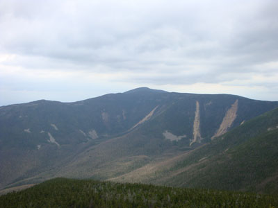
Looking at Bondcliff from near the Mt. Bond summit
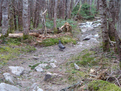
Looking down the Bondcliff Trail at a grouse on the way to West Bond
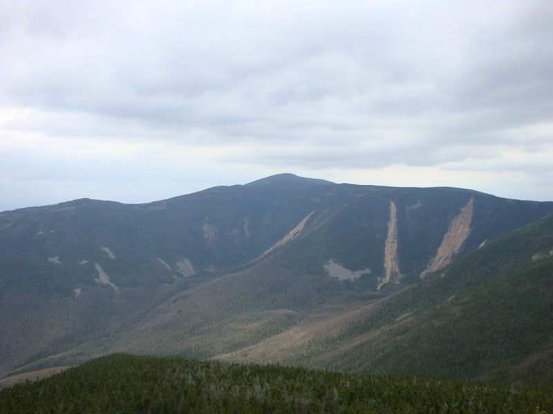
Looking at South Twin from the West Bond summit
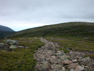
The Bondcliff Trail on the way to Mt. Guyot
Looking at Mt. Carrigain from Mt. Guyot
The changing of seasons on the Twinway on the way to Zealand Mountain
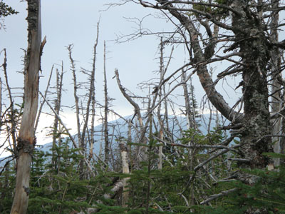
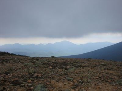
A lack of views as seen from Zealand Mountain

Directions to trailhead: To get to Lincoln Woods, take Route 112 East from I-93 past Loon to the Lincoln Woods WMNF fee parking area (left side of road). To get to the Zealand Trail trailhead, take US 302 west from Bartlett past Bretton Woods Ski Area. A few minutes after, take a left onto Zealand Road. The Zealand WMNF fee parking area and Zealand Trail trailhead are located at the end of the road.
Back to Bondcliff Profile
Back to Mt. Bond Profile
Back to Mt. Bond (West Peak) Profile
Back to Mt. Guyot Profile
Back to Zealand Mountain Profile
|