Home
States
Colorado
Connecticut
Maine
Massachusetts
New Hampshire
New York
Rhode Island
Utah
Vermont
View All
Lists
NE 4,000 Footers
NE 100 Highest
NH 4,000 Footers
NH 100 Highest
NH 52 With A View
NH Belknap Range
NH Ossipee 10
Links
Trail Conditions
Trip Log
Sunrises
Sunsets
About
|
Bondcliff, Mt. Bond, Mt. Bond (West Peak), Mt. Guyot, Zealand Mountain
Lincoln, NH, Bethlehem, NH, Livermore, NH
Trailheads, measurements, times, distances, and maps are all approximate and relative to the hike(s) as shown below.

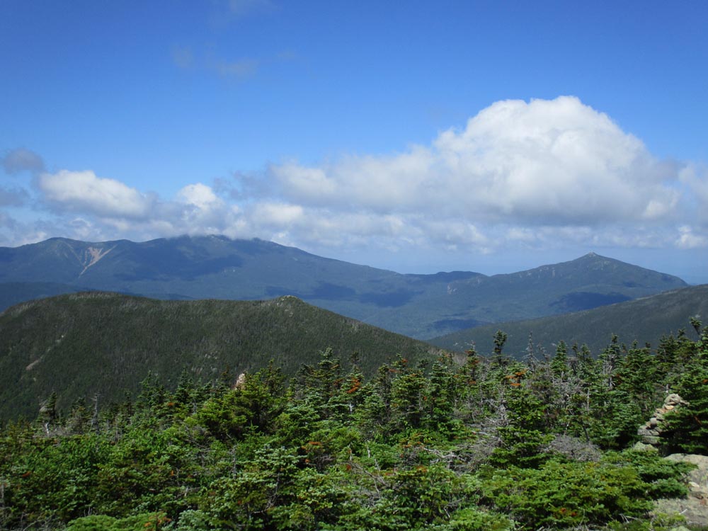
The eroded Bondcliff Trail
Route: Lincoln Woods Trail, Bondcliff Trail, (Bondcliff), Bondcliff Trail, (Mt. Bond), Bondcliff Trail, West Bond Trail, (West Bond), West Bond Trail, Bondcliff Trail, Twinway, (Mt. Guyot), Twinway, spur trail, (Zealand Mountain), spur trail, Twinway, Zealand Trail
Lincoln Woods was its usual tedious self; much easier to take first thing in the morning.
Bondcliff Trail had patches of mud, running water, etc. and blowdowns. I could see in a few places were someone could be tricked into following a herd path or drainage. Hillary Stumble was dry, as was the ridge. Some mud in places between the peaks.
Lots of slick rock on the Twinway between Guyot and Zealand, as well as below Zeacliff. Also some deep mud/flooded trail/floating bog bridges in places.
Zealand Trail was a little slick/muddy in the rocky area.
Early start allowed for climbing in the cooler temperatures. Occasional breeze made for nice walking in places. Still some flowers in bloom. Very crowded trails.
| Hike Ratings |
|
Getting To Trailhead: |
Easy |
| Destination: |
Bondcliff |
|
Length: |
Very Difficult |
|
Steepness: |
Difficult |
|
Navigation: |
Easy |
|
Views: |
Excellent |
|
Crowds: |
Moderate |
| Destination: |
Mt. Bond |
|
Length: |
Very Difficult |
|
Steepness: |
Difficult |
|
Navigation: |
Easy |
|
Views: |
Excellent |
|
Crowds: |
Heavy |
| Destination: |
Mt. Bond (West Peak) |
|
Length: |
Very Difficult |
|
Steepness: |
Difficult |
|
Navigation: |
Easy |
|
Views: |
Excellent |
|
Crowds: |
Heavy |
| Destination: |
Mt. Guyot |
|
Length: |
Very Difficult |
|
Steepness: |
Difficult |
|
Navigation: |
Easy |
|
Views: |
Excellent |
|
Crowds: |
Heavy |
| Destination: |
Zealand Mountain |
|
Length: |
Very Difficult |
|
Steepness: |
Difficult |
|
Navigation: |
Easy |
|
Views: |
Minimal |
|
Crowds: |
Heavy |
|
| Hike Stats |
|
Date Hiked: |
Saturday, July 13, 2019 |
| Parking Elevation: |
1,170' |
| Destination: |
Bondcliff |
| Time Elapsed: |
03:42 |
| Trailhead Elevation: |
1,170' |
| Summit Elevation: |
4,265' |
| Distance: |
9.1 miles |
| Vertical Gain: |
3,245' |
| Destination: |
Mt. Bond |
| Time Elapsed: |
00:39 |
| Trailhead Elevation: |
4,265' |
| Summit Elevation: |
4,698' |
| Distance: |
1.2 miles |
| Vertical Gain: |
718' |
| Destination: |
Mt. Bond (West Peak) |
| Time Elapsed: |
00:34 |
| Trailhead Elevation: |
4,698' |
| Summit Elevation: |
4,540' |
| Distance: |
1 mile |
| Vertical Gain: |
420' |
| Destination: |
Mt. Guyot |
| Time Elapsed: |
00:48 |
| Trailhead Elevation: |
4,540' |
| Summit Elevation: |
4,580' |
| Distance: |
1.3 miles |
| Vertical Gain: |
510' |
| Destination: |
Zealand Mountain |
| Time Elapsed: |
00:43 |
| Trailhead Elevation: |
1,170' |
| Summit Elevation: |
4,260' |
| Vertical Gain: |
320' |
|
|
| Hike Time Elapsed: |
09:49 |
| Hike Vertical Gain: |
5,259' |
|

Looking at West Bond from near the Bondcliff summit

The Bondcliff Trail on the way to Mt. Bond

Looking at West Bond, the Franconia Ridge, and Mt. Garfield from Mt. Bond

Looking down the Bondcliff Trail on the way to West Bond

Looking at South Twin from the West Bond summit

The Bondcliff Trail on the way to Mt. Guyot

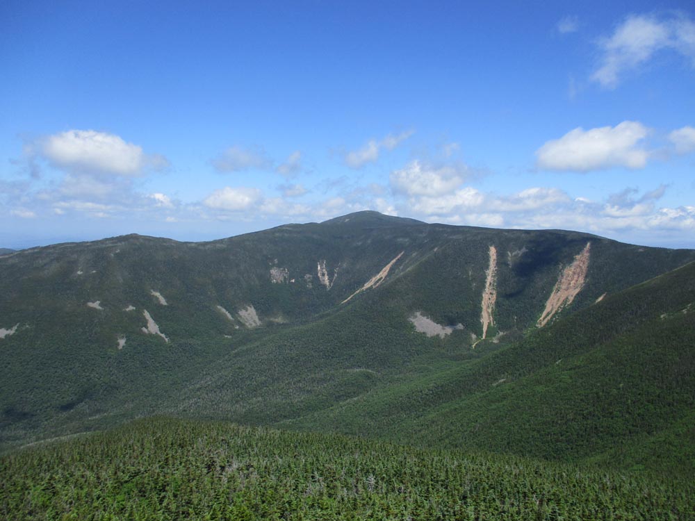
Looking at Mt. Bond and West Bond from Mt. Guyot

The rocky Twinway on the way to Zealand Mountain

A lack of views from the summit of Zealand Mountain
Directions to trailhead: To get to Lincoln Woods, take Route 112 East from I-93 past Loon to the Lincoln Woods WMNF fee parking area (left side of road). To get to the Zealand Trail trailhead, take US 302 west from Bartlett past Bretton Woods Ski Area. A few minutes after, take a left onto Zealand Road. The Zealand WMNF fee parking area and Zealand Trail trailhead are located at the end of the road.
Back to Bondcliff Profile
Back to Mt. Bond Profile
Back to Mt. Bond (West Peak) Profile
Back to Mt. Guyot Profile
Back to Zealand Mountain Profile
|