Home
States
Colorado
Connecticut
Maine
Massachusetts
New Hampshire
New York
Rhode Island
Utah
Vermont
View All
Lists
NE 4,000 Footers
NE 100 Highest
NH 4,000 Footers
NH 100 Highest
NH 52 With A View
NH Belknap Range
NH Ossipee 10
Links
Trail Conditions
Trip Log
Sunrises
Sunsets
About
|
Bondcliff, Mt. Bond, Mt. Bond (West Peak)
Lincoln, NH
Trailheads, measurements, times, distances, and maps are all approximate and relative to the hike(s) as shown below.
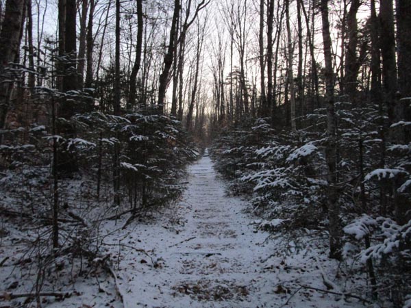
The lower Bondcliff Trail
Route: Lincoln Woods Trail, Bondcliff Trail, (Bondcliff), Bondcliff Trail, (Mt. Bond), Bondcliff Trail, West Bond Spur, (West Bond), West Bond Spur, Bondcliff Trail, (Mt. Bond), Bondcliff Trail, (Bondcliff), Bondcliff Trail, Lincoln Woods Trail
Lincoln Woods Trail had a dusting of snow this morning with some mud pits. Snow in the sun had melted by this afternoon. Bondcliff Trail flats were the same.
Ascent of the Bondcliff Trail had a consistent dusting of snow, most of which was still remaining this afternoon. Some areas of water running down the trail unmitigated. Very little ice encountered; Hillary Stumble was not an issue. Barebooted all the way to Bondcliff (and on the descent too).
Ridge was fine, with very little wind. Some powder here and there, but very little ice. A little bit of ice on the ascent of Bond in the treed portion (including the scramble ledge; ice was soft, so no issue getting purchase today).
Iciest stretch was descending the north side of Bond; black ice under the half inch of powder. Dull Microspikes sufficed. Also some black ice under powder on the way to West Bond.
Beautiful weather with sunny skies and minimal wind; felt like late October rather than early December.
| Hike Ratings |
|
Getting To Trailhead: |
Easy |
| Destination: |
Bondcliff |
|
Length: |
Very Difficult |
|
Steepness: |
Difficult |
|
Navigation: |
Easy |
|
Views: |
Excellent |
|
Crowds: |
Minimal |
| Destination: |
Mt. Bond |
|
Length: |
Very Difficult |
|
Steepness: |
Difficult |
|
Navigation: |
Easy |
|
Views: |
Excellent |
|
Crowds: |
Minimal |
| Destination: |
Mt. Bond (West Peak) |
|
Length: |
Very Difficult |
|
Steepness: |
Difficult |
|
Navigation: |
Easy |
|
Views: |
Excellent |
|
Crowds: |
Minimal |
|
| Hike Stats |
|
Date Hiked: |
Thursday, December 3, 2020 |
| Parking Elevation: |
1,170' |
| Destination: |
Bondcliff |
| Time Elapsed: |
03:58 |
| Trailhead Elevation: |
1,170' |
| Summit Elevation: |
4,265' |
| Distance: |
9.1 miles |
| Vertical Gain: |
3,245' |
| Destination: |
Mt. Bond |
| Time Elapsed: |
00:41 |
| Trailhead Elevation: |
4,265' |
| Summit Elevation: |
4,698' |
| Distance: |
1.2 miles |
| Vertical Gain: |
718' |
| Destination: |
Mt. Bond (West Peak) |
| Time Elapsed: |
00:34 |
| Trailhead Elevation: |
4,698' |
| Summit Elevation: |
4,540' |
| Distance: |
1 mile |
| Vertical Gain: |
420' |
|
|
| Hike Time Elapsed: |
10:02 |
| Hike Distance: |
22.6 miles |
| Hike Vertical Gain: |
5,366' |
|

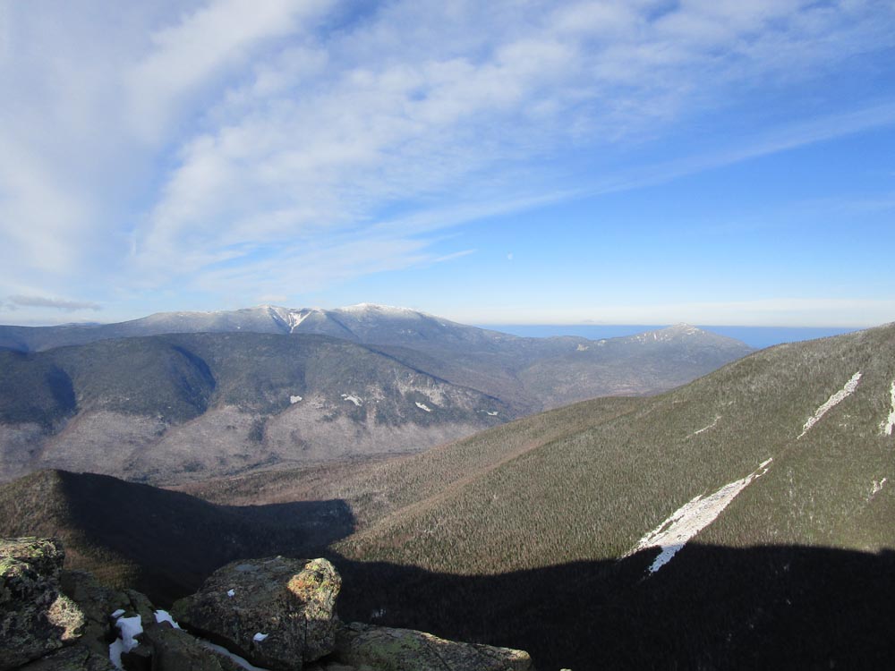
Looking at Owl's Head, Franconia Ridge, and Mt. Garfield from Bondcliff
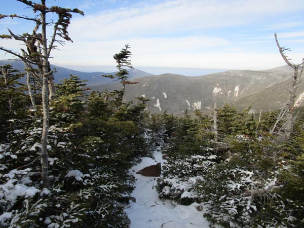
The Bondcliff Trail on the way to Mt. Bond

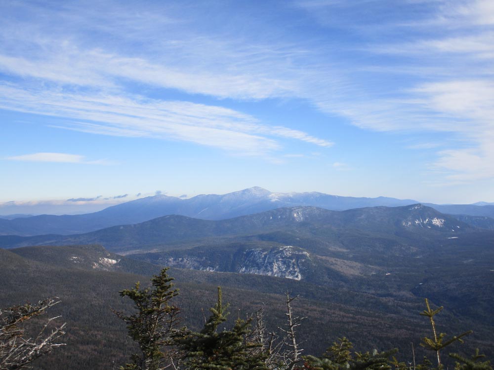
Looking at Mt. Washington from Mt. Bond
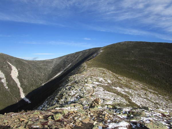
Looking down the Bondcliff Trail on the way to West Bond

Bondcliff as seen from West Bond
Directions to trailhead: To get to Lincoln Woods, take Route 112 East from I-93 past Loon to the Lincoln Woods WMNF fee parking area (left side of road).
Back to Bondcliff Profile
Back to Mt. Bond Profile
Back to Mt. Bond (West Peak) Profile
|