Home
States
Colorado
Connecticut
Maine
Massachusetts
New Hampshire
New York
Rhode Island
Utah
Vermont
View All
Lists
NE 4,000 Footers
NE 100 Highest
NH 4,000 Footers
NH 100 Highest
NH 52 With A View
NH Belknap Range
NH Ossipee 10
Links
Trail Conditions
Trip Log
Sunrises
Sunsets
About
|
Cathedral Ledge
Conway, NH, Barlett, NH
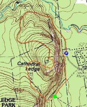
Trailheads, measurements, times, distances, and maps are all approximate and relative to the hike(s) as shown below.
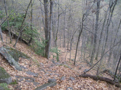
Looking down the Bryce Trail
Route: Unknown paths, Bryce Path, (Cathedral Ledge), unknown paths, auto road
The weather forecasts were calling for a mostly sunny day. Ha. Since I wanted to get outside and get some exercise, I decided to stay local and do a smaller hike in the wet weather.
I was somewhat surprised to see the parking areas at the bottom of Cathedral Ledge pretty much full. After taking a series of herd paths from the ledge to the Bryce Path junction, I headed up the first of the two steep portions of the hike. Fortunately the rain was very light, preventing the rocks and stairs from being too wet.
After passing the White Horse Ledge Trail, the Bryce Path was a bit submerged. Fortunately I was wearing waterproof hiking shoes, so I stayed dry as I bypassed the mess.
Shortly after that was the second steeper pitch. Again, since it was only sprinkling out, the ground wasn't too bad.
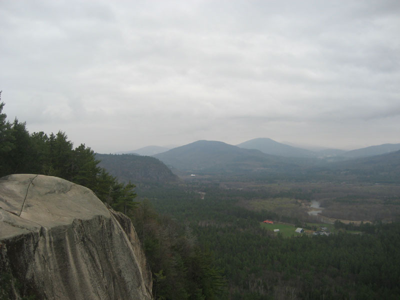
Just as I reached the ledge summit, the rain started to pick up a bit. After checking out a few of the neat cliff vistas, I decided to descend via the closed auto road, so that I wouldn't have to worry about slipping on any steep sections of trail.
| Hike Ratings |
|
Getting To Trailhead: |
Moderate |
| Destination: |
Cathedral Ledge |
|
Length: |
Moderate |
|
Steepness: |
Difficult |
|
Navigation: |
Easy |
|
Views: |
Excellent |
|
Crowds: |
Minimal |
|
| Hike Stats |
|
Date Hiked: |
Saturday, May 3, 2008 |
| Hike Commenced: |
1:07 PM |
| Parking Elevation: |
520' |
| Destination: |
Cathedral Ledge |
| Ascent Commenced: |
1:15 PM |
| Summit Reached: |
1:37 PM |
| Time Elapsed: |
00:22 |
| Trailhead Elevation: |
580' |
| Summit Elevation: |
1,159' |
| Vertical Gain: |
609' |
|
|
| Hike Ended: |
2:17 PM |
| Hike Time Elapsed: |
01:10 |
| Hike Vertical Gain: |
699' |
|
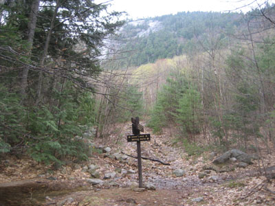
Bryce Trail junction with the paths from the base of Cathedral Ledge

Looking northeast from near the summit of Cathedral Ledge.

Directions to trailhead: Follow the signs for Cathedral Ledge State Park from North Conway. Entrance way is next to the West Side Road stop sign, northwest of downtown. Parking is a bit tricky due to private property, however there is space near Cathedral Ledge.
Back to Cathedral Ledge Profile
|