Home
States
Colorado
Connecticut
Maine
Massachusetts
New Hampshire
New York
Rhode Island
Utah
Vermont
View All
Lists
NE 4,000 Footers
NE 100 Highest
NH 4,000 Footers
NH 100 Highest
NH 52 With A View
NH Belknap Range
NH Ossipee 10
Links
Trail Conditions
Trip Log
Sunrises
Sunsets
About
|
Copple Crown Mountain
Brookfield, NH, New Durham, NH
Trailheads, measurements, times, distances, and maps are all approximate and relative to the hike(s) as shown below.

Looking down the trail to Copple Crown Mountain
Route: Copple Crown Trail, (Copple Crown Mountain), East Peak spur trail, Copple Crown Trail
Since I wanted to do something tame with a change of scenery, I decided to head south and hike Copple Crown.
Arriving at the trailhead at the end of the bumpy dirt road, I set foot up the old road to the right of the parking lot - considered by some to be part of the Copple Crown Trail. I wasn't able to go as fast I would have wanted, as the footing was a bit gravelly/rocky. Learning from my mistake two years prior, I kept going past a prominent ascending logging road on the left, continuing down the old road until I saw a kiosk on my left.
The trail portion of the trail was pretty tame - most of the steep terrain was aided by switchbacks. Reaching the East Peak junction sign, I continued to the main peak.
While the views were good, the vista wasn't quite as open as I recall it being two years earlier - it seems as if some brush has grown in. Nonetheless, I had good views of the lake, the Sandwich Range, and the Ossipees.
Back at the junction, I took the East Peak trail. Signed as being .3 miles, the vista seemed to me to be about a tenth of a mile (I didn't see any evidence of a trail beyond that). The vista there, facing to the south, was significantly better than the summit vista - ranging from points east in Maine to Mt. Monadnock to the southwest, it was well worth the side trip.
| Hike Ratings |
|
Getting To Trailhead: |
Easy |
| Destination: |
Copple Crown Mountain |
|
Length: |
Moderate |
|
Steepness: |
Moderate |
|
Navigation: |
Moderate |
|
Views: |
Excellent |
|
Crowds: |
Minimal |
|
| Hike Stats |
|
Date Hiked: |
Monday, September 21, 2009 |
| Hike Commenced: |
4:27 PM |
| Parking Elevation: |
850' |
| Destination: |
Copple Crown Mountain |
| Ascent Commenced: |
4:27 PM |
| Summit Reached: |
5:27 PM |
| Time Elapsed: |
01:00 |
| Trailhead Elevation: |
850' |
| Summit Elevation: |
1,868' |
| Vertical Gain: |
1,078' |
|
|
| Hike Ended: |
6:48 PM |
| Hike Time Elapsed: |
02:21 |
| Hike Vertical Gain: |
1,198' |
|
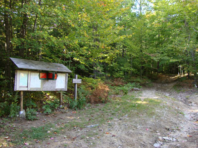
The trailhead to the old road to the trail to Copple Crown Mountain

Looking at the Sandwich Dome and the Ossipees from the Copple Crown Mountain summit


Directions to trailhead: Take Route 109 West from Route 16, then take a left onto Governors Road. Shortly thereafter, take a right onto Moose Mountain Road. Continue down this - it will turn to dirt - going straight (there will be a Dead End sign - don't go right!). There will be a parking lot at the end of this somewhat rough road, with a Copple Crown sign pointing to the right to the trailhead.
Back to Copple Crown Mountain Profile
|


