Home
States
Colorado
Connecticut
Maine
Massachusetts
New Hampshire
New York
Rhode Island
Utah
Vermont
View All
Lists
NE 4,000 Footers
NE 100 Highest
NH 4,000 Footers
NH 100 Highest
NH 52 With A View
NH Belknap Range
NH Ossipee 10
Links
Trail Conditions
Trip Log
Sunrises
Sunsets
About
|
Dixville Peak
Dixville, NH
Trailheads, measurements, times, distances, and maps are all approximate and relative to the hike(s) as shown below.

Looking up the access road to Dixville Peak
Route: Access road
Basically drove up to the base of the actual climb of the wind farm access road, parked, and jogged up the road. There is a gate near the top that says road not for public use, as well as a no snowmobiles logo, but nothing specifically prohibiting foot use. ATV riders were checking out the towers on foot. Looks like the summit was blown up...the highest point now is a remaining ledge on the southwest side of the second wind turbine. Wouldn't want to be anywhere near that if there's ice on the turbine, though.
Roadwalk was very scenic with views to the west, south, and east. Some northwest views from near the summit as well.
Very noisy and dusty from the ATV traffic, though.
| Hike Ratings |
|
Getting To Trailhead: |
Moderate |
| Destination: |
Dixville Peak |
|
Length: |
Moderate |
|
Steepness: |
Moderate |
|
Navigation: |
Easy |
|
Views: |
Excellent |
|
Crowds: |
Heavy |
|
| Hike Stats |
|
Date Hiked: |
Saturday, August 10, 2013 |
| Parking Elevation: |
2,760' |
| Destination: |
Dixville Peak |
| Time Elapsed: |
00:18 |
| Trailhead Elevation: |
2,760' |
| Summit Elevation: |
3,470' |
| Distance: |
1.4 miles |
| Vertical Gain: |
710' |
|
|
| Hike Time Elapsed: |
00:38 |
| Hike Vertical Gain: |
710' |
|

Starting up the access road on foot near a pull off

Looking down the access road to Dixville Peak

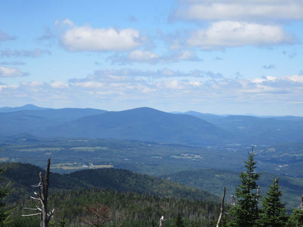
Looking at the Vermont Monadnock from near the summit of Dixville Peak


Directions to trailhead: From Route 26 east of the height of land in Dixville Notch, take a right onto West Branch (Clear Stream Road). Eventually, when passing a large open area on the right, take a right onto a road that will have power lines on it. There are a few places to pull off the road as one ascends.
Back to Dixville Peak Profile
|