Home
States
Colorado
Connecticut
Maine
Massachusetts
New Hampshire
New York
Rhode Island
Utah
Vermont
View All
Lists
NE 4,000 Footers
NE 100 Highest
NH 4,000 Footers
NH 100 Highest
NH 52 With A View
NH Belknap Range
NH Ossipee 10
Links
Trail Conditions
Trip Log
Sunrises
Sunsets
About
|
Dixville Peak, Table Rock
Dixville, NH
Trailheads, measurements, times, distances, and maps are all approximate and relative to the hike(s) as shown below.

The abandoned Balsams Wilderness ski area
Route: Bunny Hop XC Ski Trail, snowmobile trail, ski trails, Dixville Peak Trail, herd path, Mt. Gloriette Trail, Table Rock Trail, (Table Rock), Table Rock Trail, xc ski trail, snowmobile trail, Bunny Hop XC Ski Trail
Nice weather most of the day way north with blue skies and mild temperatures.
Started off on snowmobile trails (not much nordic use anymore due to Balsams being closed), dropping into the bottom of the closed alpine ski area. About 6" of snowpack down low.
We then bee lined up to the top of the ski area, then when looking toward the turbines, headed right down a novice trail briefly, then took a left onto the Cohos Trail toward Dixville. 1.5 feet of snow at this point, with only a few sets of tracks. Awhile later, the trail joined an active snowmobile trail corridor, which we followed to the side of Dixville Peak, the wrapped around, touched the remaining highpoint (20 vertical feet or so of the summit was blasted away for the wind turbine), dropped back to the snowmbile corridor, and doubled back to the ski area.
With plenty of time and nice weather to spare, we headed north toward Table Rock. This section of the Cohos Trail had a set of snowmobile tracks for much of the way as well (until the corridor narrowed maybe half a mile before Table Rock). Snowshoe tracks heading toward Three Brothers Trail. None on the steep Table Rock Trail. A good 1.5-2 feet of snow on the ridge. Table Rock itself was a little bit icy.
We took the easier branch of the Table Rock (west) down, which was also snowshoed out. Near the bottom, we followed an old herd path onto an unused nordic trail back to the alpine ski area base, and then back out to Route 26.
| Hike Ratings |
|
Getting To Trailhead: |
Moderate |
| Destination: |
Dixville Peak |
|
Length: |
Moderate |
|
Steepness: |
Difficult |
|
Navigation: |
Moderate |
|
Views: |
Excellent |
|
Crowds: |
Heavy |
| Destination: |
Table Rock |
|
Length: |
Moderate |
|
Steepness: |
Moderate |
|
Navigation: |
Moderate |
|
Views: |
Excellent |
|
Crowds: |
Minimal |
|
| Hike Stats |
|
Date Hiked: |
Saturday, February 1, 2014 |
| Parking Elevation: |
1,680' |
| Destination: |
Dixville Peak |
| Time Elapsed: |
01:46 |
| Trailhead Elevation: |
1,680' |
| Summit Elevation: |
3,470' |
| Vertical Gain: |
1,909' |
| Destination: |
Table Rock |
| Time Elapsed: |
01:24 |
| Trailhead Elevation: |
3,470' |
| Summit Elevation: |
2,510' |
| Vertical Gain: |
189' |
|
|
| Hike Time Elapsed: |
04:32 |
| Hike Vertical Gain: |
2,138' |
|

The Bunny Hop Trail crossing on Route 26

Looking up the snowmobile trail to Dixville Peak

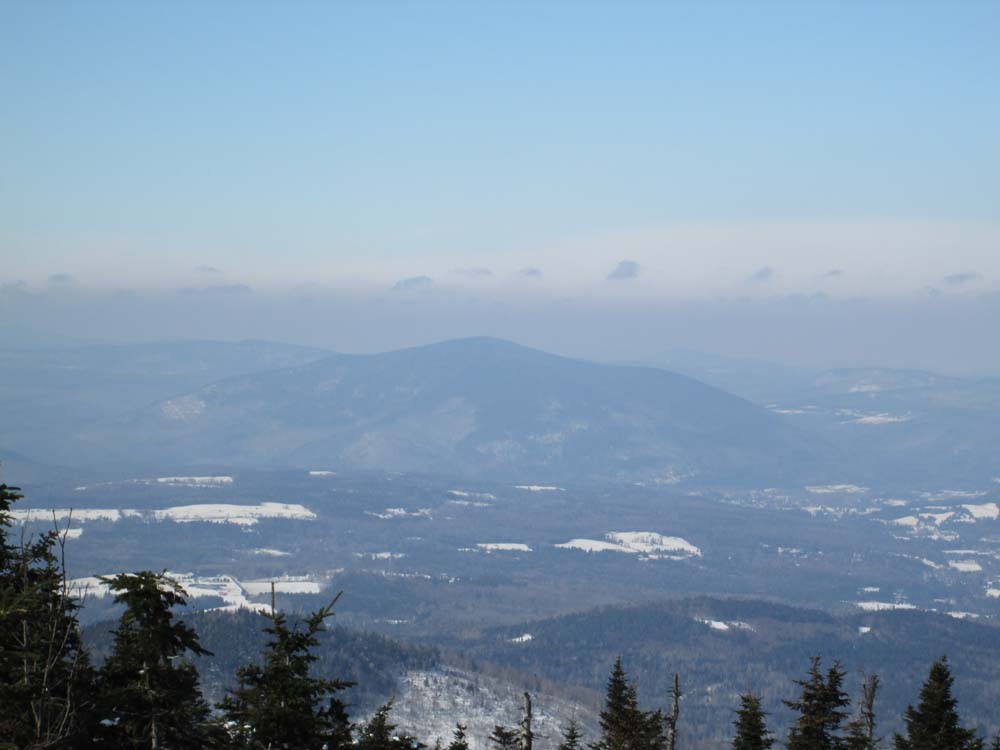
Looking at the Vermont Monadnock from near the summit of Dixville Peak

The trail between Balsams Wilderness ski area and Table Rock

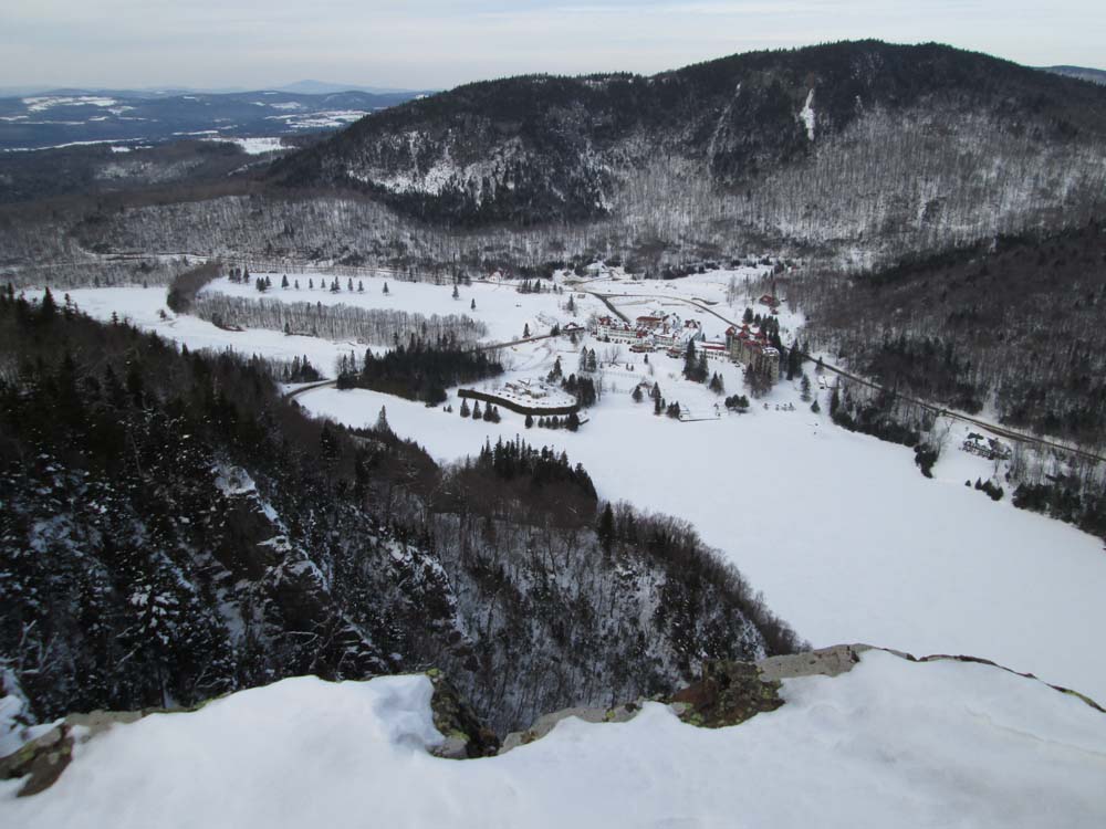
Looking at the abandoned Balsams Wilderness Grand Hotel from Table Rock
Directions to trailhead: While there is little to no room to park, the Bunny Hop XC ski trail (and snowmobile trail) crosses Route 26 west of Dixville Notch.
Back to Dixville Peak Profile
Back to Table Rock Profile
|