Home
States
Colorado
Connecticut
Maine
Massachusetts
New Hampshire
New York
Rhode Island
Utah
Vermont
View All
Lists
NE 4,000 Footers
NE 100 Highest
NH 4,000 Footers
NH 100 Highest
NH 52 With A View
NH Belknap Range
NH Ossipee 10
Links
Trail Conditions
Trip Log
Sunrises
Sunsets
About
|
East Doublehead Mountain, West Doublehead Mountain, Mt. Squam, Mt. Percival, Mt. Morgan, Mt. Livermore, Cotton Mountain
Sandwich, NH
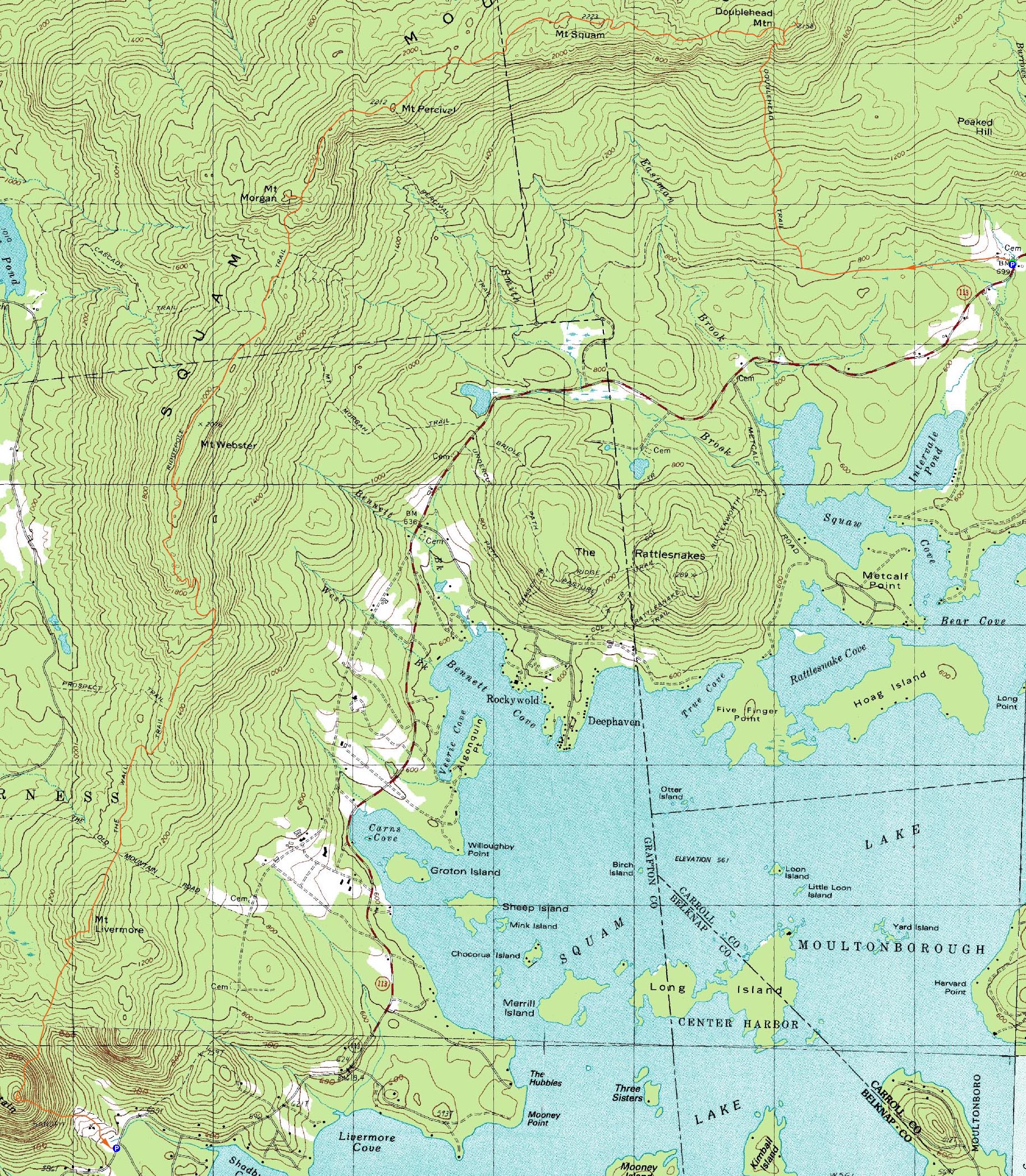
Trailheads, measurements, times, distances, and maps are all approximate and relative to the hike(s) as shown below.
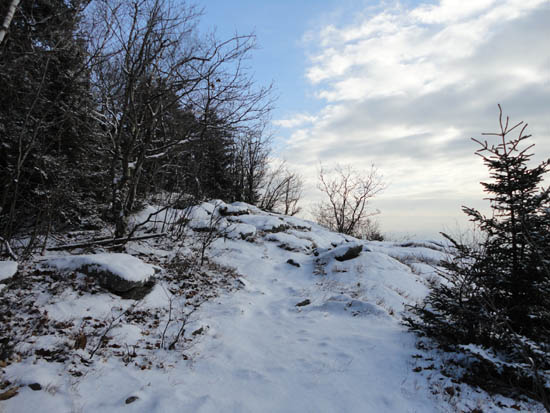
Looking up the Doublehead Trail
Route: Old Highway, Doublehead Trail, Crawford Ridgepole Trail, (East Doublehead Mountain), Crawford Ridgepole Trail, (West Doublehead Mountain), Crawford Ridgepole Trail, (Mt. Squam), Crawford Ridgepole Trail, (Mt. Percival), Crawford Ridgepole Trail, Mt. Morgan Trail, (Mt. Morgan), Mt. Morgan Trail, Crawford Ridgepole Trail, (Mt. Livermore), Crawford Ridgepole Trail, (Cotton Mountain - East Peak), Cotton Mountain Trail
With winter taking hold in the Whites, we decided to hike in the Lakes Region. It looked to be a nice day for a fall hike, however a little bit of snow fell overnight and the mostly sunny forecast was never to be.
After spotting a vehicle at the Cotton Mountain trailhead, we headed east on Route 113 to Thompson Road. Starting on the Old Highway roadwalk, we eventually turned right onto the Doublehead Trail. The new snow was just enough to make things slippery, so we ended up donning Microspikes for the climb up the steeps.
After taking a few shots of the views from near the top of the Doublehead Trail, we climbed up to the Crawford Ridgepole Trail, then took a quick side trip to East Doublehead. With the northern views socked in, we didn't hesistate long, turning around and heading over to West Doublehead.
Beyond West Doublehead, we had to proceed with caution in places, as black and blue ice was concealed by the new snowfall.
After passing over the somewhat sharp, ledgy summit of Mt. Squam, we continued on our way to Mt. Percival. Normally a very nice summit, the cloudy skies and lack of blue lake views took away from the scenery.
Our next stop was Mt. Morgan, via the short spur trail to the summit. Once again, northern views were a bit socked in.
Descending off Mt. Morgan, we had to take our time as the trail was pretty much wall to wall in blue ice for extended stretches. This issue passed as we passed through the col and started the steady climb up Mt. Webster.
While we found a side trail that led to a ledgy (no view) area with a cairn on a highpoint, it didn't appear to be anywhere near the "X" on the USGS maps (in hindsight). Shortly past this spur, there were excellent views from ledges adjacent the Crawford Ridgepole Trail.
A little while after passing these ledges, the trail started to descend via a bunch of switchbacks. After passing over Old Mountain Road, the trail climbed up to Mt. Livermore, from where we had decent, but still cloudy views.
After descending the countless switchbacks, we continued into the col and then steeply up the side of Cotton Mountain on the Crawford Ridgepole Trail. Reaching the trailed summit (the true summit is a bushwhack west), we continued on the short path to the vista, from where we had our last views of the day.
After that, it was a steep, slow descent on the Cotton Mountain Trail on slippery, snow covered leaves.
| Hike Ratings |
|
Getting To Trailhead: |
Easy |
| Destination: |
East Doublehead Mountain |
|
Length: |
Moderate |
|
Steepness: |
Difficult |
|
Navigation: |
Easy |
|
Views: |
Excellent |
|
Crowds: |
Minimal |
| Destination: |
West Doublehead Mountain |
|
Length: |
Moderate |
|
Steepness: |
Moderate |
|
Navigation: |
Easy |
|
Views: |
Moderate (due to weather) |
|
Crowds: |
Minimal |
| Destination: |
Mt. Squam |
|
Length: |
Moderate |
|
Steepness: |
Very Difficult |
|
Navigation: |
Easy |
|
Views: |
Excellent |
|
Crowds: |
Minimal |
| Destination: |
Mt. Percival |
|
Length: |
Moderate |
|
Steepness: |
Very Difficult |
|
Navigation: |
Moderate |
|
Views: |
Excellent |
|
Crowds: |
Minimal |
| Destination: |
Mt. Morgan |
|
Length: |
Moderate |
|
Steepness: |
Difficult |
|
Navigation: |
Moderate |
|
Views: |
Excellent |
|
Crowds: |
Minimal |
| Destination: |
Mt. Livermore |
|
Length: |
Difficult |
|
Steepness: |
Moderate |
|
Navigation: |
Easy |
|
Views: |
Excellent |
|
Crowds: |
Minimal |
| Destination: |
Cotton Mountain |
|
Length: |
Difficult |
|
Steepness: |
Difficult |
|
Navigation: |
Easy |
|
Views: |
Excellent |
|
Crowds: |
Minimal |
|
| Hike Stats |
|
Date Hiked: |
Saturday, December 11, 2010 |
| Hike Commenced: |
7:48 AM |
| Parking Elevation: |
720' |
| Destination: |
East Doublehead Mountain |
| Ascent Commenced: |
7:48 AM |
| Summit Reached: |
9:16 AM |
| Time Elapsed: |
01:28 |
| Trailhead Elevation: |
720' |
| Summit Elevation: |
2,158' |
| Distance: |
2.4 miles |
| Vertical Gain: |
1,508' |
| Destination: |
West Doublehead Mountain |
| Ascent Commenced: |
9:18 AM |
| Summit Reached: |
9:26 AM |
| Time Elapsed: |
00:08 |
| Trailhead Elevation: |
2,158' |
| Summit Elevation: |
2,130' |
| Distance: |
.2 mile |
| Vertical Gain: |
70' |
| Destination: |
Mt. Squam |
| Ascent Commenced: |
9:26 AM |
| Summit Reached: |
10:04 AM |
| Time Elapsed: |
00:38 |
| Trailhead Elevation: |
2,130' |
| Summit Elevation: |
2,223' |
| Distance: |
.9 mile |
| Vertical Gain: |
403' |
| Destination: |
Mt. Percival |
| Ascent Commenced: |
10:04 AM |
| Summit Reached: |
11:02 AM |
| Time Elapsed: |
00:58 |
| Trailhead Elevation: |
2,223' |
| Summit Elevation: |
2,212' |
| Vertical Gain: |
352' |
| Destination: |
Mt. Morgan |
| Ascent Commenced: |
11:07 AM |
| Summit Reached: |
11:39 AM |
| Time Elapsed: |
00:32 |
| Trailhead Elevation: |
2,212' |
| Summit Elevation: |
2,220' |
| Distance: |
.8 mile |
| Vertical Gain: |
168' |
| Destination: |
Mt. Livermore |
| Ascent Commenced: |
11:43 AM |
| Summit Reached: |
2:18 PM |
| Time Elapsed: |
02:35 |
| Trailhead Elevation: |
2,220' |
| Summit Elevation: |
1,500' |
| Vertical Gain: |
540' |
| Destination: |
Cotton Mountain |
| Ascent Commenced: |
2:34 PM |
| Summit Reached: |
3:20 PM |
| Time Elapsed: |
00:46 |
| Trailhead Elevation: |
1,500' |
| Summit Elevation: |
1,200' |
| Vertical Gain: |
360 |
|
|
| Hike Ended: |
3:43 PM |
| Hike Time Elapsed: |
07:55 |
| Hike Vertical Gain: |
3,406' |
|
The beginning of the Old Highway roadwalk
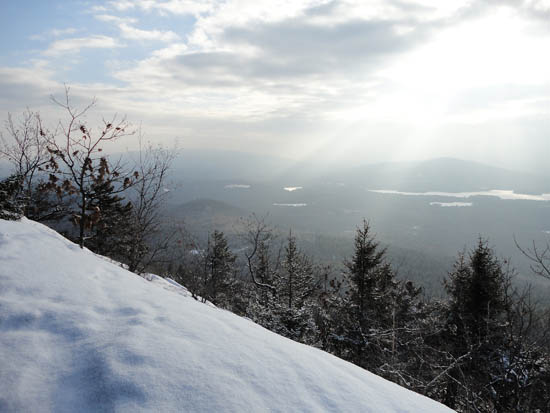
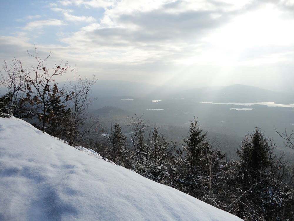
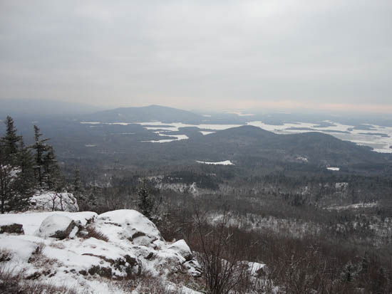
The Ossipees and Red Hill as seen from the ledges below East Doublehead along the Doublehead Trail
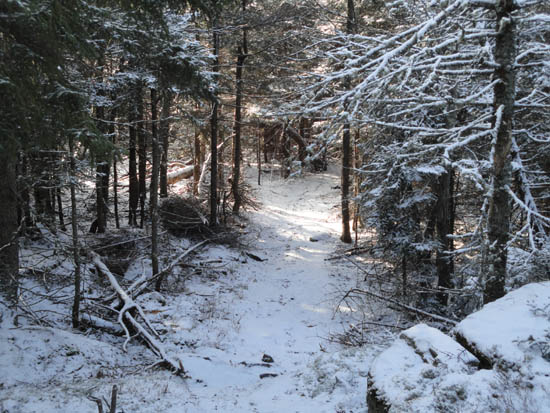
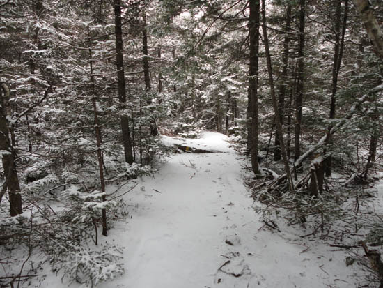
The Crawford-Ridgepole Trail on the way to West Doublehead Mountain
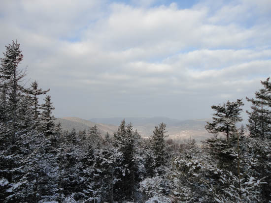
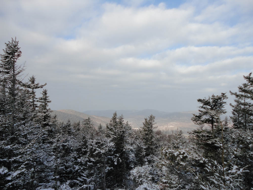
Looking north from West Doublehead Mountain

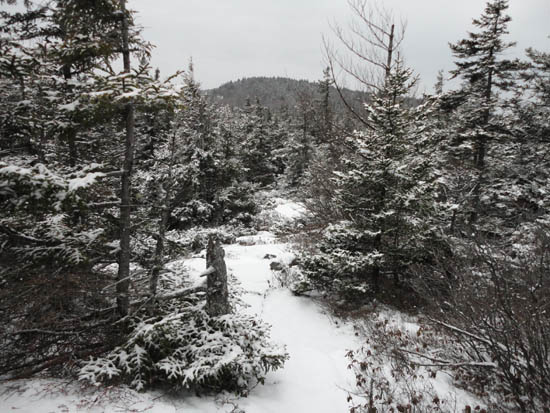
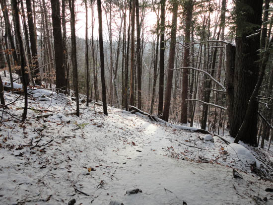
What's hiding under the snow? Crawford Ridgepole Trail to Mt. Squam

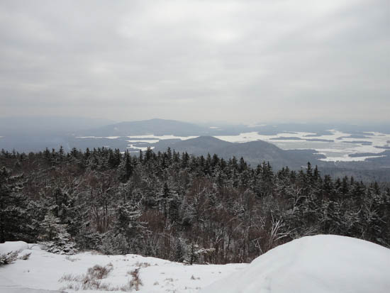
Looking at the Ossipees from Mt. Squam
The Crawford-Ridgepole Trail on the way to Mt. Percival
Red Hill and the Rattlesnakes as seen from Mt. Percival
The Crawford-Ridgepole Trail on the way to Mt. Morgan
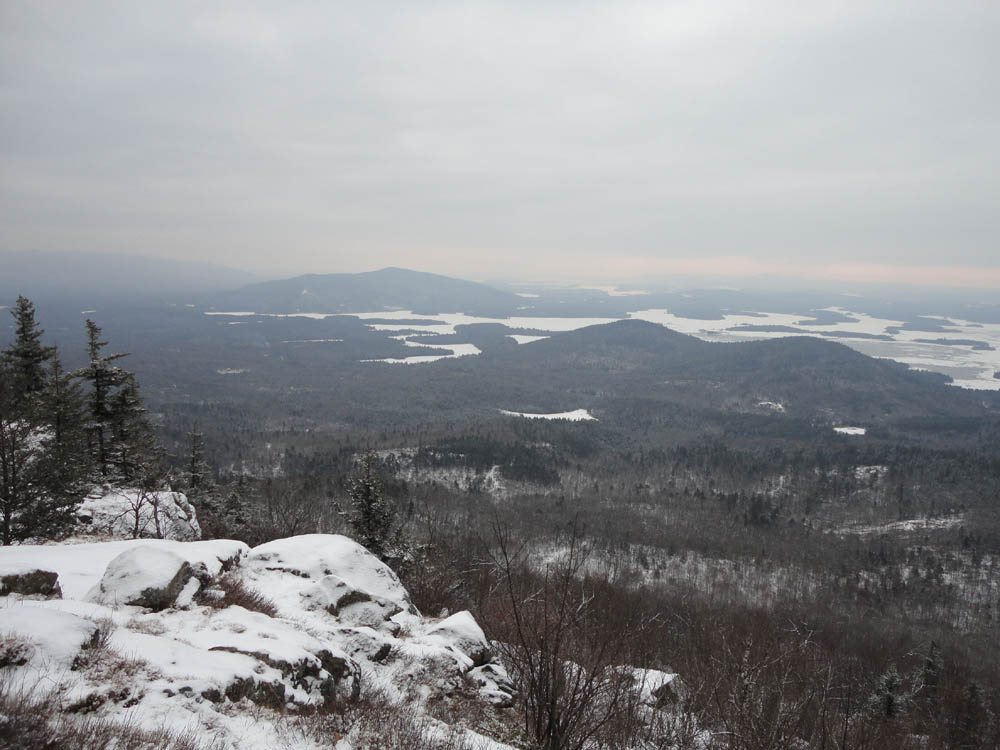
Red Hill and the Rattlesnakes as seen from near the summit of Mt. Morgan
The Crawford-Ridgepole Trail below Mt. Morgan on the way to Mt. Livermore

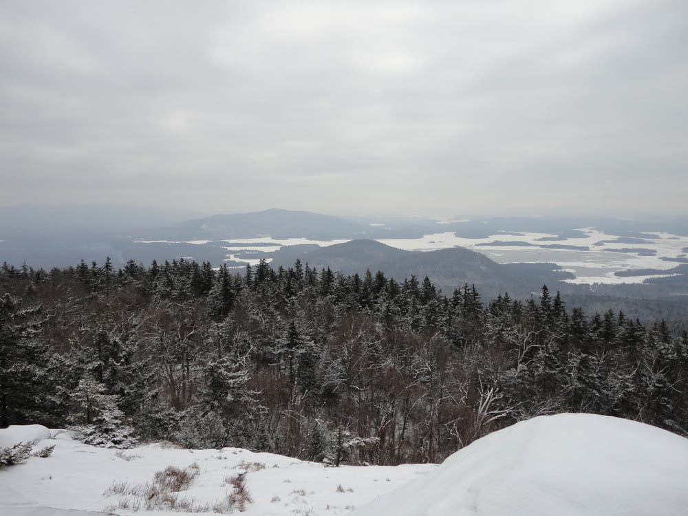
The Rattlesnakes and Red Hill as seen from Mt. Livermore
The Crawford-Ridgepole Trail on the way to Cotton Mountain
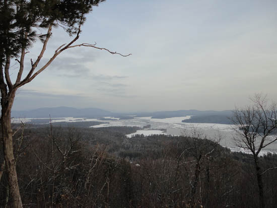
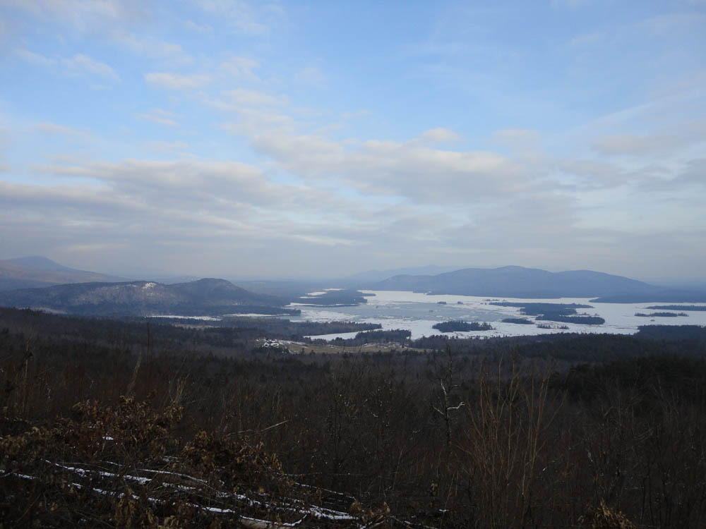
Looking at Red Hill and Squam Lake from the Cotton Mountain vista


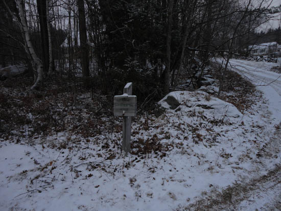
Directions to trailhead: Take Route 113 West from Center Sandwich. Thompson Road will eventually be on the right. There a small dirt parking area located on the side of Route 113. The Old Highway starts as a roadwalk up Thompson Road. Continuing west on Route 113, the Cotton Mountain Trail trailhead will eventually be on the right.
Back to East Doublehead Mountain Profile
Back to West Doublehead Mountain Profile
Back to Mt. Squam Profile
Back to Mt. Percival Profile
Back to Mt. Morgan Profile
Back to Mt. Livermore Profile
Back to Cotton Mountain Profile
|