Home
States
Colorado
Connecticut
Maine
Massachusetts
New Hampshire
New York
Rhode Island
Utah
Vermont
View All
Lists
NE 4,000 Footers
NE 100 Highest
NH 4,000 Footers
NH 100 Highest
NH 52 With A View
NH Belknap Range
NH Ossipee 10
Links
Trail Conditions
Trip Log
Sunrises
Sunsets
About
|
East Rattlesnake
Sandwich, NH, Holderness, NH
Trailheads, measurements, times, distances, and maps are all approximate and relative to the hike(s) as shown below.

The Butterworth Trail
Route: Col Trail, bushwhack, Butterworth Trail, (East Rattlesnake), Ridge Trail, Col Trail
After spending much of the day hiking and doing trail maintenance on Mt. Chocorua, I headed over to the Rattlesnakes for a late afternoon hike.
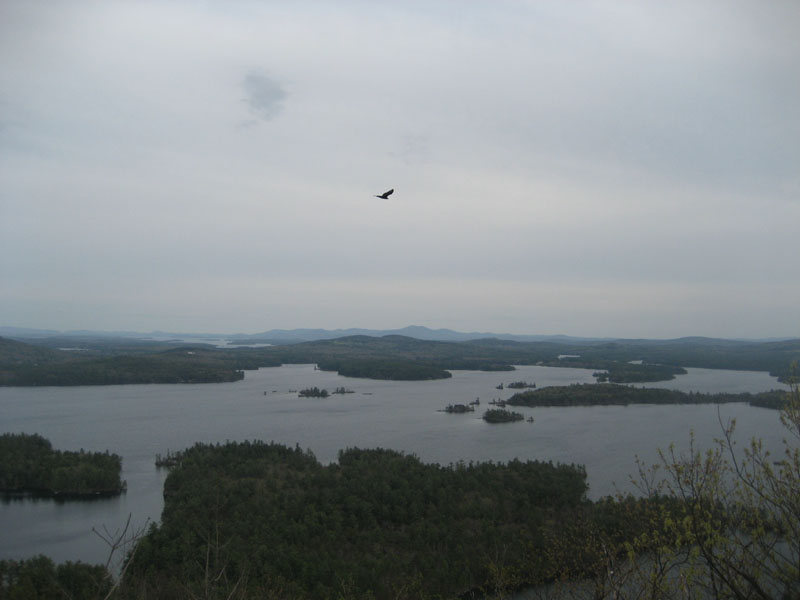
Rather than do the traditional Rattlesnake hike, we opted to go to the Col Trail, bushwhack along a nice brook, then connect to the Butterworth Trail to the summit of the peak. Down at the viewpoint along the Ridge Trail, the views were pretty strong despite the overcast skies.
Rather than bushwhack back, we continued along the Ridge Trail, using the Col Trail to descend back to the base. There's certainly a lot to explore around these two peaks!
| Hike Ratings |
|
Getting To Trailhead: |
Easy |
| Destination: |
East Rattlesnake |
|
Length: |
Easy |
|
Steepness: |
Moderate |
|
Navigation: |
Difficult |
|
Views: |
Excellent |
|
Crowds: |
Minimal |
|
| Hike Stats |
|
Date Hiked: |
Sunday, May 3, 2009 |
| Hike Commenced: |
5:07 PM |
| Parking Elevation: |
740' |
| Destination: |
East Rattlesnake |
| Ascent Commenced: |
5:07 PM |
| Summit Reached: |
5:53 PM |
| Time Elapsed: |
00:46 |
| Trailhead Elevation: |
740' |
| Summit Elevation: |
1,289' |
| Vertical Gain: |
639' |
|
|
| Hike Ended: |
6:41 PM |
| Hike Time Elapsed: |
01:34 |
| Hike Vertical Gain: |
699' |
|

The Col Trail trailhead off Route 113

A wildflower along the bushwhack

Looking across Squam Lake from East Rattlesnake


Directions to trailhead: Take Route 113 West from Center Sandwich. The Col Trail trailhead and small parking area is located on the left, shortly after a turn and before the Holderness border. The Col Trail starts off as a woods road.
Back to East Rattlesnake Profile
|