Home
States
Colorado
Connecticut
Maine
Massachusetts
New Hampshire
New York
Rhode Island
Utah
Vermont
View All
Lists
NE 4,000 Footers
NE 100 Highest
NH 4,000 Footers
NH 100 Highest
NH 52 With A View
NH Belknap Range
NH Ossipee 10
Links
Trail Conditions
Trip Log
Sunrises
Sunsets
About
|
East Rattlesnake
Sandwich, NH
Trailheads, measurements, times, distances, and maps are all approximate and relative to the hike(s) as shown below.

Looking up the Butterworth Trail
Route: Butterworth Trail, (East Rattlesnake), Ridge Trail, (East Rattlesnake), Butterworth Trail
With mediocre weather and limited time, I went for a quick jog up a somewhat new-to-me trail. Starting at Metcalf Road, I slowly jogged my way up the twisty Butterworth Trail, keeping my eye out for blazes marking many short switchbacks. Due to wet leaves and a lack of energy, I found my progress to be slow on this never overly steep trail.
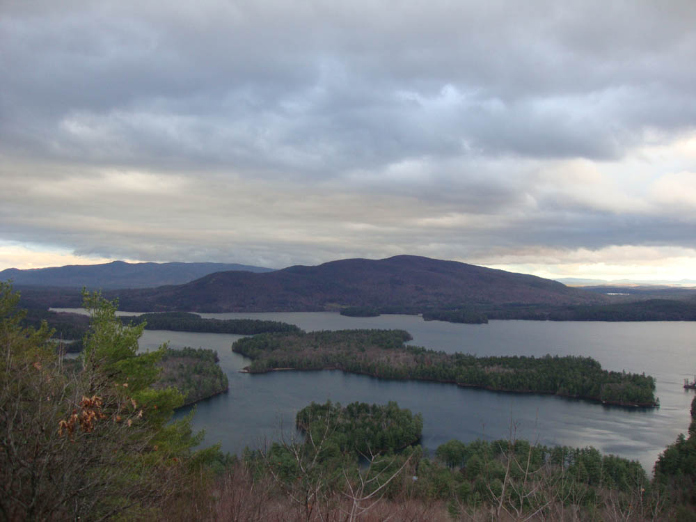
After reaching the wooded summit, I continued down the Ridge Trail to the viewpoint, from where I had excellent views from the Ossipees to Kearsarge, despite an extended rain event having just moved through.
Once again due to the wet leaves, the descent was a slow jog as well.
| Hike Ratings |
|
Getting To Trailhead: |
Easy |
| Destination: |
East Rattlesnake |
|
Length: |
Easy |
|
Steepness: |
Moderate |
|
Navigation: |
Easy |
|
Views: |
Excellent |
|
Crowds: |
Minimal |
|
| Hike Stats |
|
Date Hiked: |
Wednesday, November 17, 2010 |
| Hike Commenced: |
3:26 PM |
| Parking Elevation: |
570' |
| Destination: |
East Rattlesnake |
| Ascent Commenced: |
3:27 PM |
| Summit Reached: |
3:40 PM |
| Time Elapsed: |
00:13 |
| Trailhead Elevation: |
575' |
| Summit Elevation: |
1,289' |
| Distance: |
.7 miles |
| Vertical Gain: |
719' |
|
|
| Hike Ended: |
4:01 PM |
| Hike Time Elapsed: |
00:35 |
| Hike Distance: |
1.6 miles |
| Hike Vertical Gain: |
818' |
|

The Butterworth Trail trailhead on Metcalf Road

Looking at the Ossipees and Red Hill from the East Rattlesnake vista


Directions to trailhead: Take Route 113 East from Holderness. Shortly after passing the Col Trail, take a right onto Metcalf Road. There is minimal roadside parking within a few hundred feet of the Butterworth Trail trailhead, which will be on the right.
Back to East Rattlesnake Profile
|