Home
States
Colorado
Connecticut
Maine
Massachusetts
New Hampshire
New York
Rhode Island
Utah
Vermont
View All
Lists
NE 4,000 Footers
NE 100 Highest
NH 4,000 Footers
NH 100 Highest
NH 52 With A View
NH Belknap Range
NH Ossipee 10
Links
Trail Conditions
Trip Log
Sunrises
Sunsets
About
|
East Rattlesnake
Holderness, NH
Trailheads, measurements, times, distances, and maps are all approximate and relative to the hike(s) as shown below.
Descending the Col Trail
Route: East Rattlesnake Trail, Ridge Trail, Col Trail
East Rattlesnake Trail was broken out but not consolidated, as was the section of the Ridge Trail to the viewpoint. Above there, the trail was unbroken to the wooded summit. No recent traffic up from the other side.
Back on the Ridge Trail, there were some extended drifted in areas on the way to the Col. No recent traffic heading to Route 113 on the Col Trail, but there were some tracks heading to West Rattlesnake. Col Trail westbound was broken out but not well consolidated. Five Finger Point and Pasture Trail both appear to have some recent use.
Though comparatively warm in the single digits, a cold morning with some bitter gusts of wind. Though there are some three foot deep sections on the ridge, the snowpack on the western slope is probably one to two feet.
| Hike Ratings |
|
Getting To Trailhead: |
Easy |
| Destination: |
East Rattlesnake |
|
Length: |
Easy |
|
Steepness: |
Moderate |
|
Navigation: |
Easy |
|
Views: |
Excellent |
|
Crowds: |
Minimal |
|
| Hike Stats |
|
Date Hiked: |
Friday, February 20, 2015 |
| Time to Trailhead: |
00:04 |
| Parking Elevation: |
623' |
| Destination: |
East Rattlesnake |
| Time Elapsed: |
00:17 |
| Trailhead Elevation: |
720' |
| Summit Elevation: |
1,289' |
| Vertical Gain: |
584' |
|
|
| Hike Time Elapsed: |
00:55 |
| Hike Vertical Gain: |
711' |
|
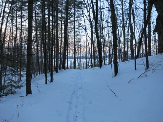
The East Rattlesnake Trail trailhead
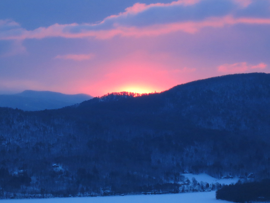
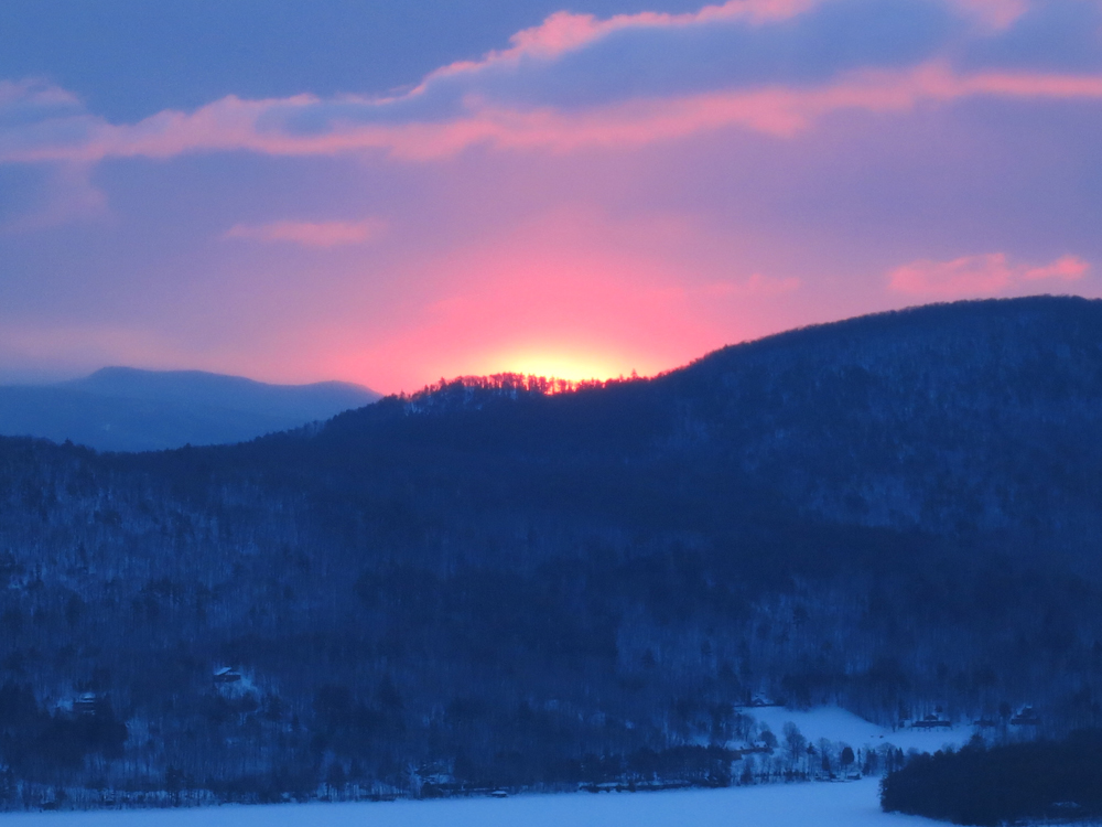
The sunrise from the East Rattlesnake view point
Directions to trailhead: Take Route 113 West from Center Sandwich. Shortly after the Mt. Morgan parking lot, take a left onto Pinehurst Road. Park outside the private property entranceway (don't block the road!), then follow the road up shortly, taking a left, then a right between two cabins. The East Rattlsnake Trail sign will be a minute or two up the path.
Back to East Rattlesnake Profile
|