Home
States
Colorado
Connecticut
Maine
Massachusetts
New Hampshire
New York
Rhode Island
Utah
Vermont
View All
Lists
NE 4,000 Footers
NE 100 Highest
NH 4,000 Footers
NH 100 Highest
NH 52 With A View
NH Belknap Range
NH Ossipee 10
Links
Trail Conditions
Trip Log
Sunrises
Sunsets
About
|
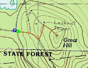
Great Hill
Tamworth, NH
Trailheads, measurements, times, distances, and maps are all approximate and relative to the hike(s) as shown below.
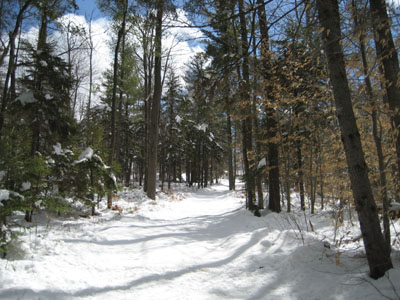
Heading up toward the Great Hill summit
After not hiking all week due to the snowy weather, I finally was able to sneak out during my lunch break and snowshoe Great Hill. I was somewhat surprised when I discovered unbroken trail upon arriving at the parking lot - cross country skiers must have hung up their equipment for the season!
There was probably about 8-12" of snow on the trail, making for some extra effort in comparison to my hike on Sunday.
The views from the summit were great again, though an oncoming storm to the west was quickly consuming the mountaintops.
| Hike Ratings |
|
Getting To Trailhead: |
Easy |
| Destination: |
Great Hill |
|
Length: |
Easy |
|
Steepness: |
Easy |
|
Navigation: |
Moderate |
|
Views: |
Excellent |
|
Crowds: |
Minimal |
|
| Hike Stats |
|
Date Hiked: |
Friday, April 6, 2007 |
| Hike Commenced: |
11:21 AM |
| Parking Elevation: |
1,020' |
| Destination: |
Great Hill |
| Ascent Commenced: |
11:21 AM |
| Summit Reached: |
11:38 AM |
| Time Elapsed: |
00:17 |
| Trailhead Elevation: |
1,025' |
| Summit Elevation: |
1,270' |
| Vertical Gain: |
250' |
|
|
| Hike Ended: |
11:56 AM |
| Hike Time Elapsed: |
00:35 |
| Hike Vertical Gain: |
260' |
|
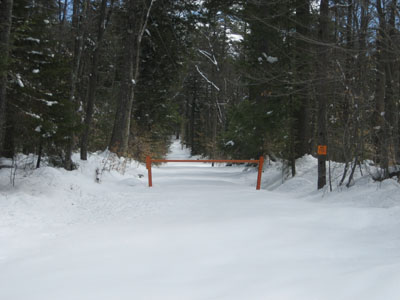
Trailhead to Great Hill summit
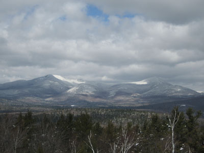
Looking northwest from the Great Hill summit at Mt. Whiteface and Mt. Passaconaway

Directions to trailhead: Take Great Hill Road from Tamworth Village. Parking area a few miles up once road turns to dirt. Trail to firetower starts at orange gate on uphill side of parking area.
Back to Great Hill Profile
|

