Home
States
Colorado
Connecticut
Maine
Massachusetts
New Hampshire
New York
Rhode Island
Utah
Vermont
View All
Lists
NE 4,000 Footers
NE 100 Highest
NH 4,000 Footers
NH 100 Highest
NH 52 With A View
NH Belknap Range
NH Ossipee 10
Links
Trail Conditions
Trip Log
Sunrises
Sunsets
About
|
Green Mountain
Effingham, NH
Trailheads, measurements, times, distances, and maps are all approximate and relative to the hike(s) as shown below.
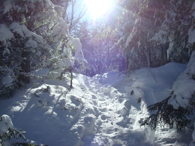
Heading up the High Watch Trail to the Green Mountain summit
Route: High Watch Trail
Originally, my intent was to take the morning off and try to do a more moderate hike - in the area of 5 miles and maybe 1,500 vertical feet. My back interjected and told me to stay put. My brain (or lack thereof) then interjected and forced me to get out on what was a cold but nice winter day - after all, it's not every day you can go hiking on Leap Year Day.
Arriving at the end of the plowed portion of the High Watch Road, I was happy to see there was some room to park off the paved road itself. I was also glad to see that the trail had been broken out.
It was about 11 degrees when I started, however the bright sun and low winds made it seem considerably warmer. There was also still a lot of snow in the trees from the day or so old storm, making for great scenery on the way up.
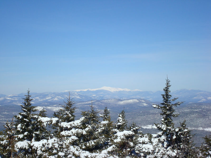
Since I was still hot, I climbed the tower in just my tee shirt - reality hit not too long after that, so I didn't spend too much time taking photos. Nonetheless, the views were about as strong as they get - the Presidentials were clear as a bell, the Sebago Lake region in Maine very easily seen, as well as the Sandwich Range.
I was sort of wishing I had my skis for the descent, as I could see a few folks had taken some turns a day earlier - though there are some low branches on the top of the trail, there is decent room to make short turns on the steeps. Perhaps one day I'll give it a try.
| Hike Ratings |
|
Getting To Trailhead: |
Easy |
| Destination: |
Green Mountain |
|
Length: |
Moderate |
|
Steepness: |
Difficult |
|
Navigation: |
Easy |
|
Views: |
Excellent |
|
Crowds: |
Minimal |
|
| Hike Stats |
|
Date Hiked: |
Friday, February 29, 2008 |
| Hike Commenced: |
10:17 AM |
| Parking Elevation: |
738' |
| Destination: |
Green Mountain |
| Ascent Commenced: |
10:19 AM |
| Summit Reached: |
11:02 AM |
| Time Elapsed: |
00:43 |
| Trailhead Elevation: |
735' |
| Summit Elevation: |
1,907' |
| Distance: |
1.3 miles |
| Vertical Gain: |
1,182' |
|
|
| Hike Ended: |
11:45 AM |
| Hike Time Elapsed: |
01:28 |
| Hike Distance: |
2.6 miles |
| Hike Vertical Gain: |
1,205' |
|
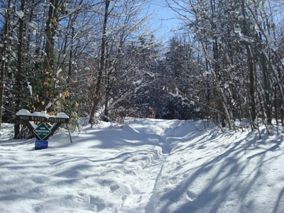
High Watch Trail trailhead
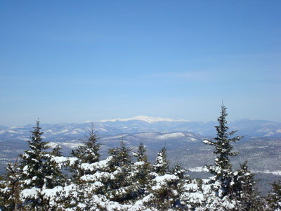
Looking northwest from the Green Mountain summit tower at the Presidential Range
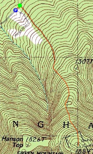

Directions to trailhead: Take Green Mountain Road from Route 25 to High Watch Road (there will be a small 'Fire Tower' sign). At the end of this road, there will be a class four road sign. The trailhead is shortly after this on the right.
Back to Green Mountain Profile
|