Home
States
Colorado
Connecticut
Maine
Massachusetts
New Hampshire
New York
Rhode Island
Utah
Vermont
View All
Lists
NE 4,000 Footers
NE 100 Highest
NH 4,000 Footers
NH 100 Highest
NH 52 With A View
NH Belknap Range
NH Ossipee 10
Links
Trail Conditions
Trip Log
Sunrises
Sunsets
About
|
Kinsman Mountain (North Peak), Kinsman Mountain (South Peak), Bald Peak
Easton, NH, Lincoln, NH
Trailheads, measurements, times, distances, and maps are all approximate and relative to the hike(s) as shown below.

Looking up the Kinsman Ridge Trail near the north peak
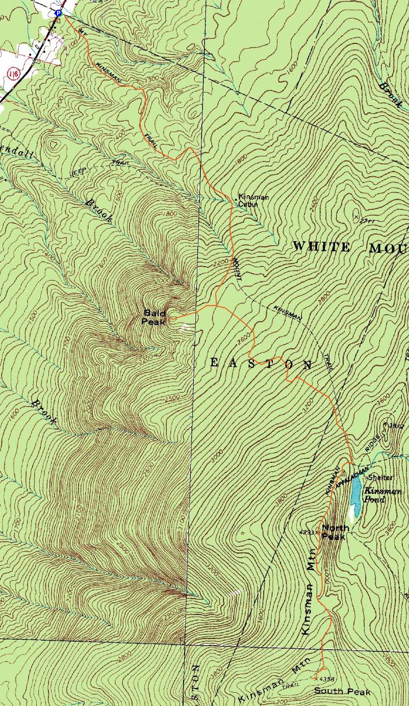
Route: Mt. Kinsman Trail, Kinsman Ridge Trail, (Kinsman Mountain North Peak), Kinsman Ridge Trail, (Kinsman Mountain South Peak), Kinsman Ridge Trail, (Kinsman Mountain North Peak), Kinsman Ridge Trail, Mt. Kinsman Trail, spur path, (Bald Peak), spur path, Mt. Kinsman Trail
While high winds in the forecast again, it seemed like a good day not to go above treeline. Thus, perhaps it was a good idea to ascend something with a bit more tree coverage, such as the Kinsmans.
After finding a makeshift parking area adjacent to the somewhat-hard-to-find Mt. Kinsman Trail trailhead, we put on our snowshoes and headed up the trail. The first section of trail, really a series of woods roads, was covered with a thin base of frozen granular and ice with a little bit of powder on top. Beyond the Bald Peak spur trail junction, the depths quickly picked up. Other than the icy top portion of the trail, it was fairly easy going.
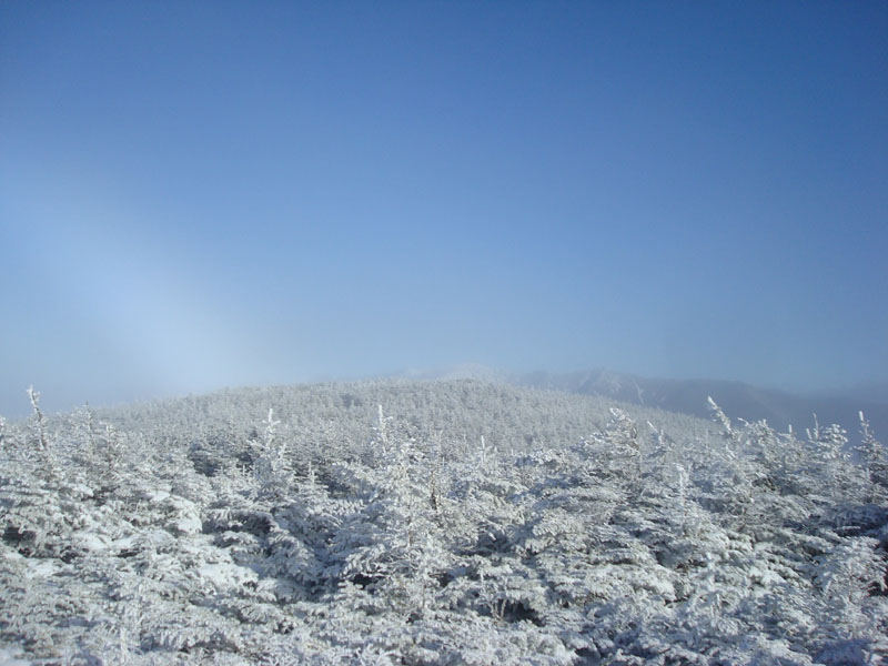
Once at the Kinsman Ridge Trail, we added some layers and soon made our way up a series of short icy scrambles (MSRs were fortunately adequate). At the summit of North Kinsman, we had blue sky but no views, due to an undercast.
Our next stop was South Kinsman. The ridge was rather beautiful with the blue sky and rime and snow on the trees. Perhaps the most challenging section of trail was the icy area coming off the north peak.
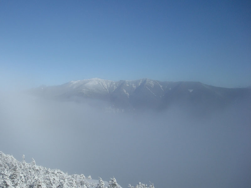
The views from the south peak were limited as well due to the undercast, though there was an impressive layer of clouds to the west and even a snow-bow visible.
By the time we made our way back to the north peak, we started to get some brief views to the east as the clouds worked their way through the notch. In addition to the Franconia Ridge, distant peaks such as Mt. Chocorua even appeared in the distance for a few seconds at a time.
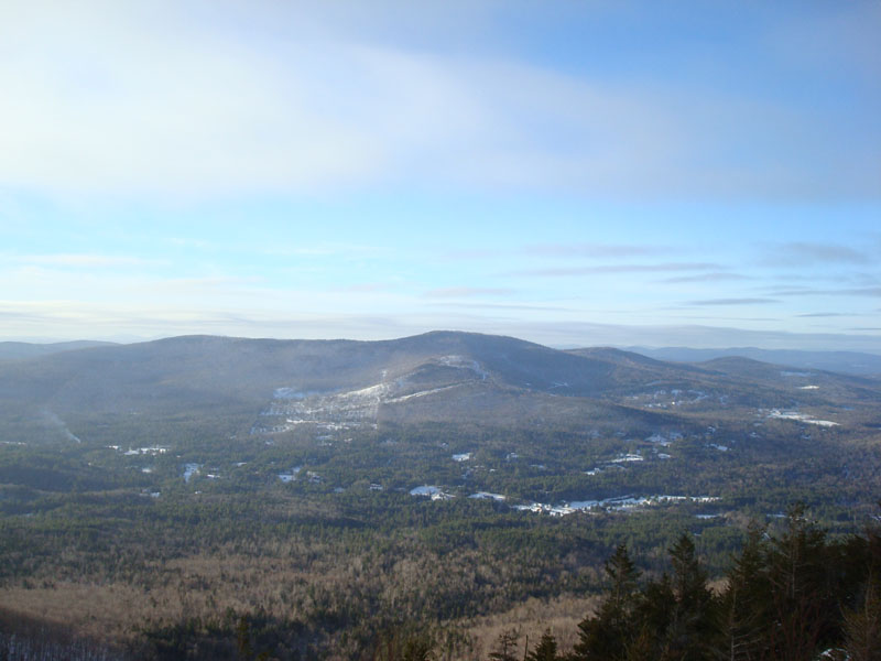
On the way back to the trailhead, we decided to do a brief trip over to Bald Peak. While the Kinsmans weren't visible from it due to the clouds, the views in most other directions were rather nice.
While it wasn't a bluebird, cloud free day as forecasted, it was nonetheless a nice hike.
| Hike Ratings |
|
Getting To Trailhead: |
Moderate |
| Destination: |
Kinsman Mountain (North Peak) |
|
Length: |
Moderate |
|
Steepness: |
Difficult |
|
Navigation: |
Easy |
|
Views: |
Excellent |
|
Crowds: |
Moderate |
| Destination: |
Kinsman Mountain (South Peak) |
|
Length: |
Moderate |
|
Steepness: |
Difficult |
|
Navigation: |
Easy |
|
Views: |
Moderate (due to weather) |
|
Crowds: |
Moderate |
| Destination: |
Bald Peak |
|
Length: |
Moderate |
|
Steepness: |
Difficult |
|
Navigation: |
Easy |
|
Views: |
Excellent |
|
Crowds: |
Moderate |
|
| Hike Stats |
|
Date Hiked: |
Sunday, January 4, 2009 |
| Hike Commenced: |
8:46 AM |
| Parking Elevation: |
1,030' |
| Destination: |
Kinsman Mountain (North Peak) |
| Ascent Commenced: |
8:46 AM |
| Summit Reached: |
11:42 AM |
| Time Elapsed: |
02:56 |
| Trailhead Elevation: |
1,030' |
| Summit Elevation: |
4,293'' |
| Distance: |
4.1 miles |
| Vertical Gain: |
3,273' |
| Destination: |
Kinsman Mountain (South Peak) |
| Ascent Commenced: |
11:51 AM |
| Summit Reached: |
12:34 PM |
| Time Elapsed: |
00:43 |
| Trailhead Elevation: |
4,293' |
| Summit Elevation: |
4,358' |
| Distance: |
.9 mile |
| Vertical Gain: |
373' |
| Destination: |
Bald Peak |
| Ascent Commenced: |
12:42 PM |
| Summit Reached: |
2:40 PM |
| Time Elapsed: |
01:58 |
| Trailhead Elevation: |
1,030' |
| Summit Elevation: |
2,470' |
| Vertical Gain: |
378' |
|
|
| Hike Ended: |
3:43 PM |
| Hike Time Elapsed: |
06:57 |
| Hike Distance: |
10.4 miles |
| Hike Vertical Gain: |
4,099' |
|

The Mt. Kinsman Trail trailhead on Route 116

Looking at the Franconia Ridge from the ledge near the summit of Kinsman Mountain's North Peak

Looking up the Kinsman Ridge Trail on the way to the south peak of Mt. Kinsman

Looking at the Franconia Ridge (snowbow to the left) from near the summit of Kinsman Mountain's South Peak

Looking down the spur trail to Bald Peak

Looking at Cooley Hill and Cole Hill from Bald Peak


Directions to trailhead: Take Route 112 West from Lincoln to Route 116 North. The old Mt. Kinsman Trail trailhead is on the right, between two rock pillars, literally just before the Easton-Franconia border sign. NOTE - As of spring 2009, the new trailhead and parking area are located just south of Tamarack Camp.
Back to Kinsman Mountain (North Peak) Profile
Back to Kinsman Mountain (South Peak) Profile
Back to Bald Peak Profile
|