Home
States
Colorado
Connecticut
Maine
Massachusetts
New Hampshire
New York
Rhode Island
Utah
Vermont
View All
Lists
NE 4,000 Footers
NE 100 Highest
NH 4,000 Footers
NH 100 Highest
NH 52 With A View
NH Belknap Range
NH Ossipee 10
Links
Trail Conditions
Trip Log
Sunrises
Sunsets
About
|
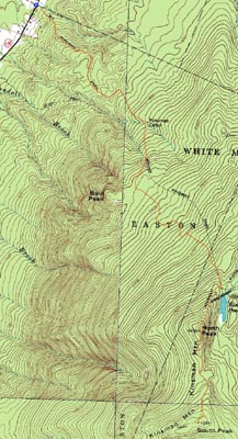
Kinsman Mountain (North Peak), Kinsman Mountain (South Peak)
Easton, NH, Lincoln, NH
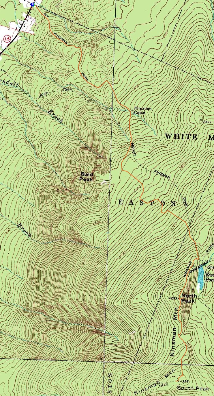
Trailheads, measurements, times, distances, and maps are all approximate and relative to the hike(s) as shown below.

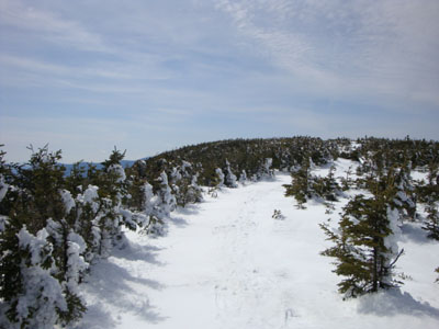
Looking down the Kinsman Ridge Trail near the north peak
Route: Mt. Kinsman Trail, Kinsman Ridge Trail, (Kinsman Mountain North Peak), Kinsman Ridge Trail, (Kinsman Mountain South Peak), Kinsman Ridge Trail, (Kinsman Mountain North Peak), Kinsman Ridge Trail, Mt. Kinsman Trail
With crap weather in the forecast, I decided to take most of the day off from work so that I could get some blue sky hiking in prior to the rain. Since spring is starting to wreck hiking trails and water crossings, I decided to get the Kinsmans in before the approaches become tricky.
The first part of the Mt. Kinsman Trail was a bit muddy with some patches of blue ice. While the first water crossing was open, the second and third were still bridged.
While I was feeling a bit sluggish while hiking the flats, I finally felt some semblence of energy by the time I started to ascend above Bald Peak. Though I never ended up seeing it, I was following fresh tracks of some canine creature. Reaching the Kinsman Ridge Trail, it was looking like a nice day. The views from the north peak were quite nice - it looked like a nice day on the Franconia Ridge!
In Microspikes up to this point, I continued with them on, heading over to South Kinsman with 1-3" of new sticky snow on the ground. While my previous two visits to South Kinsman had been in the clouds, I had decent views on this day. While Vermont was hazy and cloudy, there were strong views to Moosilauke and points east.
Though it was tempting to head over to Bald Peak, I had to get back to work. What a nice day to be out on the trails!
| Hike Ratings |
|
Getting To Trailhead: |
Moderate |
| Destination: |
Kinsman Mountain (North Peak) |
|
Length: |
Moderate |
|
Steepness: |
Difficult |
|
Navigation: |
Easy |
|
Views: |
Excellent |
|
Crowds: |
Minimal |
| Destination: |
Kinsman Mountain (South Peak) |
|
Length: |
Moderate |
|
Steepness: |
Difficult |
|
Navigation: |
Easy |
|
Views: |
Excellent |
|
Crowds: |
Minimal |
|
| Hike Stats |
|
Date Hiked: |
Thursday, April 2, 2009 |
| Hike Commenced: |
10:14 AM |
| Parking Elevation: |
1,030' |
| Destination: |
Kinsman Mountain (North Peak) |
| Ascent Commenced: |
10:14 AM |
| Summit Reached: |
12:13 PM |
| Time Elapsed: |
01:59 |
| Trailhead Elevation: |
1,030' |
| Summit Elevation: |
4,293'' |
| Distance: |
4.1 miles |
| Vertical Gain: |
3,273' |
| Destination: |
Kinsman Mountain (South Peak) |
| Ascent Commenced: |
12:16 PM |
| Summit Reached: |
12:45 PM |
| Time Elapsed: |
00:29 |
| Trailhead Elevation: |
4,293' |
| Summit Elevation: |
4,358' |
| Distance: |
.9 mile |
| Vertical Gain: |
373' |
|
|
| Hike Ended: |
3:21 PM |
| Hike Time Elapsed: |
05:07 |
| Hike Distance: |
10 miles |
| Hike Vertical Gain: |
4,004' |
|
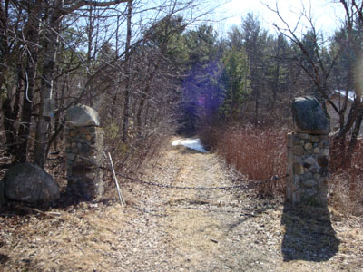
The Mt. Kinsman Trail trailhead on Route 116
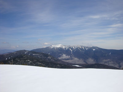
Cannon Mountain and the Franconia Ridge as seen from the ledge near the summit of Kinsman Mountain's North Peak
The Kinsman Ridge Trail near the south peak of Mt. Kinsman
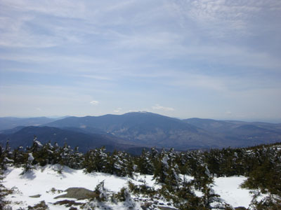
Looking at Mt. Moosilauke from near the summit of Kinsman Mountain's South Peak

Directions to trailhead: Take Route 112 West from Lincoln to Route 116 North. The old Mt. Kinsman Trail trailhead is on the right, between two rock pillars, literally just before the Easton-Franconia border sign. Parking is only available on the side of Route 116. NOTE - As of spring 2009, the new trailhead and parking area are located just south of Tamarack Camp.
Back to Kinsman Mountain (North Peak) Profile
Back to Kinsman Mountain (South Peak) Profile
|