Home
States
Colorado
Connecticut
Maine
Massachusetts
New Hampshire
New York
Rhode Island
Utah
Vermont
View All
Lists
NE 4,000 Footers
NE 100 Highest
NH 4,000 Footers
NH 100 Highest
NH 52 With A View
NH Belknap Range
NH Ossipee 10
Links
Trail Conditions
Trip Log
Sunrises
Sunsets
About
|
Kinsman Mountain (North Peak), Kinsman Mountain (South Peak)
Easton, NH, Lincoln, NH
Trailheads, measurements, times, distances, and maps are all approximate and relative to the hike(s) as shown below.

Looking up the new section of the Mt. Kinsman Trail
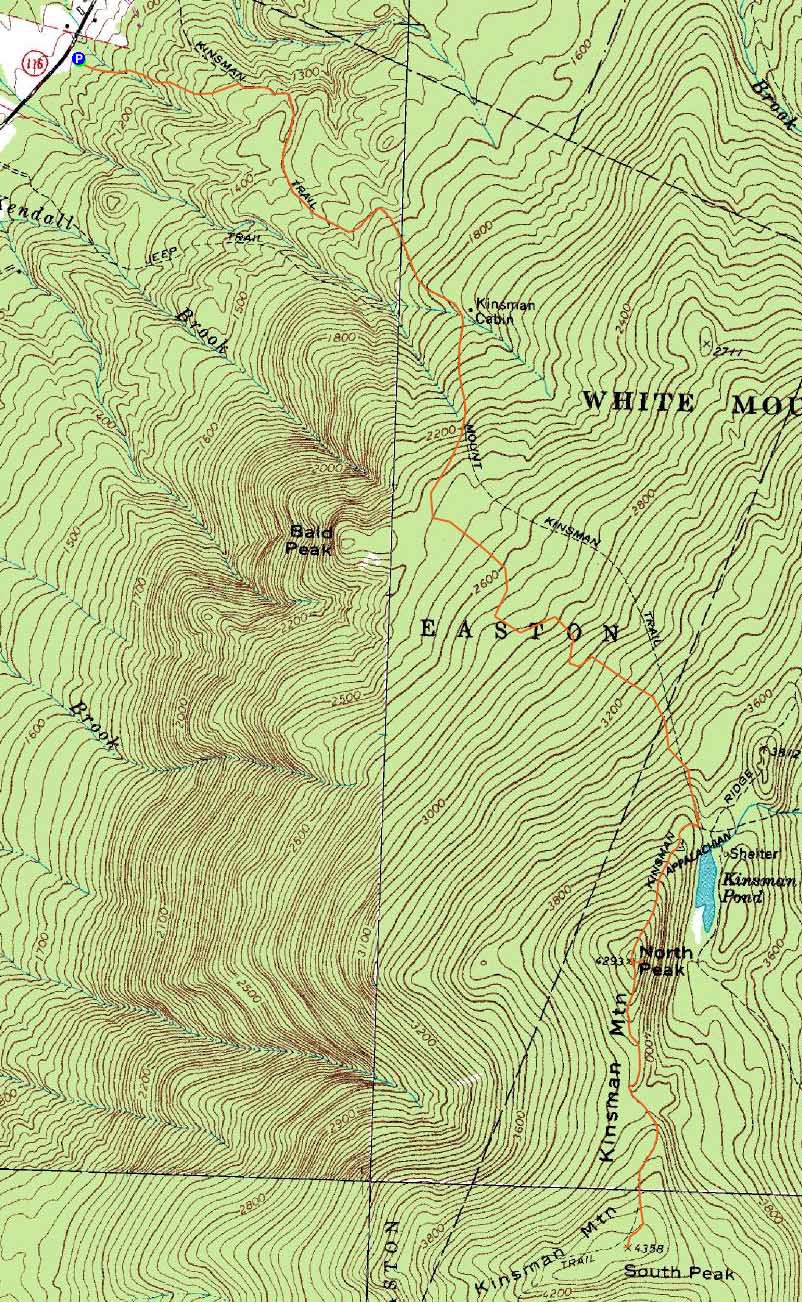
Route: Mt. Kinsman Trail, Kinsman Ridge Trail, (Kinsman Mountain North Peak), Kinsman Ridge Trail, (Kinsman Mountain South Peak), Kinsman Ridge Trail, (Kinsman Mountain North Peak), Kinsman Ridge Trail, Mt. Kinsman Trail, Gorge path, Mt. Kinsman Trail
After three consecutive days on the trails without much rest, I decided to do something a bit more tame - the Kinsmans sounded good.
The new section of the Mt. Kinsman Trail appeared to hold up pretty decently to the month of rain. Above there, the trail was a little bit muddy in places, but not too bad considering.
Though clouds were moving in, the views from the North Kinsman ledges were still pretty strong. Though my energy level dropped off whilst I had lunch on the ledge, I still headed over to South Kinsman. Though the sky continued to cloud up, the views were still decent.
Having walked by it many times, I decided to check out the Gorge spur trail on the way back down the Mt. Kinsman Trail. This short descending trail led to a neat gorge (shocking, considering the sign that said 'Gorge') with a waterfall at the start of it. While I was tempted to bushwhack down to the base of the gorge, I decided I'd rather get back down before potential thunderstorms moved in.
Fortunately, I beat the storms by a few hours and was back at the trailhead without getting rained on. Great success!
| Hike Ratings |
|
Getting To Trailhead: |
Easy |
| Destination: |
Kinsman Mountain (North Peak) |
|
Length: |
Moderate |
|
Steepness: |
Difficult |
|
Navigation: |
Easy |
|
Views: |
Excellent |
|
Crowds: |
Heavy |
| Destination: |
Kinsman Mountain (South Peak) |
|
Length: |
Moderate |
|
Steepness: |
Difficult |
|
Navigation: |
Easy |
|
Views: |
Excellent |
|
Crowds: |
Heavy |
|
| Hike Stats |
|
Date Hiked: |
Saturday, July 11, 2009 |
| Hike Commenced: |
9:47 AM |
| Parking Elevation: |
1,060' |
| Destination: |
Kinsman Mountain (North Peak) |
| Ascent Commenced: |
9:47 AM |
| Summit Reached: |
11:43 AM |
| Time Elapsed: |
01:56 |
| Trailhead Elevation: |
1,060' |
| Summit Elevation: |
4,293'' |
| Vertical Gain: |
3,263' |
| Destination: |
Kinsman Mountain (South Peak) |
| Ascent Commenced: |
12:06 PM |
| Summit Reached: |
12:34 PM |
| Time Elapsed: |
00:28 |
| Trailhead Elevation: |
4,293' |
| Summit Elevation: |
4,358' |
| Distance: |
.9 mile |
| Vertical Gain: |
373' |
|
|
| Hike Ended: |
3:30 PM |
| Hike Time Elapsed: |
05:43 |
| Hike Vertical Gain: |
4,044' |
|

The new Mt. Kinsman Trail trailhead off Route 116

The gorge near the Mt. Kinsman Trail

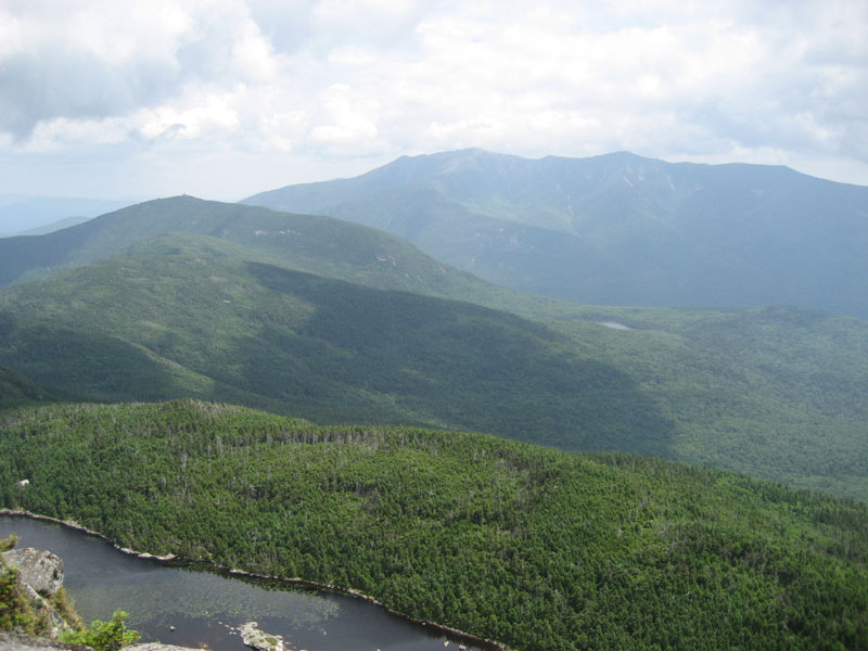
Hazy views of Cannon Mountain and the Franconia Ridge as seen from the ledge near the summit of Kinsman Mountain's North Peak

The Kinsman Ridge Trail between the peaks

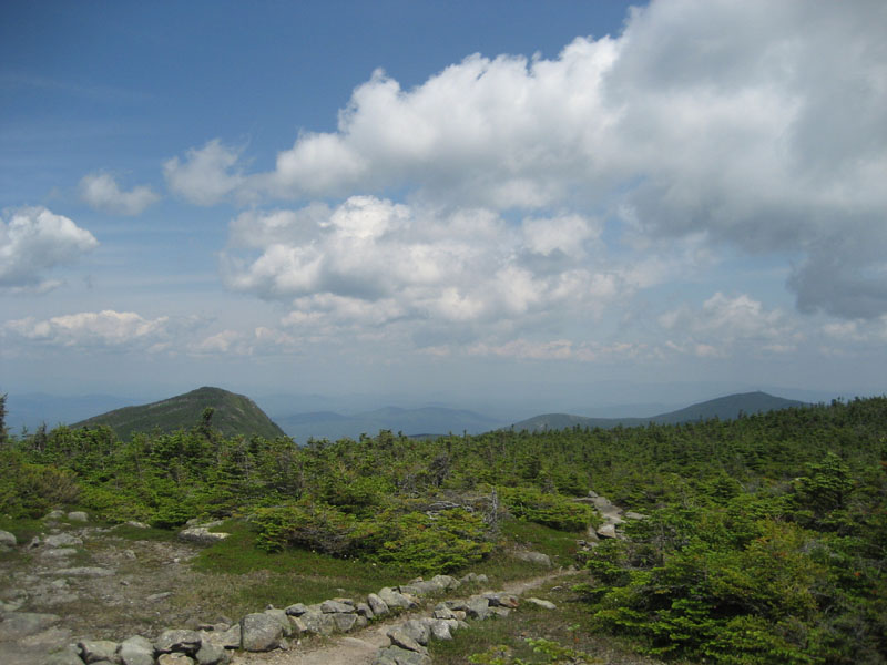
North Kinsman and Cannon as seen from near the summit of Kinsman Mountain's South Peak


Directions to trailhead: Take Route 112 West from Lincoln to Route 116 North. The short road to the Mt. Kinsman Trail trailhead and parking area will eventually be on the right, just before Tamarack Camp.
Back to Kinsman Mountain (North Peak) Profile
Back to Kinsman Mountain (South Peak) Profile
|