Home
States
Colorado
Connecticut
Maine
Massachusetts
New Hampshire
New York
Rhode Island
Utah
Vermont
View All
Lists
NE 4,000 Footers
NE 100 Highest
NH 4,000 Footers
NH 100 Highest
NH 52 With A View
NH Belknap Range
NH Ossipee 10
Links
Trail Conditions
Trip Log
Sunrises
Sunsets
About
|
Kinsman Mountain (North Peak), Kinsman Mountain (South Peak)
Easton, NH, Lincoln, NH
Trailheads, measurements, times, distances, and maps are all approximate and relative to the hike(s) as shown below.
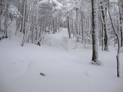
Looking up the drifted Mt. Kinsman Trail
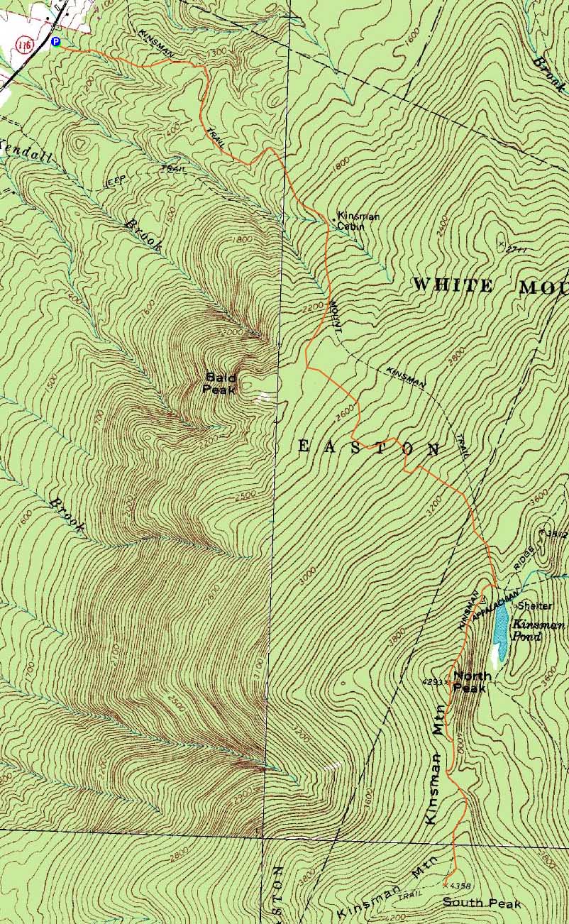
Route: Mt. Kinsman Trail, Kinsman Ridge Trail, (Kinsman Mountain North Peak), Kinsman Ridge Trail, (Kinsman Mountain South Peak), Kinsman Ridge Trail, (Kinsman Mountain North Peak), Kinsman Ridge Trail, Mt. Kinsman Trail
Five days removed from a snowstorm, we figured the odds of the Mt. Kinsman Trail being a nice snowshoe would be good. Reaching the new trailhead parking lot, which was unplowed, we were a bit surprised to see only a few inches of snow - nonetheless, there was still enough to snowshoe.
Above the Bald Peak trail junction, snow depths increased. Nearing the forest protection boundary, the last tracks ended, resulting in us breaking trail in one to three feet of snow.
Despite the high winds forecast, things were rather calm on the ridge. Though clouds were moving in, we had nice views from the North Kinsman ledge. Continuing to South Kinsman, we saw some erie clouds moving in from Vermont.
Back on the Mt. Kinsman Trail, we were a bit perturbed to see our nicely packed snowshoe path had been trashed from barebooting. Thus, the descent was not nearly as smooth as desired.
Reaching the parking lot, the storm had moved in, resulting in rain and snow showers.
| Hike Ratings |
|
Getting To Trailhead: |
Easy |
| Destination: |
Kinsman Mountain (North Peak) |
|
Length: |
Moderate |
|
Steepness: |
Difficult |
|
Navigation: |
Easy |
|
Views: |
Excellent |
|
Crowds: |
Moderate |
| Destination: |
Kinsman Mountain (South Peak) |
|
Length: |
Moderate |
|
Steepness: |
Difficult |
|
Navigation: |
Easy |
|
Views: |
Excellent |
|
Crowds: |
Moderate |
|
| Hike Stats |
|
Date Hiked: |
Sunday, December 13, 2009 |
| Hike Commenced: |
8:20 AM |
| Parking Elevation: |
1,060' |
| Destination: |
Kinsman Mountain (North Peak) |
| Ascent Commenced: |
8:20 AM |
| Summit Reached: |
11:53 AM |
| Time Elapsed: |
03:33 |
| Trailhead Elevation: |
1,060' |
| Summit Elevation: |
4,293' |
| Vertical Gain: |
3,263' |
| Destination: |
Kinsman Mountain (South Peak) |
| Ascent Commenced: |
12:02 PM |
| Summit Reached: |
12:36 PM |
| Time Elapsed: |
00:34 |
| Trailhead Elevation: |
4,293' |
| Summit Elevation: |
4,358' |
| Distance: |
.9 mile |
| Vertical Gain: |
373' |
|
|
| Hike Ended: |
3:45 AM |
| Hike Time Elapsed: |
09:25 |
| Hike Vertical Gain: |
3,994' |
|
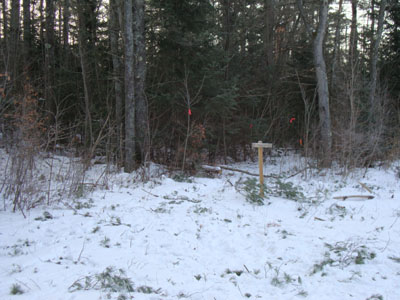
The new Mt. Kinsman Trail trailhead off Route 116

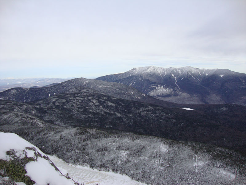
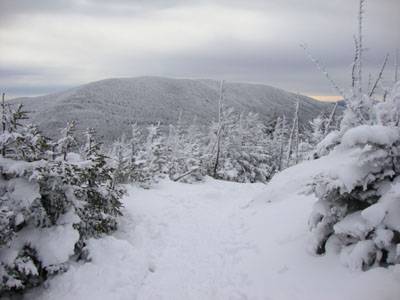
Cannon Mountain and the Franconia Ridge as seen from the ledge near the summit of Kinsman Mountain's North Peak
The Kinsman Ridge Trail between the peaks

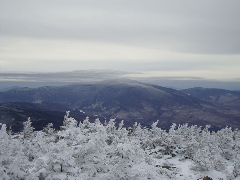
Looking at Mt. Moosilauke from near the summit of Kinsman Mountain's South Peak


Directions to trailhead: Take Route 112 West from Lincoln to Route 116 North. The short road to the Mt. Kinsman Trail trailhead and parking area will eventually be on the right, just before Tamarack Camp.
Back to Kinsman Mountain (North Peak) Profile
Back to Kinsman Mountain (South Peak) Profile
|