Home
States
Colorado
Connecticut
Maine
Massachusetts
New Hampshire
New York
Rhode Island
Utah
Vermont
View All
Lists
NE 4,000 Footers
NE 100 Highest
NH 4,000 Footers
NH 100 Highest
NH 52 With A View
NH Belknap Range
NH Ossipee 10
Links
Trail Conditions
Trip Log
Sunrises
Sunsets
About
|
Kinsman Mountain (North Peak), Kinsman Mountain (South Peak)
Easton, NH, Lincoln, NH
Trailheads, measurements, times, distances, and maps are all approximate and relative to the hike(s) as shown below.
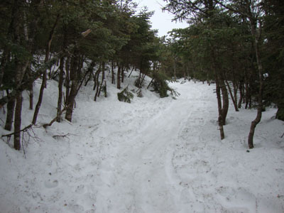
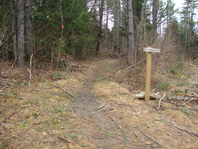
Looking up the Mt. Kinsman Trail
Route: Mt. Kinsman Trail, Kinsman Ridge Trail, (Kinsman Mountain North Peak), Kinsman Ridge Trail, (Kinsman Mountain South Peak), Kinsman Ridge Trail, (Kinsman Mountain North Peak), Kinsman Ridge Trail, Mt. Kinsman Trail
With a bad weather forecast, we opted to take a mild approach to the Kinsmans via the Mt. Kinsman Trail. Due to deep mud, the new parking area was inaccessible, resulting in roadside parking.
The snow didn't start with any consistency until the first water crossing. A short while after passing the Bald Peak spur junction, it was time for snowshoes.
The ledge scrambles on the Kinsman Ridge Trail were nicely filled in, making for relatively easy travel. While there weren't any views on North Kinsman at first, things cleared out as we reached South Kinsman. By the time we made it back to North Kinsman, the views were halfway decent - much to the contrary of the forecast. Adjacent to the highpoint, I bushwhacked a few dozen feet west to a really nice viewpoint (courtesy the deep snow).
While the forecast was for light rain, we made it back to the trailhead under partly sunny skies.
| Hike Ratings |
|
Getting To Trailhead: |
Easy |
| Destination: |
Kinsman Mountain (North Peak) |
|
Length: |
Moderate |
|
Steepness: |
Difficult |
|
Navigation: |
Easy |
|
Views: |
Minimal (due to weather) |
|
Crowds: |
Minimal |
| Destination: |
Kinsman Mountain (South Peak) |
|
Length: |
Moderate |
|
Steepness: |
Difficult |
|
Navigation: |
Easy |
|
Views: |
Excellent |
|
Crowds: |
Minimal |
| Destination: |
Kinsman Mountain (North Peak) |
|
Length: |
Moderate |
|
Steepness: |
Difficult |
|
Navigation: |
Easy |
|
Views: |
Excellent |
|
Crowds: |
Minimal |
|
| Hike Stats |
|
Date Hiked: |
Sunday, March 21, 2010 |
| Hike Commenced: |
9:03 AM |
| Parking Elevation: |
1,045' |
| Destination: |
Kinsman Mountain (North Peak) |
| Ascent Commenced: |
9:04 AM |
| Summit Reached: |
11:49 AM |
| Time Elapsed: |
02:45 |
| Trailhead Elevation: |
1,060' |
| Summit Elevation: |
4,293' |
| Vertical Gain: |
3,263' |
| Destination: |
Kinsman Mountain (South Peak) |
| Ascent Commenced: |
11:53 AM |
| Summit Reached: |
12:31 PM |
| Time Elapsed: |
00:38 |
| Trailhead Elevation: |
4,293' |
| Summit Elevation: |
4,358' |
| Distance: |
.9 mile |
| Vertical Gain: |
373' |
|
|
| Hike Ended: |
3:34 PM |
| Hike Time Elapsed: |
06:31 |
| Hike Vertical Gain: |
4,009' |
|
The new Mt. Kinsman Trail trailhead off Route 116

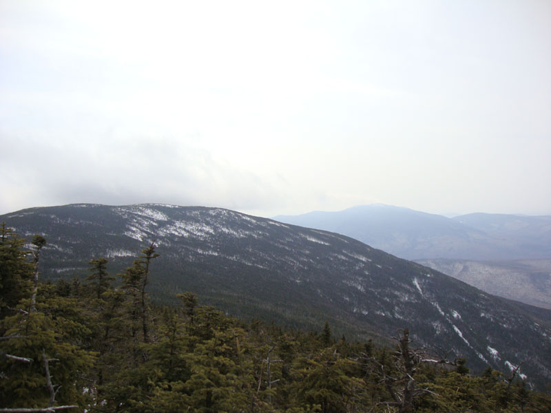
Looking at South Kinsman and Mt. Moosilauke from near the summit of North Kinsman
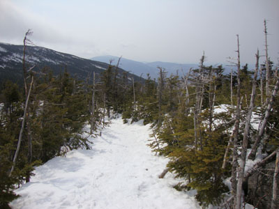
The Kinsman Ridge Trail between the peaks

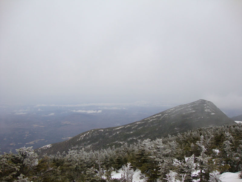
North Kinsman as seen from South Kinsman


Directions to trailhead: Take Route 112 West from Lincoln to Route 116 North. The short road to the Mt. Kinsman Trail trailhead and parking area will eventually be on the right, just before Tamarack Camp.
Back to Kinsman Mountain (North Peak) Profile
Back to Kinsman Mountain (South Peak) Profile
|