Home
States
Colorado
Connecticut
Maine
Massachusetts
New Hampshire
New York
Rhode Island
Utah
Vermont
View All
Lists
NE 4,000 Footers
NE 100 Highest
NH 4,000 Footers
NH 100 Highest
NH 52 With A View
NH Belknap Range
NH Ossipee 10
Links
Trail Conditions
Trip Log
Sunrises
Sunsets
About
|
Kinsman Mountain (North Peak), Kinsman Mountain (South Peak)
Easton, NH, Lincoln, NH
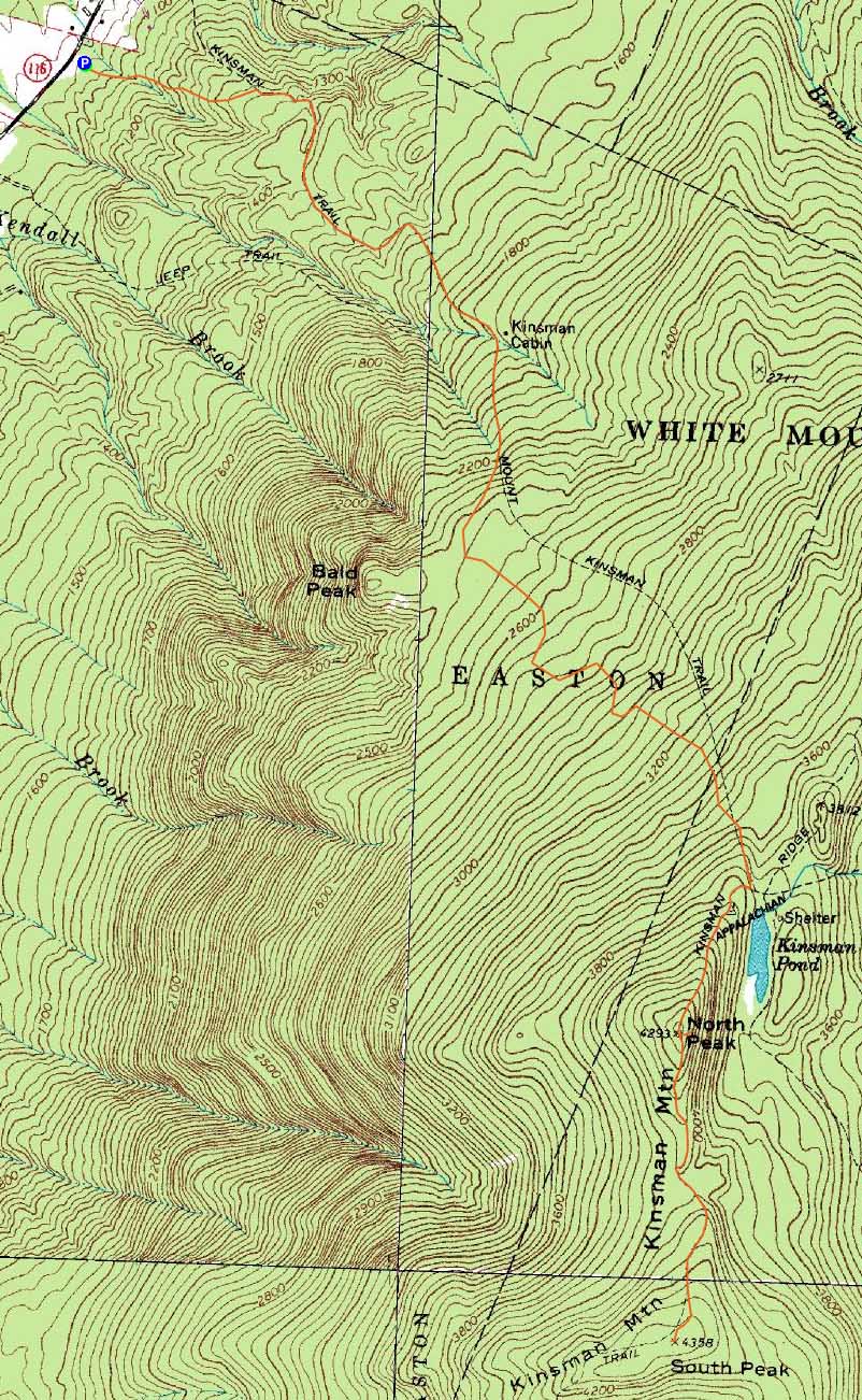
Trailheads, measurements, times, distances, and maps are all approximate and relative to the hike(s) as shown below.
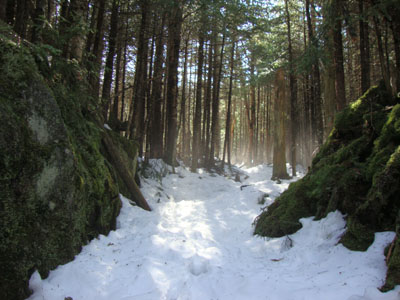
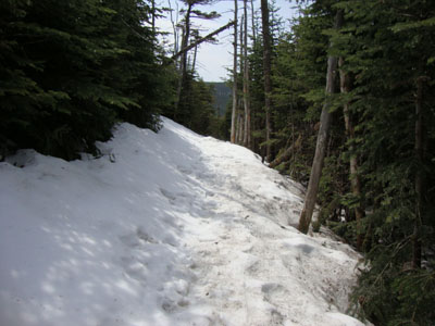
Looking up the Mt. Kinsman Trail as the snow melts
Route: Mt. Kinsman Trail, Kinsman Ridge Trail, (Kinsman Mountain North Peak), Kinsman Ridge Trail, (Kinsman Mountain South Peak), Kinsman Ridge Trail, (Kinsman Mountain North Peak), Kinsman Ridge Trail, Mt. Kinsman Trail
With a decent forecast, the plan was to hike the Kinsmans and then perhaps something else in the afternoon. Starting on bare ground, we worked out way up the Mt. Kinsman Trail, taking some time to get across the three water crossings without getting wet (running a lot higher than normal, perhaps due to some overnight rain). Shortly after passing the Bald Peak junction, we hit the slushy remnants of the recent snow. While forecasted to top out in the 70s, the temperatures seemed to be soaring.
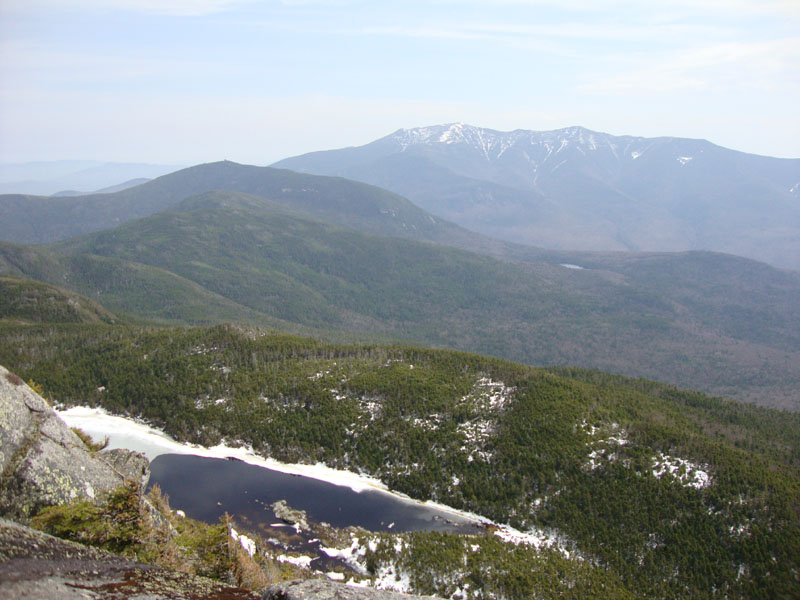
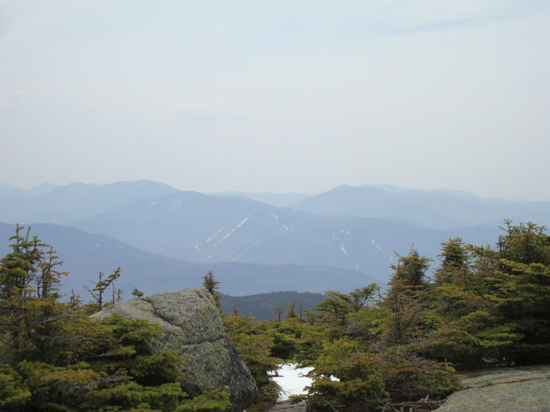
The ledge scramble on the Kinsman Ridge Trail was still nicely filled in with multiple feet of snow, making for easy passage. Reaching the summit, we headed down to the ledge vista for hazy views of the Franconias. After that, we continued on to South Kinsman, where we once again had hazy views.
The descent was a bit sloppy, thanks to the melting snow, slush, and mud. In addition, it seemed to be wicked hot. Sure enough, upon reaching the trailhead, the temperature was 85 degrees - significantly higher than the low to mid 70s forecast!
| Hike Ratings |
|
Getting To Trailhead: |
Easy |
| Destination: |
Kinsman Mountain (North Peak) |
|
Length: |
Moderate |
|
Steepness: |
Difficult |
|
Navigation: |
Easy |
|
Views: |
Excellent |
|
Crowds: |
Minimal |
| Destination: |
Kinsman Mountain (South Peak) |
|
Length: |
Moderate |
|
Steepness: |
Difficult |
|
Navigation: |
Easy |
|
Views: |
Excellent |
|
Crowds: |
Minimal |
|
| Hike Stats |
|
Date Hiked: |
Sunday, May 2, 2010 |
| Hike Commenced: |
8:07 AM |
| Parking Elevation: |
1,060' |
| Destination: |
Kinsman Mountain (North Peak) |
| Ascent Commenced: |
8:07 AM |
| Summit Reached: |
10:46 AM |
| Time Elapsed: |
02:39 |
| Trailhead Elevation: |
1,060' |
| Summit Elevation: |
4,293' |
| Vertical Gain: |
3,263' |
| Destination: |
Kinsman Mountain (South Peak) |
| Ascent Commenced: |
10:58 AM |
| Summit Reached: |
11:25 PM |
| Time Elapsed: |
00:27 |
| Trailhead Elevation: |
4,293' |
| Summit Elevation: |
4,358' |
| Distance: |
.9 mile |
| Vertical Gain: |
373' |
|
|
| Hike Ended: |
1:31 PM |
| Hike Time Elapsed: |
05:24 |
| Hike Vertical Gain: |
3,994' |
|
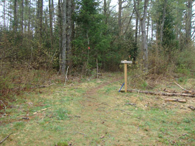
The Mt. Kinsman Trail trailhead off Route 116
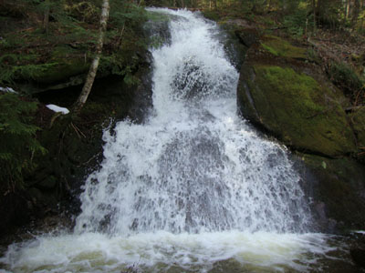
Waterfalls along the Mt. Kinsman Trail

Looking at Kinsman Pond and the Franconia Ridge from the North Kinsman view ledge
The Kinsman Ridge Trail between the peaks

Loon Mountain as seen from South Kinsman


Directions to trailhead: Take Route 112 West from Lincoln to Route 116 North. The short road to the Mt. Kinsman Trail trailhead and parking area will eventually be on the right, just before Tamarack Camp.
Back to Kinsman Mountain (North Peak) Profile
Back to Kinsman Mountain (South Peak) Profile
|