Home
States
Colorado
Connecticut
Maine
Massachusetts
New Hampshire
New York
Rhode Island
Utah
Vermont
View All
Lists
NE 4,000 Footers
NE 100 Highest
NH 4,000 Footers
NH 100 Highest
NH 52 With A View
NH Belknap Range
NH Ossipee 10
Links
Trail Conditions
Trip Log
Sunrises
Sunsets
About
|
Monadnock Mountain
Dublin, NH, Jaffrey, NH
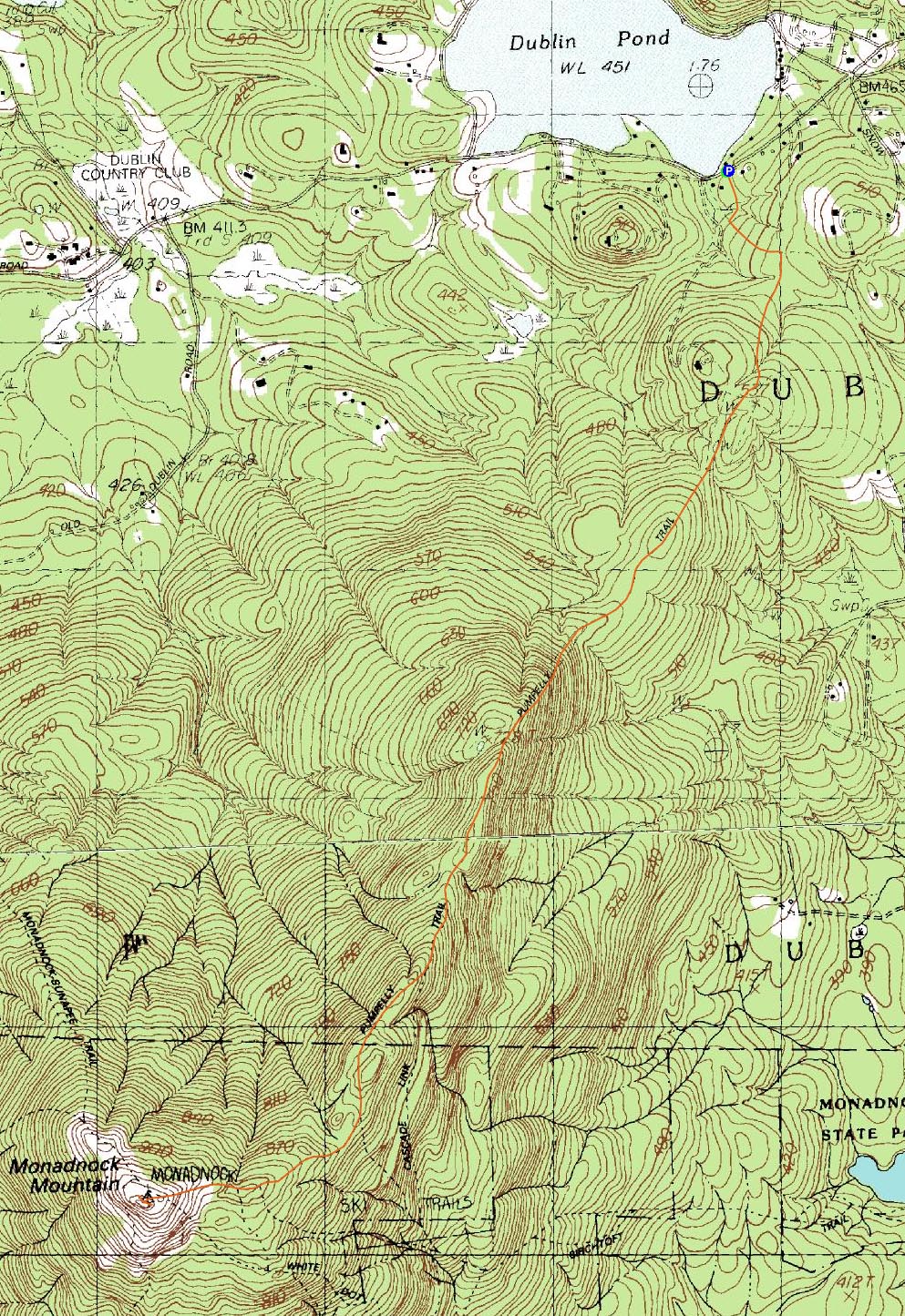
Trailheads, measurements, times, distances, and maps are all approximate and relative to the hike(s) as shown below.

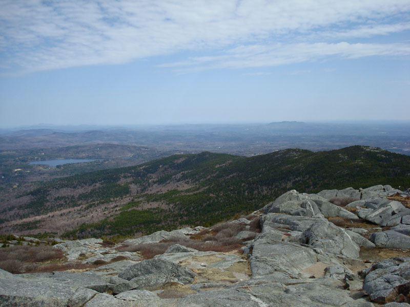
Looking down the Pumpelly Trail
Route: Pumpelly Trail
Ever since setting my eyes on the Pumpelly Ridge when I hiked Monadnock in 2006, I've been interested in ascending it. While the crowds Monadnock almost always has, I never bothered to check it out in the subsequent months and years.
Until now. Since I was sick of the snow up north, I decided to head down south and check out the Pumpelly Trail finally.
Arriving near the trailhead on Lake Road, another hiker pointed out the unmarked trailhead for me. From there, the Pumpelly Trail was fairly gradual - and not marked. Nonetheless, I was able to follow it (though on the way back some folks I talked to found it hard to track).
Soon, the trail took a left turn and started a steep, rocky ascent. After kicking my butt for a few hundred vertical feet, it leveled off and began a more steady ascent through some ledgey areas, including some very minor scrambles.
After passing some trail junctions, the open ledges and views of the summit became more frequent. In addition, the cloud cover at the start of the day burned up and allowed for blue skies from Monadnock to points east.
As usual, the summit was crowded. After taking a few photos, I descended back down the Pumpelly Trail a bit and found a quiet place to have lunch while still above the treeline. After that, I headed back to the trailhead and plotted a second hike for the day, Crotched Mountain.
| Hike Ratings |
|
Getting To Trailhead: |
Moderate |
| Destination: |
Monadnock Mountain |
|
Length: |
Moderate |
|
Steepness: |
Difficult |
|
Navigation: |
Moderate |
|
Views: |
Excellent |
|
Crowds: |
Heavy |
|
| Hike Stats |
|
Date Hiked: |
Saturday, April 26, 2008 |
| Hike Commenced: |
9:40 AM |
| Parking Elevation: |
1,495' |
| Destination: |
Monadnock Mountain |
| Ascent Commenced: |
9:40 AM |
| Summit Reached: |
11:24 AM |
| Time Elapsed: |
01:44 |
| Trailhead Elevation: |
1,490' |
| Summit Elevation: |
3,165' |
| Distance: |
4.4 miles |
| Vertical Gain: |
2,035' |
|
|
| Hike Ended: |
1:43 PM |
| Hike Time Elapsed: |
04:03 |
| Hike Distance: |
8.8 miles |
| Hike Vertical Gain: |
2,400' |
|

The Pumpelly Trail trailhead on Lake Road

Looking northeast at the Pumpelly Ridge from the Monadnock Mountain summit


Directions to trailhead: Take Route 101 West into Dublin, past the flagpole in the center of the road. Lake Road will be on the left. The Pumpelly Trail trailhead is about .4 miles down Lake Road, on the left. The trailhead is not signed, but is across from a cabin with vertical log siding. A no dogs sign is located a few feet down the trail from the trailhead. There is room to park on the side of the road.
Back to Monadnock Mountain Profile
|