Home
States
Colorado
Connecticut
Maine
Massachusetts
New Hampshire
New York
Rhode Island
Utah
Vermont
View All
Lists
NE 4,000 Footers
NE 100 Highest
NH 4,000 Footers
NH 100 Highest
NH 52 With A View
NH Belknap Range
NH Ossipee 10
Links
Trail Conditions
Trip Log
Sunrises
Sunsets
About
|
Mount Chocorua
Albany, NH
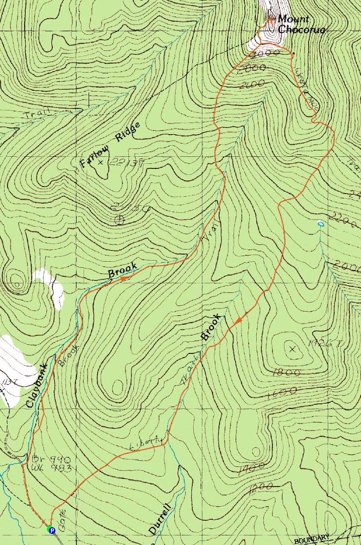
Trailheads, measurements, times, distances, and maps are all approximate and relative to the hike(s) as shown below.

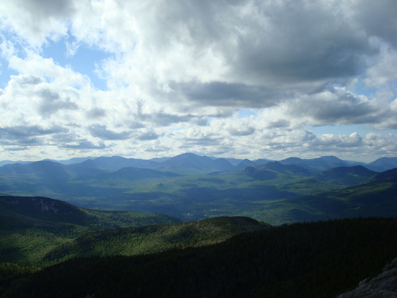
Looking down the Brook Trail
Route: Brook Trail, (Mt. Chocorua summit), Liberty Trail
Since the upcoming week looked wet and rainy in the weather forecast, I decided to do something somewhat significant after work on Monday.
Arriving at a nearly empty Paugus Mill parking area, I quickly DEETed up and headed on my way, the mosquitos a bit pesky but not too bad. The first portion of the Brook Trail is a flat series of roads.
After following the roads for a bit, the trail starts to follow a brook for awhile (still nothing steep).
Once past the brook area, the trail ascends up a series of ledges, including some open steep portions and some scrambles. Soon thereafter, it meets up with the Liberty Trail and then the Piper Trail, arriving at the summit. I found the trail somewhat hard to follow in the ledges prior to the Liberty junction, as the blazes have faded.
Once again, I had the summit to myself. While I wished the the cloud cover wasn't as heavy as it was, the temperature was pleasant, the breeze just right, and the bugs non existent. With those conditions, I spent awhile on the summit, looking at the views and scrambling down the east face to look at some plaques.
I decided to take the Liberty Trail down. The upper part was nice, as a variety of flowers added some color in the area near the Liberty cabin. As I descended, the mosquitos became heavier and heavier. Finally, I ran out of patience (I literally couldn't move my arm without hitting a bunch of them), and start jogging. While the faster pace helped to reduce the bite attempts, they were still everywhere. Everything was fine and dandy until I felt my knee a bit. Remembering what I went through last year, I slowed to a walk right away. Nonetheless, the discomfort is back - looks like another bout with tendinitis.
The mosquitos were absolutely amazing - as I quickly jumped into my truck, I could hear them swarming outside - it literally sounded like a bunch of bees swarming.
| Hike Ratings |
|
Getting To Trailhead: |
Easy |
| Destination: |
Mount Chocorua |
|
Length: |
Moderate |
|
Steepness: |
Difficult |
|
Navigation: |
Moderate |
|
Views: |
Excellent |
|
Crowds: |
Minimal |
|
| Hike Stats |
|
Date Hiked: |
Monday, June 2, 2008 |
| Hike Commenced: |
3:24 PM |
| Parking Elevation: |
900' |
| Destination: |
Mount Chocorua |
| Ascent Commenced: |
3:24 PM |
| Summit Reached: |
5:02 PM |
| Time Elapsed: |
01:38 |
| Trailhead Elevation: |
900' |
| Summit Elevation: |
3,474' |
| Distance: |
3.6 miles |
| Vertical Gain: |
2,674' |
|
|
| Hike Ended: |
6:59 PM |
| Hike Time Elapsed: |
03:35 |
| Hike Distance: |
7.5 miles |
| Hike Vertical Gain: |
2,814' |
|

Book Trail trailhead at the Paugus Mill Road parking lot

A wildflower getting ready to bloom on the Liberty Trail

Looking out toward Mt. Carrigain from the Mount Chocorua summit


Directions to trailhead: From Route 25, take Route 113 East to Tamworth. At the four way intersection next to the village, go straight onto 113A. Continue a few minutes, taking a right onto Fowler's Mill Road. A few minutes later, take a left onto Paugus Road. The WMNF fee parking area is at the end of this road.
Back to Mount Chocorua Profile
|