Home
States
Colorado
Connecticut
Maine
Massachusetts
New Hampshire
New York
Rhode Island
Utah
Vermont
View All
Lists
NE 4,000 Footers
NE 100 Highest
NH 4,000 Footers
NH 100 Highest
NH 52 With A View
NH Belknap Range
NH Ossipee 10
Links
Trail Conditions
Trip Log
Sunrises
Sunsets
About
|
Mt. Adams, Mt. Madison
Thompson and Meserve's Purchase, NH, Low and Burbank's Grant, NH
Trailheads, measurements, times, distances, and maps are all approximate and relative to the hike(s) as shown below.

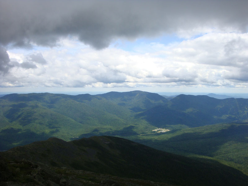
Looking up the Madison Gulf Trail
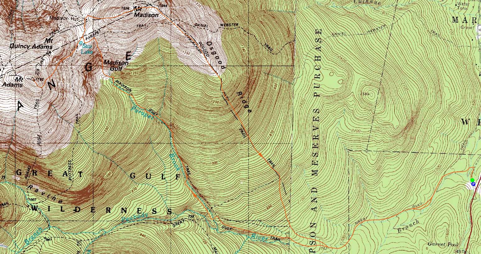
Route: Great Gulf Trail, Madison Gulf Trail, Parapet Trail, Star Lake Trail, (Mt. Adams), Star Lake Trail, Osgood Trail, (Mt. Madison), Osgood Trail, Great Gulf Trail
Though the weather forecast was mediocre, it looked to be a decent day in the Northern Presidentials.
The Great Gulf Trail was fairly tame up to the Osgood Cutoff. Shortly beyond that, I reached the Madison Gulf Trail junction. The first portion of the trail wasn't overly steep. Beyond that, it steepened up, getting rough and wet in places. Nearing treeline, there were some nice views as the small scrambles continued. I certainly wouldn't want to descend the trail, or try to do the water crossings after rain.
I then took the Star Lake Trail to the summit of Mt. Adams. Having previously been on the trail in fog, it was interesting to see the actual topography and views. I found the Star Lake Trail to be more challenging and rewarding than the Madison Gulf Trail.
After taking in decent views from Mt. Adams - fog passing over Madison and Washington on occasion - I worked my way down to the hut, stopping for some lunch.
The summit of Mt. Madison was a little bit chilly and windy, however the views were pretty strong. From there, I descended via the Osgood Trail. Rather scenic for the top mile or so, I found the footing to be much better than the Madison Gulf Trail, though still not a cakewalk.
After having hiked Madison from Valley Way or Airline every previous time, it was nice to try a new approach.
| Hike Ratings |
|
Getting To Trailhead: |
Easy |
| Destination: |
Mt. Adams |
|
Length: |
Moderate |
|
Steepness: |
Very Difficult |
|
Navigation: |
Moderate |
|
Views: |
Excellent |
|
Crowds: |
Minimal |
| Destination: |
Mt. Madison |
|
Length: |
Difficult |
|
Steepness: |
Very Difficult |
|
Navigation: |
Easy |
|
Views: |
Excellent |
|
Crowds: |
Moderate |
|
| Hike Stats |
|
Date Hiked: |
Thursday, August 6, 2009 |
| Hike Commenced: |
9:24 AM |
| Parking Elevation: |
1,360' |
| Destination: |
Mt. Adams |
| Ascent Commenced: |
9:25 AM |
| Summit Reached: |
12:47 PM |
| Time Elapsed: |
03:22 |
| Trailhead Elevation: |
1,350' |
| Summit Elevation: |
5,774' |
| Distance: |
6.5 miles |
| Vertical Gain: |
4,584' |
| Destination: |
Mt. Madison |
| Ascent Commenced: |
12:51 PM |
| Summit Reached: |
2:04 PM |
| Time Elapsed: |
01:13 |
| Trailhead Elevation: |
5,410' |
| Summit Elevation: |
5,367' |
| Distance: |
1.5 miles |
| Vertical Gain: |
607' |
|
|
| Hike Ended: |
5:03 PM |
| Hike Time Elapsed: |
07:39 |
| Hike Vertical Gain: |
5,381' |
|

The Great Gulf Trail trailhead

An alpine flower along the Star Lake Trail

Mt. Madison as seen from near the summit of Mt. Adams

The Star Lake Trail

Flowers along the Star Lake Trail

The Carters and Wildcats as seen from Mt. Madison

Looking down the Osgood Trail


Directions to trailhead: Take Route 16 north from Wildcat ski area. Just after passing the Camp Dodge entrance on the right, the Great Gulf WMNF fee parking lot entrance will be on the left. The trailhead is at the back of the parking lot.
Back to Mt. Adams Profile
Back to Mt. Madison Profile
|