Home
States
Colorado
Connecticut
Maine
Massachusetts
New Hampshire
New York
Rhode Island
Utah
Vermont
View All
Lists
NE 4,000 Footers
NE 100 Highest
NH 4,000 Footers
NH 100 Highest
NH 52 With A View
NH Belknap Range
NH Ossipee 10
Links
Trail Conditions
Trip Log
Sunrises
Sunsets
About
|
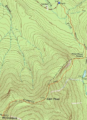
Mt. Osceola (East Peak), Mt. Osceola
Lincoln, NH, Livermore, NH
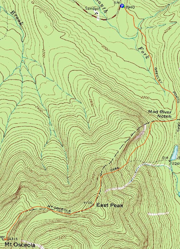
Trailheads, measurements, times, distances, and maps are all approximate and relative to the hike(s) as shown below.
Looking up the Mt. Osceola Trail on the way to Mt. Osceola's East Peak
Route: Greeley Ponds Trail, Mt. Osceola Trail, (Mt. Osceola - East Peak), Mt. Osceola Trail, (Mt. Osceola), Mt. Osceola Trail, (Mt. Osceola - East Peak), Mt. Osceola Trail, Greeley Ponds Trail
After a few warmer days, temperatures had dropped and firmed up conditions - perhaps not the best setting for a hike up East Osceola. Nonetheless, we decided to take our chances. Like an idiot, I had not sized my crampons to my somewhat new boots. After doing so in the parking lot, we headed out.
I decided to do the Greeley Ponds Trail and the first part of the Mt. Osceola Trail on Microspikes. Arriving at the steep section near the bottom of the slide, we could see we were dealing with a heck of a lot of blue ice. As such, it was time for crampons. Like an idiot, I realized I had put my crampons in the back seat of my vehicle after sizing them to my boots. It was going to be a long, dangerous day.
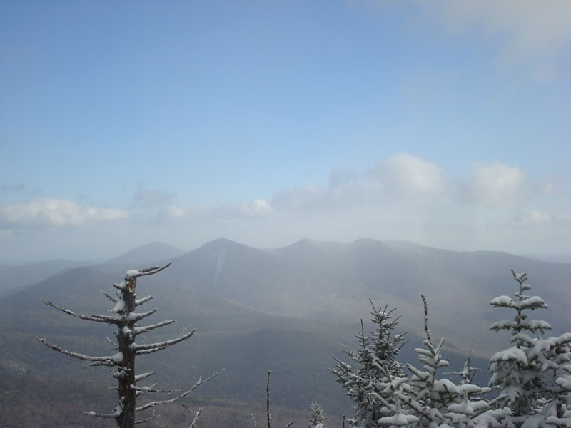
Ever so slowly, we made our way up the steep, icy trail. If not for my ice axe, I simply would not have made it. Once on top of the ridge, the winds picked up a bit, however the sun started poking through as well. While East Osceola isn't know for being scenic, the views from the vista just before the summit were quite nice.
After taking a brief break to regroup, we headed down the ridge toward Mt. Osceola. Other than the chimney area, the trail wasn't overly icy, however there was a decent amount of snow drifting. Since there was plenty of frozen granular around, we found it to be better to simply leave on traction and not bother with snowshoes. Due to the winds, any holes from postholing were quickly reclaimed.
The chimney and it's bypass were a bit of a challenge, as both had a decent amount of blue and black ice spread around the rocks. Nevertheless, we were able to slowly make our way up it and to the summit of Mt. Osceola.
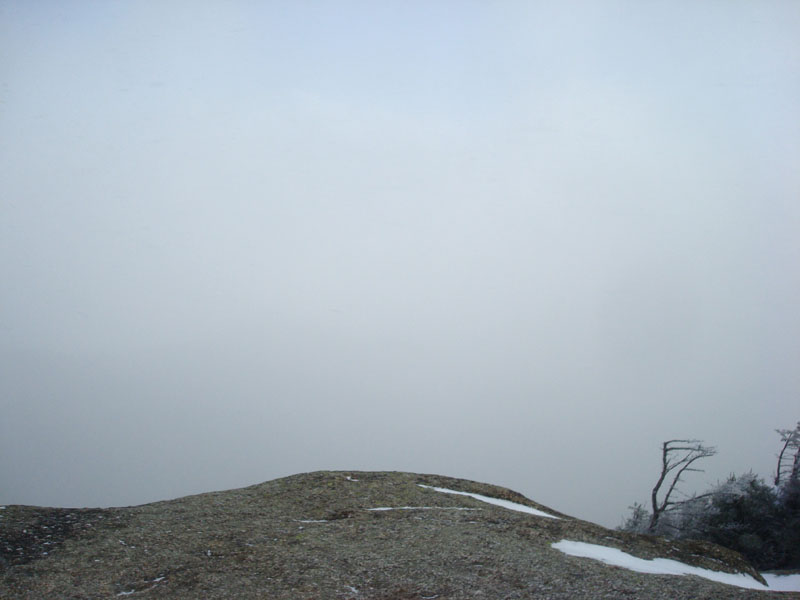
Unfortunately, the summit was in the clouds. Nonetheless, the brightness of the hiding sun made the ledge vista neat.
Other than negociating down the chimney bypass, the trip back to the east peak wasn't too bad. Just prior to starting the descent proper off that peak, we stopped at the other vista and were treated to some great views to the west (and to the east through the trees).
From here, it was very slow going. At one point near the top, a controlled slide turned into an out of control deathslide. As I tried to self arrest, I suspect I hit my funny bone on the ice, which possibly resulted in my arm not anchoring the ice axe (though the ice was so firm, it would have taken quite a hit to dig in anyways). Fortunately, there was someone anchored below to break my fall. Beyond there, I did a lot of light bushwhacking to avoid some of the other blue ice patches.
Despite the difficulties of the hike, we were able to make it back to the parking lot before dark. Certainly a challenging day!
| Hike Ratings |
|
Getting To Trailhead: |
Easy |
| Destination: |
Mt. Osceola (East Peak) |
|
Length: |
Moderate |
|
Steepness: |
Very Difficult |
|
Navigation: |
Easy |
|
Views: |
Moderate |
|
Crowds: |
Minimal |
| Destination: |
Mt. Osceola |
|
Length: |
Difficult |
|
Steepness: |
Very Difficult |
|
Navigation: |
Easy |
|
Views: |
Minimal (due to weather) |
|
Crowds: |
Minimal |
|
| Hike Stats |
|
Date Hiked: |
Tuesday, December 30, 2008 |
| Hike Commenced: |
9:32 AM |
| Parking Elevation: |
1,940' |
| Destination: |
Mt. Osceola (East Peak) |
| Ascent Commenced: |
9:32 AM |
| Summit Reached: |
12:04 PM |
| Time Elapsed: |
02:32 |
| Trailhead Elevation: |
1,940' |
| Summit Elevation: |
4,156' |
| Distance: |
2.8 miles |
| Vertical Gain: |
2,331' |
| Destination: |
Mt. Osceola |
| Ascent Commenced: |
12:11 PM |
| Summit Reached: |
1:07 PM |
| Time Elapsed: |
00:39 |
| Trailhead Elevation: |
4,156' |
| Summit Elevation: |
4,340' |
| Distance: |
1 mile |
| Vertical Gain: |
560' |
|
|
| Hike Ended: |
4:23 PM |
| Hike Time Elapsed: |
06:51 |
| Hike Distance: |
7.6 miles |
| Hike Vertical Gain: |
3,392' |
|
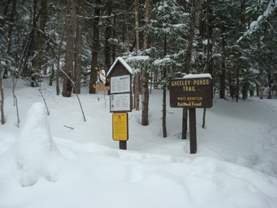
The Greeley Ponds Trail trailhead

Looking at Mt. Tripyramid from near the summit of East Osceola
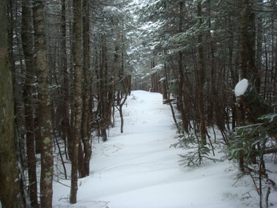
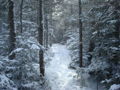
The drifted Mt. Osceola Trail along the ridge
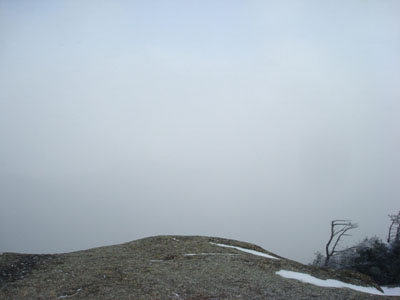
Looking into a cloud from the Mt. Osceola ledges

Directions to trailhead: Take Route 112 west from Conway. After passing the Hancock Trail trailhead and parking lot, the Greeley Ponds trailhead and WMNF fee parking area will be on the left a few minutes later.
Back to Mt. Osceola (East Peak) Profile
Back to Mt. Osceola Profile
|