Home
States
Colorado
Connecticut
Maine
Massachusetts
New Hampshire
New York
Rhode Island
Utah
Vermont
View All
Lists
NE 4,000 Footers
NE 100 Highest
NH 4,000 Footers
NH 100 Highest
NH 52 With A View
NH Belknap Range
NH Ossipee 10
Links
Trail Conditions
Trip Log
Sunrises
Sunsets
About
|
Mt. Osceola (East Peak), Mt. Osceola
Lincoln, NH, Livermore, NH
Trailheads, measurements, times, distances, and maps are all approximate and relative to the hike(s) as shown below.
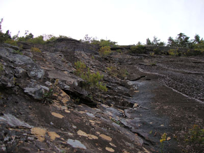
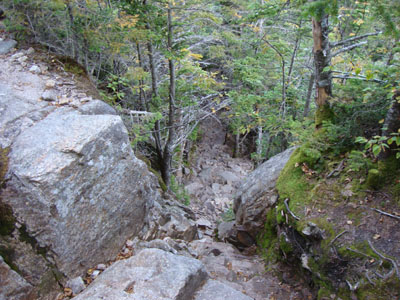
Looking up the slide near the Mt. Osceola Trail
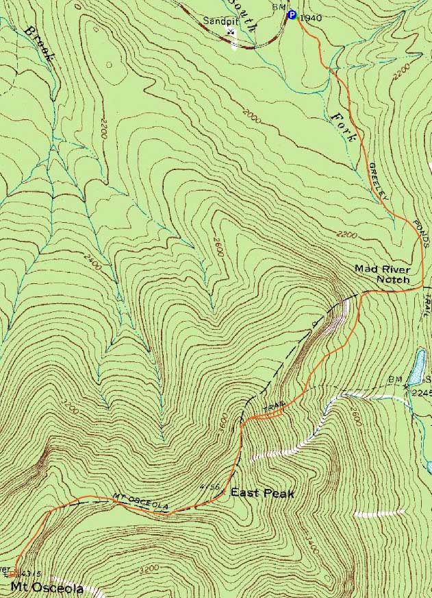
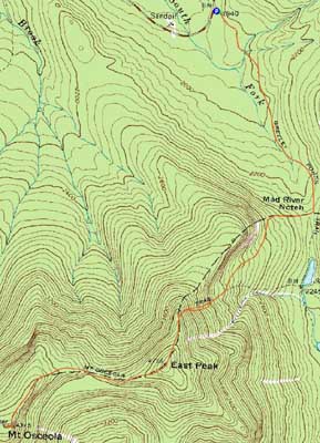
Route: Greeley Ponds Trail, Mt. Osceola Trail, bushwhack, Mt. Osceola Trail, (Mt. Osceola - East Peak), Mt. Osceola Trail, (Mt. Osceola), Mt. Osceola Trail, (Mt. Osceola - East Peak), Mt. Osceola Trail, Greeley Ponds Trail
Though it was clouding up a bit, it was still a nice day outside. My original plan was to hike both Osceolas via the Greeley Ponds and Osceola Trails. Reaching the Osceola Trail, I suddenly had an idea - why not check out the slide that the Osceola Trail runs alongside and then crosses? After days of dry weather, it seemed like a good idea at the time.
Reaching the steep section of trail, I bushwhacked over to the bottom of the slide. It looked pretty steep and slabby, however I saw a decent route up the middle. About 10-20 vertical feet up, I realized it wasn't a great route - there were some wet spots I didn't see below and some hand/foot holds were breaking loose. Not only that, but there was no way I could get back down or strafe over. Nonetheless, after quite a few 'oh crap' moments, I somehow made it up to the top of the main part of the slide - not the brightest idea I've ever had!
There were two more sections of slide, each separated by somewhat thick bushwhacks (the top section being the section the trail crosses). These paled in comparison to the first part of the slide.
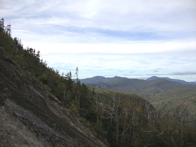
Reaching the summit of East Osceola, I realized I was a bit behind schedule, so I continued to Osceola without stopping. Reaching the ledges of Osceola, I had great views, ranging from the lakes to the Presidentials.
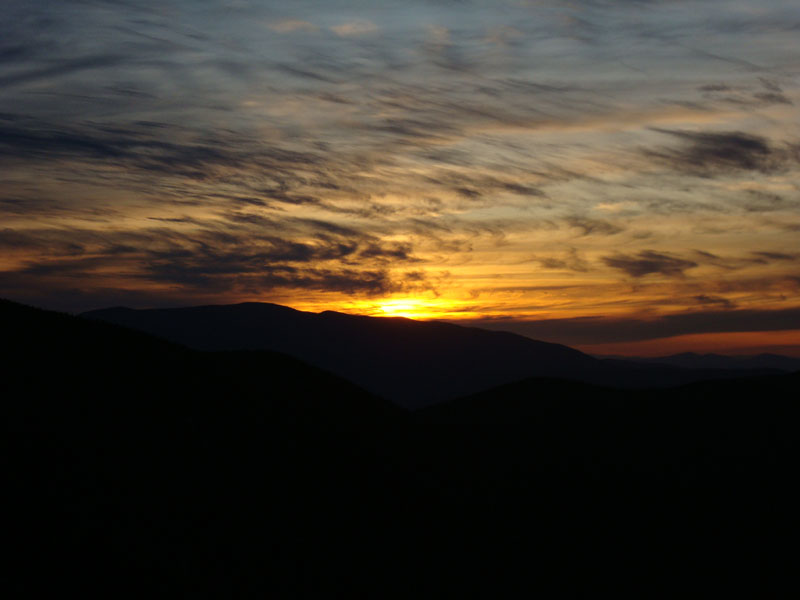
Back on East Osceola, I could see that the sunset wasn't far off. Reaching the viewpoint on the northern side of the ridge (next to where the trail plunges into the notch), I hung out for a decent sunset.
The walk out was a bit slower than normal, as I was taking special care to not roll my weak ankle with limited headlamp visibility. Nonetheless, a nice day for a hike.
| Hike Ratings |
|
Getting To Trailhead: |
Easy |
| Destination: |
Mt. Osceola (East Peak) |
|
Length: |
Moderate |
|
Steepness: |
Very Difficult |
|
Navigation: |
Difficult |
|
Views: |
Excellent |
|
Crowds: |
Moderate |
| Destination: |
Mt. Osceola |
|
Length: |
Moderate |
|
Steepness: |
Very Difficult |
|
Navigation: |
Easy |
|
Views: |
Excellent |
|
Crowds: |
Minimal |
|
| Hike Stats |
|
Date Hiked: |
Thursday, September 10, 2009 |
| Hike Commenced: |
3:59 PM |
| Parking Elevation: |
1,940' |
| Destination: |
Mt. Osceola (East Peak) |
| Ascent Commenced: |
3:59 PM |
| Summit Reached: |
5:40 PM |
| Time Elapsed: |
01:41 |
| Trailhead Elevation: |
1,940' |
| Summit Elevation: |
4,156' |
| Distance: |
2.8 miles |
| Vertical Gain: |
2,331' |
| Destination: |
Mt. Osceola |
| Ascent Commenced: |
5:40 PM |
| Summit Reached: |
6:13 PM |
| Time Elapsed: |
00:33 |
| Trailhead Elevation: |
4,156' |
| Summit Elevation: |
4,340' |
| Distance: |
1 mile |
| Vertical Gain: |
560' |
|
|
| Hike Ended: |
8:33 PM |
| Hike Time Elapsed: |
04:34 |
| Hike Distance: |
7.6 miles |
| Hike Vertical Gain: |
3,392' |
|
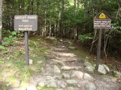
The Greeley Ponds Trail trailhead
Looking across the slide near the Mt. Osceola Trail
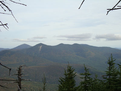
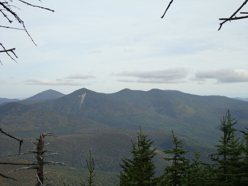
Looking at Mt. Tripyramid from near the summit of East Osceola
Looking down the chimney between the east and main peak
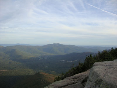
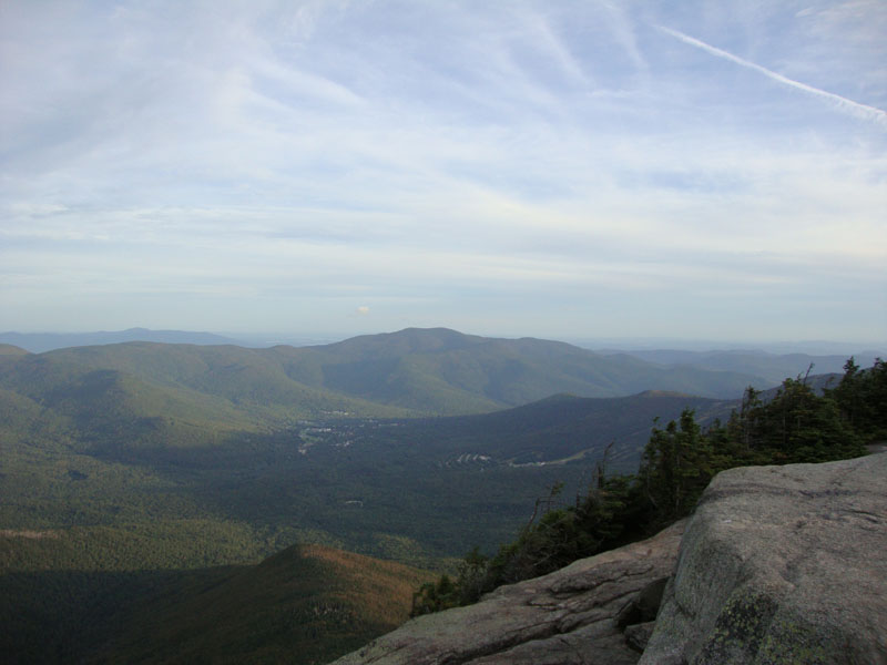
Looking at the Sandwich Dome from the Mt. Osceola ledges
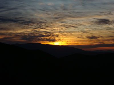
The sunset as seen from the northern viewpoint near East Osceola

Directions to trailhead: Take Route 112 west from Conway. After passing the Hancock Trail trailhead and parking lot, the Greeley Ponds trailhead and WMNF fee parking area will be on the left a few minutes later.
Back to Mt. Osceola (East Peak) Profile
Back to Mt. Osceola Profile
|