Home
States
Colorado
Connecticut
Maine
Massachusetts
New Hampshire
New York
Rhode Island
Utah
Vermont
View All
Lists
NE 4,000 Footers
NE 100 Highest
NH 4,000 Footers
NH 100 Highest
NH 52 With A View
NH Belknap Range
NH Ossipee 10
Links
Trail Conditions
Trip Log
Sunrises
Sunsets
About
|
Mt. Osceola (East Peak), Mt. Osceola
Lincoln, NH, Livermore, NH
Trailheads, measurements, times, distances, and maps are all approximate and relative to the hike(s) as shown below.

Looking down the Mt. Osceola Trail at the slide
Route: Greeley Ponds Trail, Mt. Osceola Trail, (Mt. Osceola - East Peak), Mt. Osceola Trail, (Mt. Osceola), Mt. Osceola Trail, (Mt. Osceola - East Peak), Mt. Osceola Trail, Greeley Ponds Trail
Greeley Ponds Trail was spring snow this afternoon, but set up this evening. Quite a few postholes, some very deep. Snowpack is probably on average 3 feet.
Mt. Osceola Trail up to the base of the steeps also had scattered postholes and plenty of depth. Alongside, across,and above the slide, the trail was very dangerous this evening. Barebooters and buttsliders destroyed the footbed on the initial steep, so the messed up fall line creates a no fall zone. I took a fall due to a frozen posthole, but fortunately just barely caught myself and ended up only with a jammed knee.
Slide crossing was okay with caution, but the top part is tough due to a narrow monorail.
The gully is very dangerous this evening, as the very top has some blue ice...lose your footing here in firm conditions and you'll be accelerating down into the trees.
Snowpack is much deeper as soon as you're on the ridge, probably 5 to 6 feet deep. No evidence of anyone making it this far without snowshoes recently. Good views courtesy the snowpack.
Deep snow between the peaks, probably 5 to 6 feet deep. Bushwhack around the chimney and chimney bypass is what's mostly being used. Did not see much traffic to the highpoint of Osceola (which is beyond the cliffs). Just beyond the high point, no traffic, but worth the trip, as the drifts are still very deep, deep enough to provide 360 degree views (the main reason I returned tonight, as I was staring at fog a few weeks ago).
I wore Tubbs Flex Alps the entire hike. I wouldn't have been comfortable in MSRs for the descent. Microspikes would have been useless and dangerous on the descent. Without Flex Alps, I would have snowshoed everything except the East Osceola descent, for which I would have used crampons.
| Hike Ratings |
|
Getting To Trailhead: |
Easy |
| Destination: |
Mt. Osceola (East Peak) |
|
Length: |
Moderate |
|
Steepness: |
Very Difficult |
|
Navigation: |
Easy |
|
Views: |
Excellent |
|
Crowds: |
Minimal |
| Destination: |
Mt. Osceola |
|
Length: |
Moderate |
|
Steepness: |
Very Difficult |
|
Navigation: |
Easy |
|
Views: |
Excellent |
|
Crowds: |
Minimal |
|
| Hike Stats |
|
Date Hiked: |
Wednesday, April 3, 2019 |
| Parking Elevation: |
1,940' |
| Destination: |
Mt. Osceola (East Peak) |
| Time Elapsed: |
01:41 |
| Trailhead Elevation: |
1,940' |
| Summit Elevation: |
4,156' |
| Distance: |
2.8 miles |
| Vertical Gain: |
2,331' |
| Destination: |
Mt. Osceola |
| Time Elapsed: |
00:38 |
| Trailhead Elevation: |
4,156' |
| Summit Elevation: |
4,340' |
| Distance: |
1 mile |
| Vertical Gain: |
560' |
|
|
| Hike Time Elapsed: |
04:17 |
| Hike Distance: |
7.6 miles |
| Hike Vertical Gain: |
3,392' |
|

The Greeley Ponds Trail trailhead

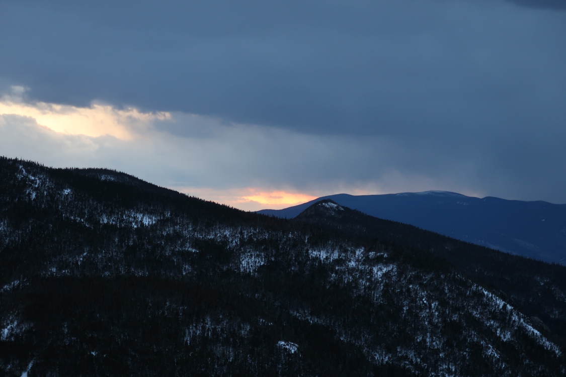
Sunset colors from near the summit of East Osceola

The snow loaded trail between the peaks

Sunset colors from the heavily drifted Mt. Osceola
Directions to trailhead: Take Route 112 west from Conway. After passing the Hancock Trail trailhead and parking lot, the Greeley Ponds trailhead and WMNF fee parking area will be on the left a few minutes later.
Back to Mt. Osceola (East Peak) Profile
Back to Mt. Osceola Profile
|