Home
States
Colorado
Connecticut
Maine
Massachusetts
New Hampshire
New York
Rhode Island
Utah
Vermont
View All
Lists
NE 4,000 Footers
NE 100 Highest
NH 4,000 Footers
NH 100 Highest
NH 52 With A View
NH Belknap Range
NH Ossipee 10
Links
Trail Conditions
Trip Log
Sunrises
Sunsets
About
|
Mt. Garfield, Garfield Ridge (West Peak), Garfield Ridge (East Peak)
Bethlehem, NH, Franconia, NH
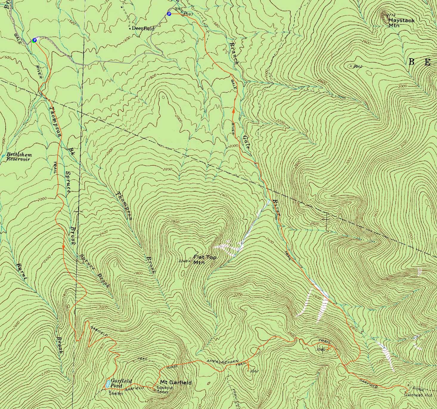
Trailheads, measurements, times, distances, and maps are all approximate and relative to the hike(s) as shown below.

The abandoned Garfield Pond Trail
Route: Garfield Trail, Garfield Pond Trail, (Garfield Pond), Garfield Ridge Trail, (Mt. Garfield), Garfield Ridge Trail, bushwhack, (Garfield Ridge West Peak), bushwhack, Garfield Ridge Trail, bushwhack, (Garfield Ridge East Peak), bushwhack, Garfield Ridge Trail, Gale River Trail
Instead of taking the vanilla approach to Garfield, we diverted onto the abandoned Garfield Pond Trail on one of the upper switchbacks and soon found ourselves at a foggy Garfield Pond. After passing by some remaining snow, we soon reached the fog-engulfed summit. Patience resulted in us seeing a few brief views.
Heading down the rough Garfield Ridge Trail (including a steep brookbed section below the campsite), we soon left the trail and bushwhacked to the recognized highpoint of West Garfield Ridge, from where we had some views through the trees.
Once back on the trail, we headed over the middle bump and then, around the third height of land on the trail, bushwhacked to recognized highpoint of East Garfield Ridge. With the spectacular view ledges, we lounged for some time.
Our next stop was Galehead. I opted to stay at the hut while others headed to the anti-climatic summit.
Upon regrouping, we headed down the Gale River Trail, on which the water crossings were a bit higher than normal.
| Hike Ratings |
|
Getting To Trailhead: |
Easy |
| Destination: |
Mt. Garfield |
|
Length: |
Moderate |
|
Steepness: |
Very Difficult |
|
Navigation: |
Difficult |
|
Views: |
Moderate (due to weather) |
|
Crowds: |
Heavy |
| Destination: |
Garfield Ridge - West Peak |
|
Length: |
Difficult |
|
Steepness: |
Very Difficult |
|
Navigation: |
Difficult |
|
Views: |
Moderate |
|
Crowds: |
Moderate |
| Destination: |
Garfield Ridge - East Peak |
|
Length: |
Difficult |
|
Steepness: |
Difficult |
|
Navigation: |
Difficult |
|
Views: |
Excellent |
|
Crowds: |
Minimal |
|
| Hike Stats |
|
Date Hiked: |
Sunday, May 29, 2011 |
| Parking Elevation: |
1,535' |
| Destination: |
Mt. Garfield |
| Time Elapsed: |
03:19 |
| Trailhead Elevation: |
1,535' |
| Summit Elevation: |
4,500' |
| Vertical Gain: |
3,095' |
| Destination: |
Garfield Ridge - West Peak |
| Time Elapsed: |
01:25 |
| Trailhead Elevation: |
4,500' |
| Summit Elevation: |
3,667' |
| Vertical Gain: |
297' |
| Destination: |
Garfield Ridge - East Peak |
| Time Elapsed: |
00:57 |
| Trailhead Elevation: |
3,667' |
| Summit Elevation: |
3,590' |
| Vertical Gain: |
410' |
|
|
| Hike Time Elapsed: |
11:23 |
| Hike Vertical Gain: |
4,656' |
|

The Garfield Trail trailhead

Garfield Pond

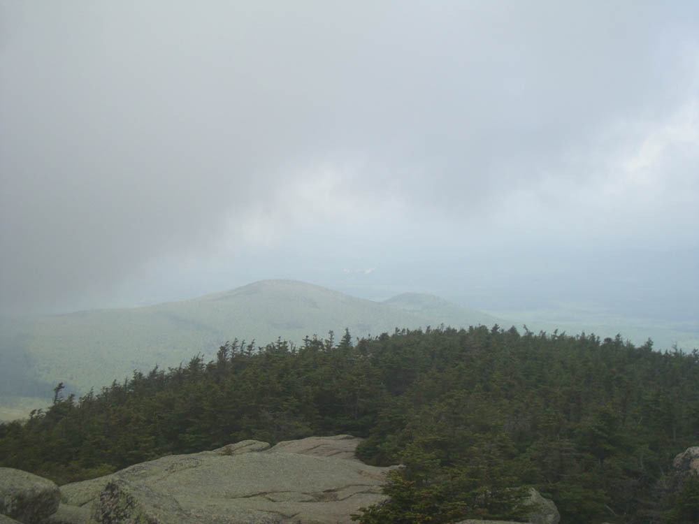
Brief views northwest from Mt. Garfield

The Garfield Ridge Trail on the way to the West Peak of Garfield Ridge

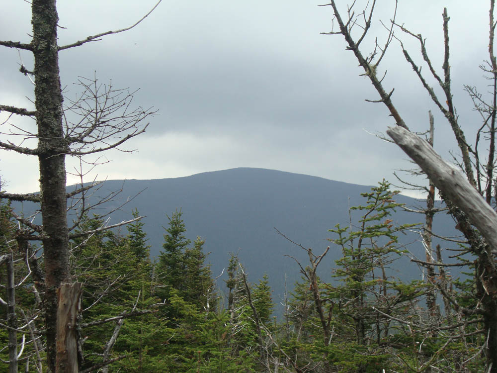
Looking at North Twin from near the summit of Garfield Ridge West Peak

The Garfield Ridge Trail between the West and East Peaks of Garfield Ridge

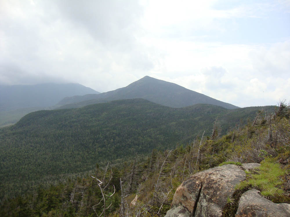
Looking at Mt. Garfield from near the summit of Garfield Ridge East Peak


Directions to trailhead: Take Route 3 South from US 302. Due to bridges being out on the west end of Gale River Road, take a left onto Gale River Road at the Five Corners junction. Bear left at the first fork, then take a right at the second fork, passing the Gale River Trail parking area. A few minutes later, the Garfield Trail WMNF fee hiker parking area is on the left, just before the Garfield Trail trailhead.
Back to Mt. Garfield Profile
Back to Garfield Ridge (West Peak) Profile
Back to Garfield Ridge (East Peak) Profile
|