Home
States
Colorado
Connecticut
Maine
Massachusetts
New Hampshire
New York
Rhode Island
Utah
Vermont
View All
Lists
NE 4,000 Footers
NE 100 Highest
NH 4,000 Footers
NH 100 Highest
NH 52 With A View
NH Belknap Range
NH Ossipee 10
Links
Trail Conditions
Trip Log
Sunrises
Sunsets
About
|
Mt. Hancock (North Peak), Mt. Hancock (South Peak)
Lincoln, NH, Livermore, NH
Trailheads, measurements, times, distances, and maps are all approximate and relative to the hike(s) as shown below.
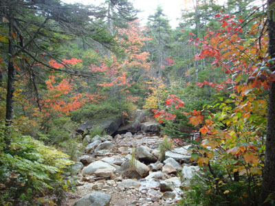
Looking down the Cedar Brook Trail
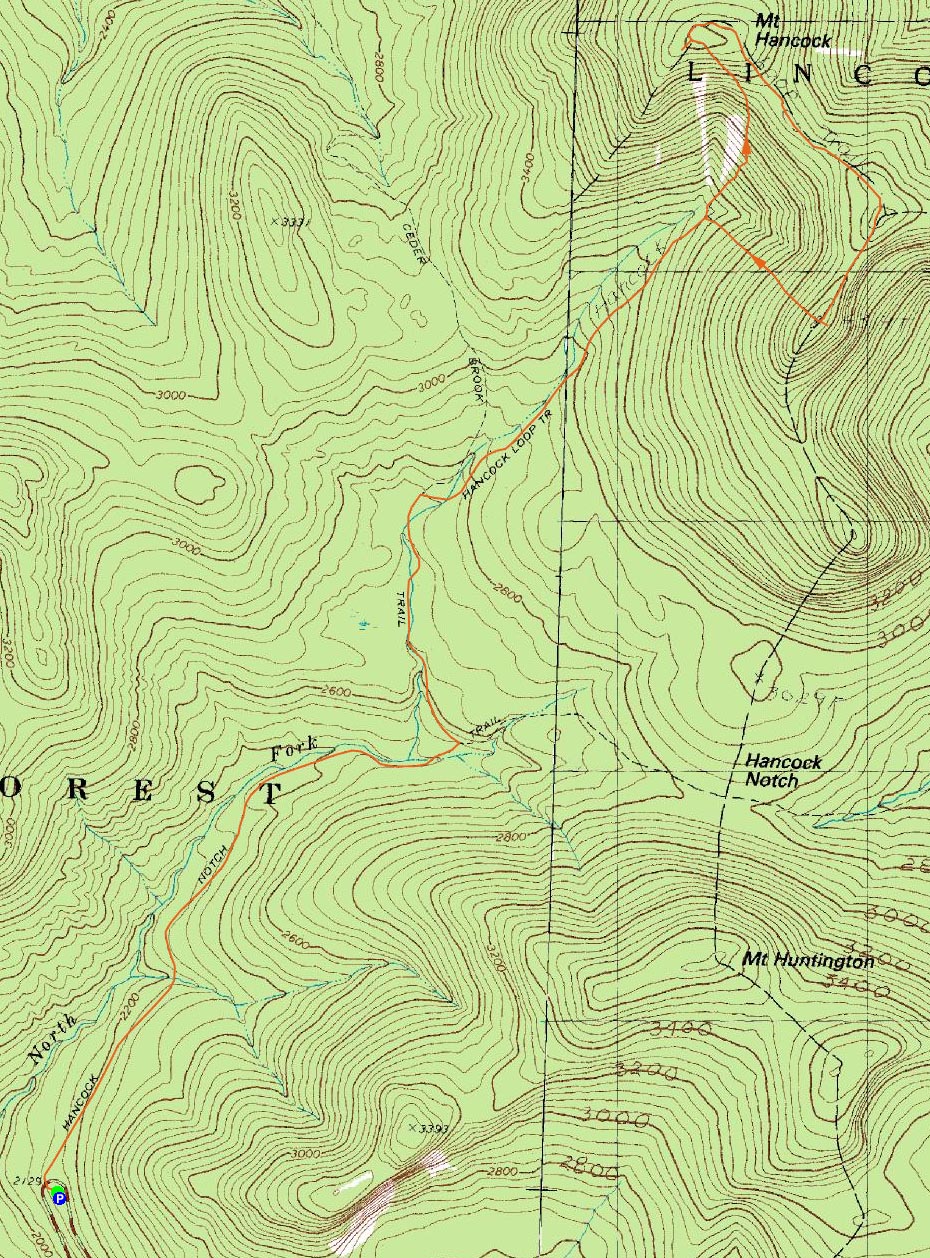
Route: Hancock Notch Trail, Cedar Brook Trail, Hancock Loop Trail, (Mt. Hancock North Peak), Hancock Loop Trail, (Mt. Hancock South Peak), Hancock Loop Trail, Cedar Brook Trail, Hancock Notch Trail
With a subpar weather forecast, I thought I was going to sit this day out. Fortunately, as the day grew nearer, it started to reverse. Seeing the fog forecasted to lift mid-morning, I decided for a late start on something that wasn't supposed to be overly abundant with views - the Hancocks.
Arriving at the fancy trailhead parking lot, I was able to snatch the last available space. Good stuff.
The trail starts at the end of the parking lot, dips down, crosses the Kanc, and then dips down a bit more, before following what appears to be an old rail grade for a long time.
I found some of the water crossings to be a little confusing, as there are all sorts of herd paths bypassing them. Nonetheless, it's easy enough to end up where you need to be.
It's pretty easy going all the way to the Hancock Loop Trail, and even from there it's pretty easy going until the trail splits.
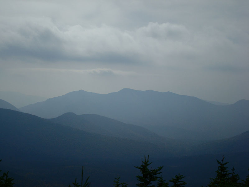
I chose to get the bulk of the vertical down up front and thus picked the north peak. After the intersection, the trail immediately dips down, before starting a relentless ascent - constantly steep, rocky, and some loose stuff - I was fading quickly! Nonetheless, I was able to make it to the summit nonstop (though, admittingly in slow motion!). Turning left and heading to the view point, I was surprised to see Grand Central Station! The view ledge was packed! Add in the fact that the view was rather hazy (still far reaching, though), and it's no shock that I didn't stick around for long.
It's pretty easy going to the south peak - a few small rocky sections, and some wet parts, but nothing too challenging. No views, either.
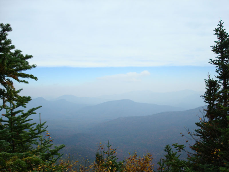
Arriving at the south peak, I quickly checked out the view point - not quite as good as the northern peak, but still a decent look toward Mt. Chocorua in the hazy distance.
After having lunch and chatting baseball with another hiker, I headed down the Hancock Loop - it seemed even steeper than the ascent up the north, though with better footing.
I was surprised to see a lot of foot traffic on the flats on the way back - certainly some leaf peepers (last I knew, Dockers aren't standard hiking fashion).
| Hike Ratings |
|
Getting To Trailhead: |
Easy |
| Destination: |
Mt. Hancock (North Peak) |
|
Length: |
Moderate |
|
Steepness: |
Very Difficult |
|
Navigation: |
Easy |
|
Views: |
Excellent |
|
Crowds: |
Heavy |
| Destination: |
Mt. Hancock (South Peak) |
|
Length: |
Moderate |
|
Steepness: |
Moderate |
|
Navigation: |
Easy |
|
Views: |
Excellent |
|
Crowds: |
Moderate |
|
| Hike Stats |
|
Date Hiked: |
Saturday, September 22, 2007 |
| Hike Commenced: |
10:42 AM |
| Parking Elevation: |
2,140' |
| Destination: |
Mt. Hancock (North Peak) |
| Ascent Commenced: |
10:42 AM |
| Summit Reached: |
12:32 PM |
| Time Elapsed: |
01:50 |
| Trailhead Elevation: |
2,140' |
| Summit Elevation: |
4,420' |
| Vertical Gain: |
2,470' |
| Destination: |
Mt. Hancock (South Peak) |
| Ascent Commenced: |
12:35 PM |
| Summit Reached: |
1:12 PM |
| Time Elapsed: |
00:37 |
| Trailhead Elevation: |
4,420' |
| Summit Elevation: |
4,319' |
| Distance: |
1.4 miles |
| Vertical Gain: |
534' |
|
|
| Hike Ended: |
3:18 PM |
| Hike Time Elapsed: |
04:36 |
| Hike Vertical Gain: |
3,154' |
|
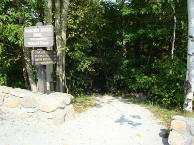
The Hancock Notch Trail trailhead
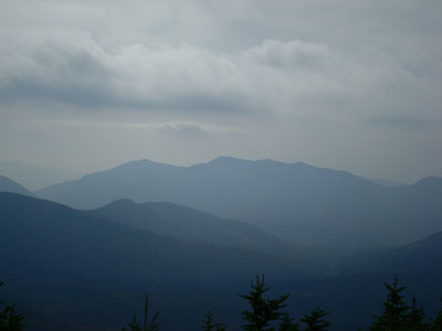
Looking southwest at Mt. Osceola from Mt. Hancock's North Peak
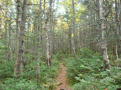
The Hancock Loop Trail to Mt. Hancock's south peak

Looking southeast at Mt. Chocorua from Mt. Hancock's Sorth Peak
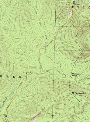

Directions to trailhead: Take Route 112 west from Route 16. After going over the pass, continue down hill a ways. The Hancock WMNF fee parking area will be on the left, just before a hairpin turn.
Back to Mt. Hancock (North Peak) Profile
Back to Mt. Hancock (South Peak) Profile
|