Home
States
Colorado
Connecticut
Maine
Massachusetts
New Hampshire
New York
Rhode Island
Utah
Vermont
View All
Lists
NE 4,000 Footers
NE 100 Highest
NH 4,000 Footers
NH 100 Highest
NH 52 With A View
NH Belknap Range
NH Ossipee 10
Links
Trail Conditions
Trip Log
Sunrises
Sunsets
About
|
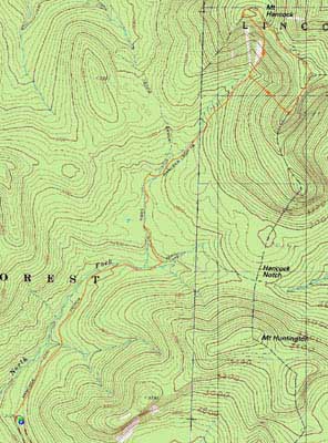
Mt. Hancock (North Peak), Mt. Hancock (South Peak)
Lincoln, NH, Livermore, NH
Trailheads, measurements, times, distances, and maps are all approximate and relative to the hike(s) as shown below.
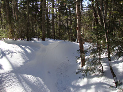
Looking down the Hancock Loop Trail
Route: Hancock Notch Trail, Cedar Brook Trail, Hancock Loop Trail, (Mt. Hancock North Peak), Hancock Loop Trail, (Mt. Hancock South Peak), Hancock Loop Trail, Cedar Brook Trail, Hancock Notch Trail
Needing to stretch my legs on a cold, windy day, I decided to head over to the Hancocks.
The flats went by fairly quickly - while I could have barebooted on the firm surface (with an inch of powder on top), I opted to wear my snowshoes. While the crossings on the Hancock Notch Trail were open (but low), the Cedar Brook Trail crossings were all ice bridged.
The wind started to howl as I reached the steeps. It tended to be overhead, though, sparing me from direct gusts. Reaching the summit of the north peak, the views were quite strong - the ski trails on Gunstock were easily seen.
The area between the peaks was a bit drifted, especially as we neared south peak. Prior to the summit, we had nice views of the Franconia Ridge. In addition, we had clear views from the near-summit vista of Chocorua and points east.
The descent went fairly smoothly, as our snowshoes provided adequate traction. Back on the flats, the temperatures were a bit more reasonable. We ended up reaching the parking lot just after sunset.
| Hike Ratings |
|
Getting To Trailhead: |
Easy |
| Destination: |
Mt. Hancock (North Peak) |
|
Length: |
Moderate |
|
Steepness: |
Very Difficult |
|
Navigation: |
Easy |
|
Views: |
Excellent |
|
Crowds: |
Minimal |
| Destination: |
Mt. Hancock (South Peak) |
|
Length: |
Moderate |
|
Steepness: |
Difficult |
|
Navigation: |
Moderate |
|
Views: |
Excellent |
|
Crowds: |
Minimal |
|
| Hike Stats |
|
Date Hiked: |
Thursday, February 4, 2010 |
| Hike Commenced: |
11:55 AM |
| Parking Elevation: |
2,140' |
| Destination: |
Mt. Hancock (North Peak) |
| Ascent Commenced: |
11:55 AM |
| Summit Reached: |
2:07 PM |
| Time Elapsed: |
02:12 |
| Trailhead Elevation: |
2,140' |
| Summit Elevation: |
4,420' |
| Vertical Gain: |
2,470' |
| Destination: |
Mt. Hancock (South Peak) |
| Ascent Commenced: |
2:14 PM |
| Summit Reached: |
3:09 PM |
| Time Elapsed: |
00:55 |
| Trailhead Elevation: |
4,420' |
| Summit Elevation: |
4,319' |
| Distance: |
1.4 miles |
| Vertical Gain: |
534' |
|
|
| Hike Ended: |
5:17 PM |
| Hike Time Elapsed: |
05:22 |
| Hike Vertical Gain: |
3,154' |
|
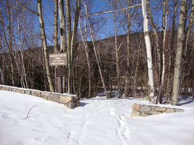
The Hancock Notch Trail trailhead
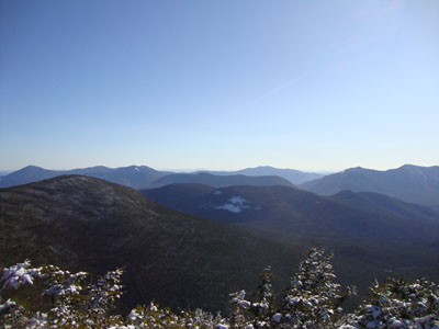
Mt. Passaconaway through Mt. Osceola, as seen from the North Hancock viewpoint
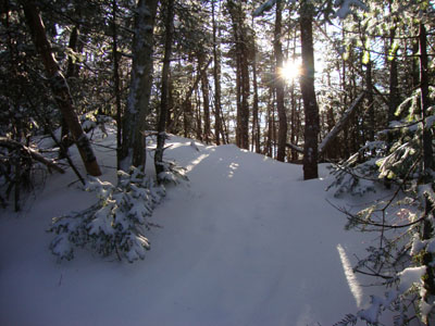
The Hancock Loop Trail between the peaks

The Mt. Chocorua as seen from near the South Hancock summit

Directions to trailhead: Take Route 112 west from Route 16. After going over the pass, continue down hill a bit. The Hancock WMNF fee parking area will be on the left, just before a hairpin turn.
Back to Mt. Hancock (North Peak) Profile
Back to Mt. Hancock (South Peak) Profile
|


