Home
States
Colorado
Connecticut
Maine
Massachusetts
New Hampshire
New York
Rhode Island
Utah
Vermont
View All
Lists
NE 4,000 Footers
NE 100 Highest
NH 4,000 Footers
NH 100 Highest
NH 52 With A View
NH Belknap Range
NH Ossipee 10
Links
Trail Conditions
Trip Log
Sunrises
Sunsets
About
|
Mt. Huntington, Mt. Huntington (South Peak)
Lincoln, NH, Livermore, NH
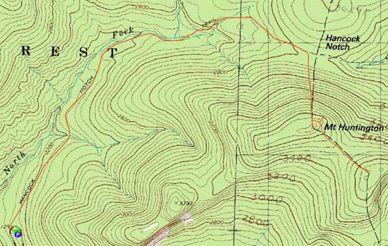
Trailheads, measurements, times, distances, and maps are all approximate and relative to the hike(s) as shown below.
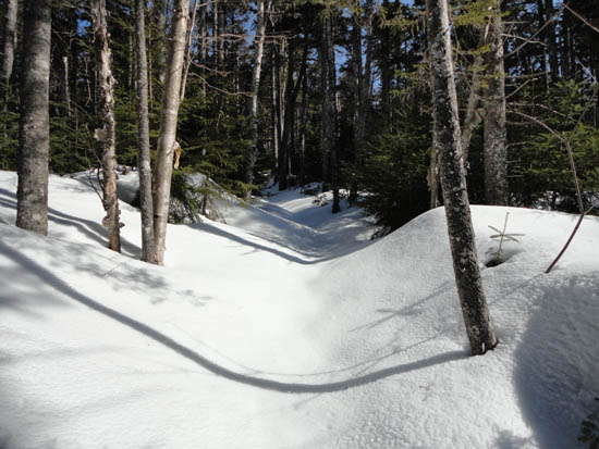
Looking up the Hancock Notch Trail
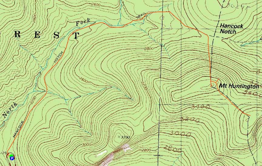
Route: Hancock Notch Trail, bushwhack, (Mt. Huntington), bushwhack, (South Huntington), bushwhack, Hancock Notch Trail
With limited time and ideal bushwhacking conditions, I decided to give the Huntingtons a try.
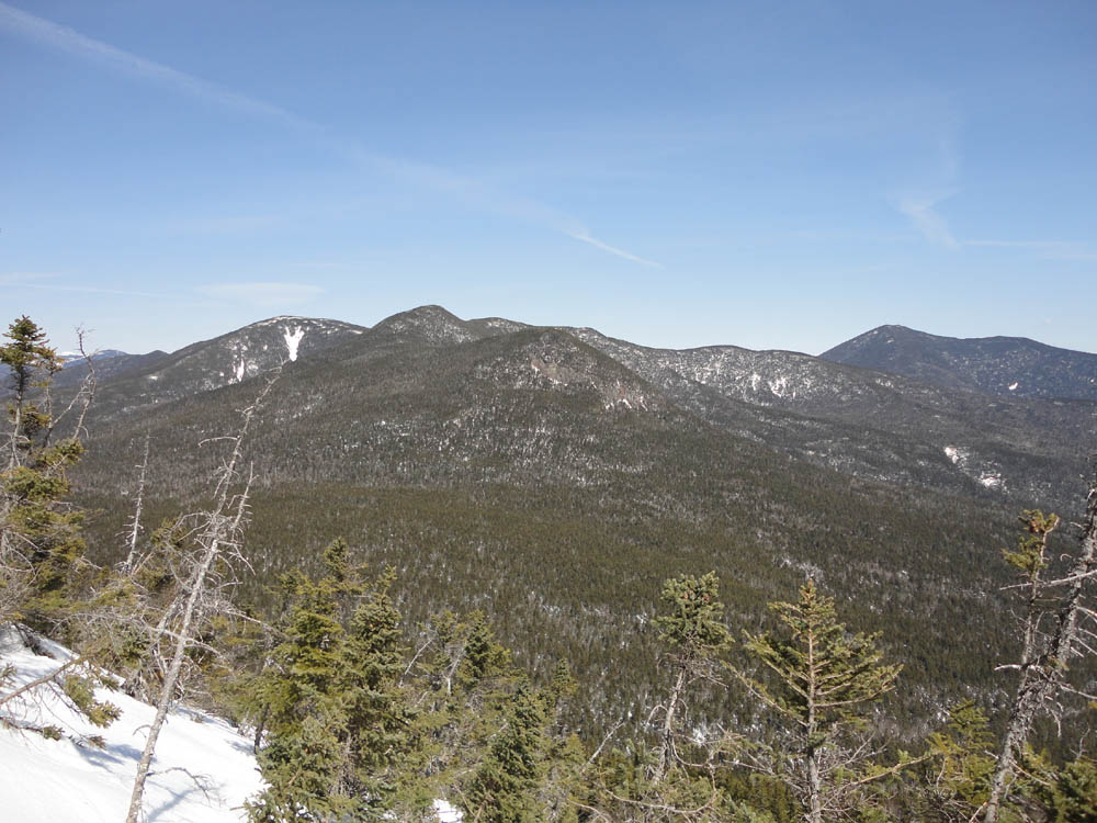
To start, the Hancock Notch Trail was smooth sailing up to the Cedar Brook Trail junction. Thereafter, there had been no recent use of the trail, so trailfinding was added to the mix. After heading through some ups and downs, the open slopes of Mt. Huntington neared. Once close to height of land, I headed slightly downhill into the notch, then up an increasingly steep slope. While I had intended to head over to the open talus fields, there was about a foot of unconsolidated snow on top of a crust, which made me a bit uneasy about open steeps. Instead, I headed uphill to a shelf, then worked my way around somewhat open woods to the recognized highpoint. Thanks to the snowpack, there were decent views of South Huntington and points south.
After briefly checking out potentially higher ground, I headed back downhill a bit, then cut along the side of the peak toward the col, as to avoid a brief steep, sprucy area adjacent to the highpoint.
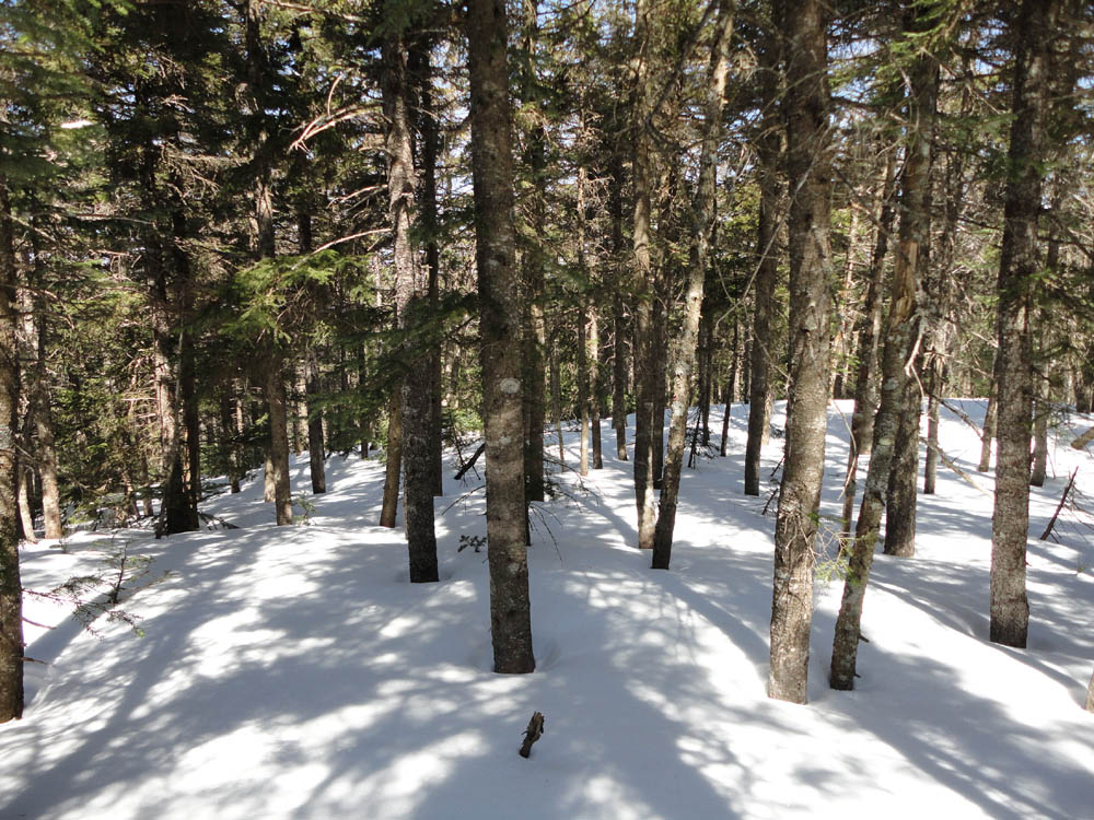
The woods in between the peaks alternated between brief somewhat thick areas of spruce to open woods. Thanks to the firm snowpack, I was able to avoid spruce traps.
The wooded recognized highpoint of South Huntington feature little in way of views. While it was tempting to perhaps look around for some sort of vista downhill, the woods weren't quite inviting enough, nor did I have enough time. Instead, I followed my tracks back to the side of Mt. Huntington, then dropped down to a good, snowpack enhanced view into Hancock Notch. From there, I headed back to my uphill tracks and dropped back into the notch.
| Hike Ratings |
|
Getting To Trailhead: |
Easy |
| Destination: |
Mt. Huntington |
|
Length: |
Moderate |
|
Steepness: |
Very Difficult |
|
Navigation: |
Difficult |
|
Views: |
Excellent |
|
Crowds: |
Minimal |
| Destination: |
Mt. Huntington (South Peak) |
|
Length: |
Moderate |
|
Steepness: |
Moderate |
|
Navigation: |
Difficult |
|
Views: |
Minimal |
|
Crowds: |
Minimal |
|
| Hike Stats |
|
Date Hiked: |
Saturday, April 9, 2011 |
| Parking Elevation: |
2,140' |
| Destination: |
Mt. Huntington |
| Time Elapsed: |
02:15 |
| Trailhead Elevation: |
2,140' |
| Summit Elevation: |
3,700' |
| Vertical Gain: |
1,740' |
| Destination: |
Mt. Huntington (South Peak) |
| Time Elapsed: |
00:26 |
| Trailhead Elevation: |
3,700' |
| Summit Elevation: |
3,700' |
| Vertical Gain: |
200' |
|
|
| Hike Time Elapsed: |
04:59 |
| Hike Vertical Gain: |
2,320' |
|
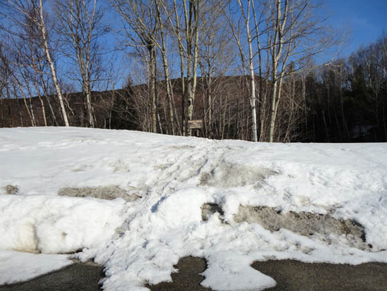
The Hancock Notch Trail trailhead
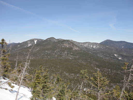
The Hancocks and Mt. Carrigain as seen from near the summit of Mt. Huntington
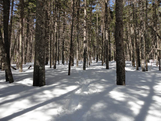
Deep snowpack and open woods between the peaks
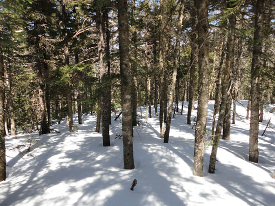
A lack of views from South Huntington

Directions to trailhead: Take Route 112 west from Route 16. After going over the pass, continue down hill a bit. The Hancock WMNF fee parking area will be on the left, just before a hairpin turn.
Back to Mt. Huntington Profile
Back to Mt. Huntington (South Peak) Profile
|