Home
States
Colorado
Connecticut
Maine
Massachusetts
New Hampshire
New York
Rhode Island
Utah
Vermont
View All
Lists
NE 4,000 Footers
NE 100 Highest
NH 4,000 Footers
NH 100 Highest
NH 52 With A View
NH Belknap Range
NH Ossipee 10
Links
Trail Conditions
Trip Log
Sunrises
Sunsets
About
|
Mt. Jackson
Carroll, NH, Hart's Location, NH, Bean's Grant, NH
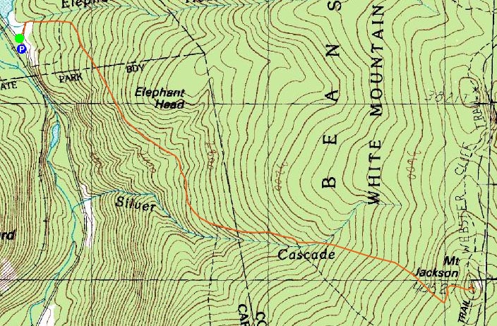
Trailheads, measurements, times, distances, and maps are all approximate and relative to the hike(s) as shown below.

Looking down the rocky section of the Webster-Jackson Trail just below the summit of Mt. Jackson
Route: Webster-Jackson Trail
I had been watching Thursday's forecast for a few days, as it looked like the only decent day all week. Fortunately, the forecast held, and I was on my way just after lunch. The temperature in Crawford Notch was in the upper 30s/lower 40s - not too bad for January!
The Webster-Jackson Trail had a firm base of frozen granular that would support barebooting. Nonetheless, I chose to wear my snowshoes.
Other than a few blowdowns, the trail was in decent shape and easy to follow. Once I reached the summit slabs, bare from the recent warm weather, I took off my snowshoes and barebooted to the summit cairn - boy was it windy! The views were excellent - though the southern skies were clouding over, it was still mostly blue sky within a few dozen miles in all other directions, other than a cloud blowing over the middle Presidentials.
On the way down, I took some time and debranched a particularly bad blowdown - the tree had fallen lengthwise up the trail in a spruce area.
All in all, a nice day in the Southern Presidentials.
| Hike Ratings |
|
Getting To Trailhead: |
Easy |
| Destination: |
Mt. Jackson |
|
Length: |
Moderate |
|
Steepness: |
Difficult |
|
Navigation: |
Easy |
|
Views: |
Excellent |
|
Crowds: |
Minimal |
|
| Hike Stats |
|
Date Hiked: |
Thursday, January 10, 2008 |
| Hike Commenced: |
12:26 PM |
| Parking Elevation: |
1,900' |
| Destination: |
Mt. Jackson |
| Ascent Commenced: |
12:30 PM |
| Summit Reached: |
2:05 PM |
| Time Elapsed: |
01:35 |
| Trailhead Elevation: |
1,905' |
| Summit Elevation: |
4,052' |
| Distance: |
2.6 miles |
| Vertical Gain: |
2,322' |
|
|
| Hike Ended: |
3:48 PM |
| Hike Time Elapsed: |
03:22 |
| Hike Distance: |
5.2 miles |
| Hike Vertical Gain: |
2,512' |
|

Webster-Jackson Trail trailhead on Route 302

Looking northeast at the Presidentials in a cloud from the Mt. Jackson summit


Directions to trailhead: Take Route 302 West from Bartlett into Carroll. There is a small parking lot on the left side of the road. Trailhead is located on the right side of the road, just after the parking lot and just before Saco Lake.
Back to Mt. Jackson Profile
|