Home
States
Colorado
Connecticut
Maine
Massachusetts
New Hampshire
New York
Rhode Island
Utah
Vermont
View All
Lists
NE 4,000 Footers
NE 100 Highest
NH 4,000 Footers
NH 100 Highest
NH 52 With A View
NH Belknap Range
NH Ossipee 10
Links
Trail Conditions
Trip Log
Sunrises
Sunsets
About
|
Mt. Jackson
Carroll, NH, Hart's Location, NH, Bean's Grant, NH
Trailheads, measurements, times, distances, and maps are all approximate and relative to the hike(s) as shown below.

Looking up the Webster-Jackson Trail
Route: Webster-Jackson Trail
The weather forecast looked decent, as well as the satellite and radar imagery. By my calculations, I had enough time to summit Mt. Jackson and get down to the Webster-Jackson junction before needing to use a headlamp.
Unfortunately, I hit some road construction and traffic, and thus was running about 15 minutes behind. Even more discouraging was the occasional sprinkle of rain as I headed west on Route 302.
The lower portion of the Webster-Jackson Trail was a little wet, but not too bad. After the junction, things became a bit muddy. As I neared the summit, the trees and some of the ground were covered in snow and rime.
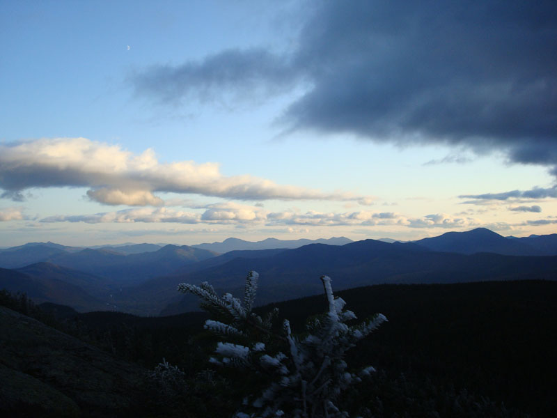
The views from the summit, despite some clouds lingering over the Presidentials and Pemi, were extremely strong. Peaks in Vermont were very easily seen, with clarity stronger than I've experienced thus far on Mt. Jackson. Points to the south and west were also easily seen. Mt. Washington, though, was in the clouds.
Since the sunset was near and there were some interesting clouds, I decided to hang around for the sunset. Fortunately I had some light winter gear with me, so I was able to stay somewhat warm thanks to my winter hat, mittens, and jacket.
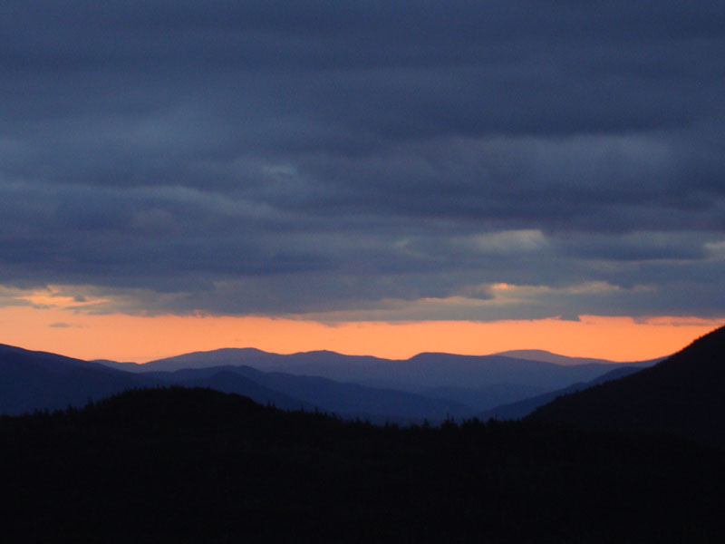
While there was some color to the west and to the south, the actual sunset was obscured by clouds. After waiting for a good 30 minutes, I could see the color fading and decided to get going. Shortly after passing the ledges, I looked up and saw some tremendous purple and pink color over Mt. Field. This color blast lasted for maybe a minute or two - without a hint of it before or after.
I was able to continue down the trail for a few minutes without my headlamp, however I finally had to give in and turn it on for the majority of the hike out.
| Hike Ratings |
|
Getting To Trailhead: |
Easy |
| Destination: |
Mt. Jackson |
|
Length: |
Moderate |
|
Steepness: |
Difficult |
|
Navigation: |
Easy |
|
Views: |
Excellent |
|
Crowds: |
Minimal |
|
| Hike Stats |
|
Date Hiked: |
Monday, October 6, 2008 |
| Hike Commenced: |
4:15 PM |
| Parking Elevation: |
1,900' |
| Destination: |
Mt. Jackson |
| Ascent Commenced: |
4:15 PM |
| Summit Reached: |
5:41 PM |
| Time Elapsed: |
01:26 |
| Trailhead Elevation: |
1,905' |
| Summit Elevation: |
4,052' |
| Distance: |
2.6 miles |
| Vertical Gain: |
2,322' |
|
|
| Hike Ended: |
7:48 PM |
| Hike Time Elapsed: |
03:33 |
| Hike Distance: |
5.2 miles |
| Hike Vertical Gain: |
2,512' |
|

Webster-Jackson Trail trailhead on Route 302

Looking at the Sandwich Range from Mt. Jackson

Sunset colors over Carr Mountain and Smarts Mountain as seen from Mt. Jackson


Directions to trailhead: Take Route 302 West from Bartlett into Carroll. There is a small parking lot on the left side of the road. Trailhead is located on the right side of the road, just after the parking lot and just before Saco Lake.
Back to Mt. Jackson Profile
|