Home
States
Colorado
Connecticut
Maine
Massachusetts
New Hampshire
New York
Rhode Island
Utah
Vermont
View All
Lists
NE 4,000 Footers
NE 100 Highest
NH 4,000 Footers
NH 100 Highest
NH 52 With A View
NH Belknap Range
NH Ossipee 10
Links
Trail Conditions
Trip Log
Sunrises
Sunsets
About
|
Mt. Jackson
Carroll, NH, Hart's Location, NH, Bean's Grant, NH
Trailheads, measurements, times, distances, and maps are all approximate and relative to the hike(s) as shown below.

Looking up the Webster-Jackson Trail
Route: Webster-Jackson Trail
While I had planned to do Mt. Pierce on this forecasted sunny afternoon, the increasing overcast pushed me to instead do Mt. Jackson.
The lower portion of the Webster-Jackson was somewhat muddy, though mostly snow and ice free. Above the Webster-Jackson split, the monorail started almost immediately. Fortunately, it was fairly firm.
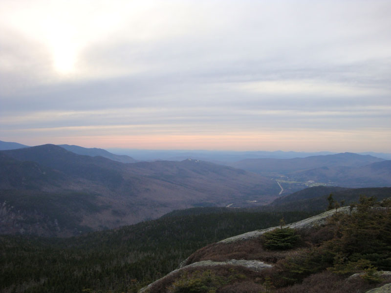
Though overcast, the views from the summit were still fairly good. The scenery during the descent, however, was superior - the sunset colors from Bugle Cliff were tremendous!
| Hike Ratings |
|
Getting To Trailhead: |
Easy |
| Destination: |
Mt. Jackson |
|
Length: |
Moderate |
|
Steepness: |
Difficult |
|
Navigation: |
Easy |
|
Views: |
Excellent |
|
Crowds: |
Minimal |
|
| Hike Stats |
|
Date Hiked: |
Monday, May 4, 2009 |
| Hike Commenced: |
4:55 PM |
| Parking Elevation: |
1,900' |
| Destination: |
Mt. Jackson |
| Ascent Commenced: |
4:56 PM |
| Summit Reached: |
6:27 PM |
| Time Elapsed: |
01:31 |
| Trailhead Elevation: |
1,905' |
| Summit Elevation: |
4,052' |
| Distance: |
2.6 miles |
| Vertical Gain: |
2,322' |
|
|
| Hike Ended: |
8:15 PM |
| Hike Time Elapsed: |
03:20 |
| Hike Distance: |
5.2 miles |
| Hike Vertical Gain: |
2,512' |
|

Webster-Jackson Trail trailhead on Route 302

Trout lilly near the Webster-Jackson Trail trailhead

Looking west from Mt. Jackson

Sunset colors as seen from Bugle Cliff


Directions to trailhead: Take Route 302 West from Bartlett into Carroll. There is a small parking lot on the left side of the road. Trailhead is located on the right side of the road, just after the parking lot and just before Saco Lake.
Back to Mt. Jackson Profile
|