Home
States
Colorado
Connecticut
Maine
Massachusetts
New Hampshire
New York
Rhode Island
Utah
Vermont
View All
Lists
NE 4,000 Footers
NE 100 Highest
NH 4,000 Footers
NH 100 Highest
NH 52 With A View
NH Belknap Range
NH Ossipee 10
Links
Trail Conditions
Trip Log
Sunrises
Sunsets
About
|
Mt. Jackson
Carroll, NH, Hart's Location, NH, Bean's Grant, NH
Trailheads, measurements, times, distances, and maps are all approximate and relative to the hike(s) as shown below.

Looking down the Webster-Jackson Trail
Route: Webster-Jackson Trail
With the wet weather moving back in, I decided to head up to Jackson during a brief break in the rain. While I started under blue skies, clouds followed me up the mountain. The folliage on the lower portion of the trail was quite colorful.
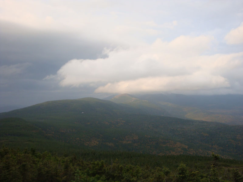
Reaching the summit, I had views in all directions - and dark clouds in all directions. In fact, it appeared that the southern Presidentials were amongst the only peaks not being rained upon.
The headlamp went on shortly after the loop split. Fortunately, the rain held off until I was about .1 miles from the road.
| Hike Ratings |
|
Getting To Trailhead: |
Easy |
| Destination: |
Mt. Jackson |
|
Length: |
Moderate |
|
Steepness: |
Difficult |
|
Navigation: |
Easy |
|
Views: |
Excellent |
|
Crowds: |
Moderate |
|
| Hike Stats |
|
Date Hiked: |
Monday, September 28, 2009 |
| Hike Commenced: |
4:20 PM |
| Parking Elevation: |
1,900' |
| Destination: |
Mt. Jackson |
| Ascent Commenced: |
4:20 PM |
| Summit Reached: |
5:32 PM |
| Time Elapsed: |
01:12 |
| Trailhead Elevation: |
1,905' |
| Summit Elevation: |
4,052' |
| Distance: |
2.6 miles |
| Vertical Gain: |
2,322' |
|
|
| Hike Ended: |
7:10 PM |
| Hike Time Elapsed: |
02:50 |
| Hike Distance: |
5.2 miles |
| Hike Vertical Gain: |
2,512' |
|

Webster-Jackson Trail trailhead on Route 302

Looking past Mt. Pierce at Mt. Eisenhower from Mt. Jackson


Directions to trailhead: Take Route 302 West from Bartlett into Carroll. There is a small parking lot on the left side of the road. Trailhead is located on the right side of the road, just after the parking lot and just before Saco Lake.
Back to Mt. Jackson Profile
|