Home
States
Colorado
Connecticut
Maine
Massachusetts
New Hampshire
New York
Rhode Island
Utah
Vermont
View All
Lists
NE 4,000 Footers
NE 100 Highest
NH 4,000 Footers
NH 100 Highest
NH 52 With A View
NH Belknap Range
NH Ossipee 10
Links
Trail Conditions
Trip Log
Sunrises
Sunsets
About
|
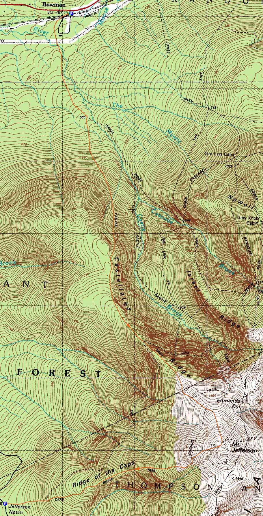
Mt. Jefferson
Randolph, NH, Thompson and Meserve's Purchase, NH
Trailheads, measurements, times, distances, and maps are all approximate and relative to the hike(s) as shown below.
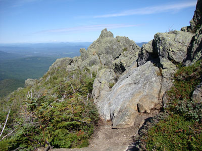
Looking down the Castle Trail
Route: Castle Trail, (Mt. Jefferson), Caps Ridge Trail
With a nice forecast, it seemed like a great day to head up to the Northern Presidentials.
The Castle Trail started off fairly gently, working its way around a field and along a stream. After the first trail junction, things began to steepen up. After the Link junction, the trail immediately began to get technical with some exposed rock slab scrambles. Though a few were tricky, there were fortunately enough hand holds to ensure ascent. In slippery conditions, this wouldn't be much fun!
The Castles section of the trail was very scenic and interesting, as the rocky crags provided a fun route with unique views. Above the Cornice junction, the trail was typical Northern Presidential traprock.
The views from the crowded summit of Mt. Jefferson were tremendous - though things were clouding up to the south, the visibility was nonetheless strong.
Needing to get back south later in the afternoon, I descended a busy Caps Ridge Trail back to my vehicle-spot. A nice day for Mt. Jefferson!
| Hike Ratings |
|
Getting To Trailhead: |
Easy |
| Destination: |
Mt. Jefferson |
|
Length: |
Moderate |
|
Steepness: |
Very Difficult |
|
Navigation: |
Moderate |
|
Views: |
Excellent |
|
Crowds: |
Heavy |
|
| Hike Stats |
|
Date Hiked: |
Friday, August 28, 2009 |
| Hike Commenced: |
7:27 AM |
| Parking Elevation: |
1,500' |
| Destination: |
Mt. Jefferson |
| Ascent Commenced: |
7:27 AM |
| Summit Reached: |
12:29 PM |
| Time Elapsed: |
05:02 |
| Trailhead Elevation: |
1,500' |
| Summit Elevation: |
5,712' |
| Distance: |
5 miles |
| Vertical Gain: |
4,462' |
|
|
| Hike Ended: |
2:40 PM |
| Hike Time Elapsed: |
07:13 |
| Hike Distance: |
7.5 miles |
| Hike Vertical Gain: |
4,527' |
|

The Castle Trail trailhead off US 2

Looking down the Castle Trail

Looking at Mt. Adams from Mt. Jefferson


Directions to trailhead: Take US 2 West from Appalachia. Shortly after passing the Lowes Path trailhead, the Castle Trail trailhead will be on the left side of the road, as well as a small parking area located adjacent to a field. To get to the Caps Ridge Trail trailhead, take Route 302 West from Bartlett into Carroll. Just after Saco Lake, take a right onto Mt. Clinton Road. Cross over Base Road and continue on Jefferson Notch Road. At the high point of the road, the WMNF fee parking lot will be on the right. The Caps Ridge Trail trailhead is at the back of the parking lot.
Back to Mt. Jefferson Profile
|