Home
States
Colorado
Connecticut
Maine
Massachusetts
New Hampshire
New York
Rhode Island
Utah
Vermont
View All
Lists
NE 4,000 Footers
NE 100 Highest
NH 4,000 Footers
NH 100 Highest
NH 52 With A View
NH Belknap Range
NH Ossipee 10
Links
Trail Conditions
Trip Log
Sunrises
Sunsets
About
|
Mt. Kearsarge
Warner, NH, Wilmot, NH
Trailheads, measurements, times, distances, and maps are all approximate and relative to the hike(s) as shown below.
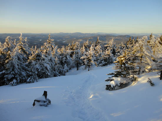
Looking down the Winslow Trail
Route: Auto road, Winslow Trail, (Mt. Kearsarge), Winslow Trail, powerline cut, auto road
With a nice afternoon on tap, I headed south to try Kearsarge in winter for the first time.
While I'm no fan of roadwalks, the mile or so gradual walk up the snowmobile-packed auto road wasn't too bad in the mild temperatures. Reaching the summer trailhead, I originally intended to hike the Barlow Trail. About a minute into breaking out an icy crust, I decided to turn around and go up the more direct Winslow Trail instead.
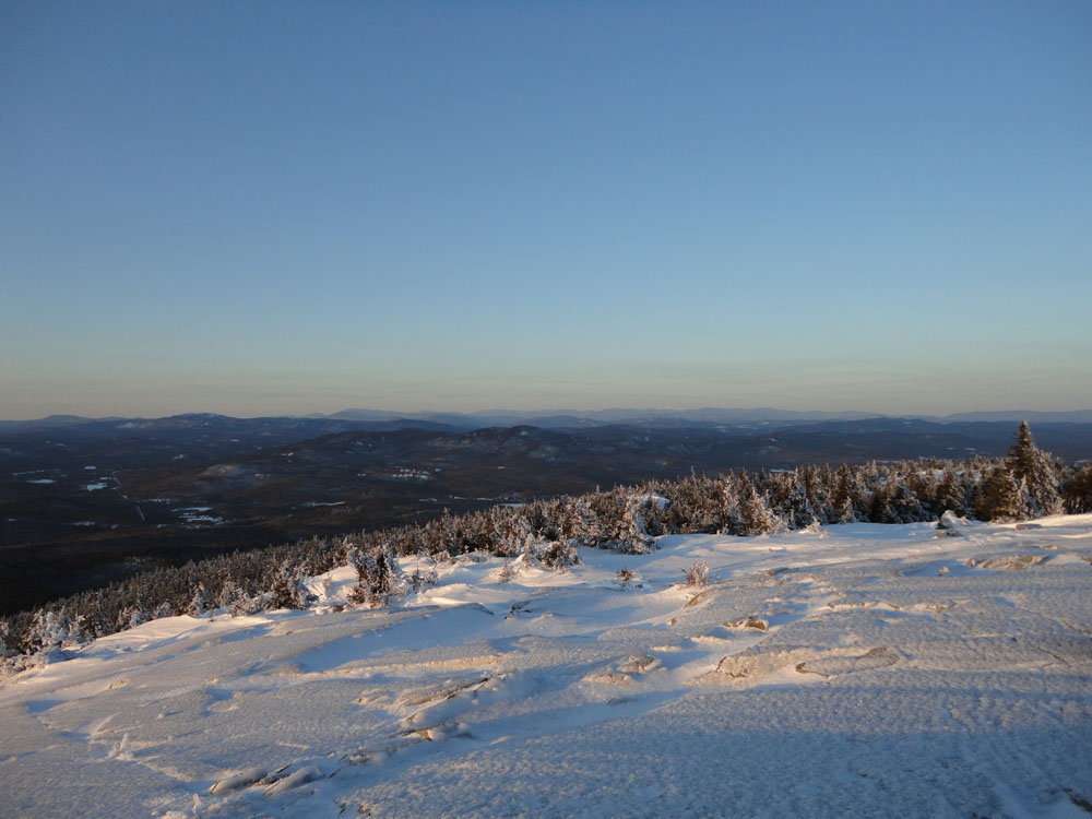
The trail was fairly smooth sailing on snowshoes with granular conditions. Nearing treeline, I stopped to layer up for an extended summit stay, as I was running a bit ahead of schedule. While the views from the summit to the south were cloudy, there was superb visibility into Vermont (including Jay Peak) and up to the Whites (including Mt. Washington in the clear).
With the summit ledges coated in textured blue ice, the sunset was quite nice. The descent after went smoothly, as I reached the auto road prior to the real dark setting in, allowing for a simple walk back without a headlamp.
| Hike Ratings |
|
Getting To Trailhead: |
Moderate |
| Destination: |
Mt. Kearsarge |
|
Length: |
Moderate |
|
Steepness: |
Difficult |
|
Navigation: |
Moderate |
|
Views: |
Excellent |
|
Crowds: |
Minimal |
|
| Hike Stats |
|
Date Hiked: |
Tuesday, March 1, 2011 |
| Parking Elevation: |
1,400' |
| Time to Trailhead: |
00:23 |
| Destination: |
Mt. Kearsarge |
| Time Elapsed: |
00:44 |
| Trailhead Elevation: |
1,850' |
| Summit Elevation: |
2,937' |
| Distance: |
1.1 miles |
| Vertical Gain: |
1,095' |
|
|
| Hike Time Elapsed: |
02:23 |
| Hike Vertical Gain: |
1,555' |
|
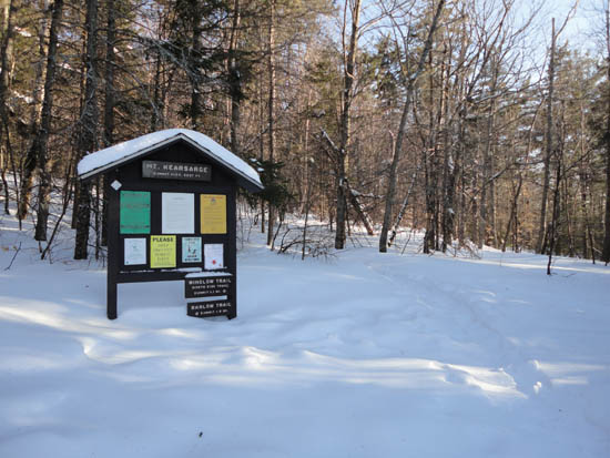
Winslow Trail trailhead

Looking toward the White Mountains from Mt. Kearsarge
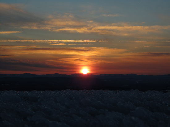
The sunset as seen from Mt. Kearsarge
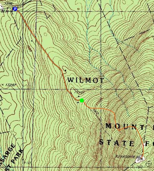

Directions to trailhead: Take Route 11 West from US 4 to Wilmot Flat, then take a left onto Old Winslow Road. At the end of this road, take a left onto Kearsarge Mountain Road. In winter, there is room for a few vehicles to park near the gate of the auto road at the height of land (Twist Hill Road continues downhill). The Winslow Trail trailhead is at the top of the gated auto road.
Back to Mt. Kearsarge Profile
|