Home
States
Colorado
Connecticut
Maine
Massachusetts
New Hampshire
New York
Rhode Island
Utah
Vermont
View All
Lists
NE 4,000 Footers
NE 100 Highest
NH 4,000 Footers
NH 100 Highest
NH 52 With A View
NH Belknap Range
NH Ossipee 10
Links
Trail Conditions
Trip Log
Sunrises
Sunsets
About
|
Mt. Kearsarge
Warner, NH, Wilmot, NH
Trailheads, measurements, times, distances, and maps are all approximate and relative to the hike(s) as shown below.

Looking down the Barlow Trail
Route: Winslow Trail, (Mt. Kearsarge), Winslow Trail, Barlow Trail,
Trails had some mud, but were otherwise in good shape as compared to the muddy mess on the east side of Cardigan yesterday. Nice refreshing breeze at summit, giving relief from lower 90s temperatures.
| Hike Ratings |
|
Getting To Trailhead: |
Easy |
| Destination: |
Mt. Kearsarge |
|
Length: |
Moderate |
|
Steepness: |
Difficult |
|
Navigation: |
Easy |
|
Views: |
Excellent |
|
Crowds: |
Moderate |
|
| Hike Stats |
|
Date Hiked: |
Friday, May 31, 2013 |
| Parking Elevation: |
1,835' |
| Destination: |
Mt. Kearsarge |
| Time Elapsed: |
00:33 |
| Trailhead Elevation: |
1,850' |
| Summit Elevation: |
2,937' |
| Distance: |
1.1 miles |
| Vertical Gain: |
1,095' |
|
|
| Hike Time Elapsed: |
01:32 |
| Hike Vertical Gain: |
1,160' |
|

Winslow Trail trailhead

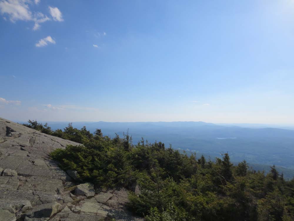
Looking west at Lovewell and Sunapee from near the summit of Mt. Kearsarge
Directions to trailhead: Take Route 11 West from US 4 to Wilmot Flat, then take a left onto Old Winslow Road. At the end of this road, take a left onto Kearsarge Mountain Road. In late spring 2013, the gate on the access road to the upper parking lot is open and a $4 cash (self serve) fee applies.
Back to Mt. Kearsarge Profile
|