Home
States
Colorado
Connecticut
Maine
Massachusetts
New Hampshire
New York
Rhode Island
Utah
Vermont
View All
Lists
NE 4,000 Footers
NE 100 Highest
NH 4,000 Footers
NH 100 Highest
NH 52 With A View
NH Belknap Range
NH Ossipee 10
Links
Trail Conditions
Trip Log
Sunrises
Sunsets
About
|
Mt. Lafayette, Mt. Truman, Mt. Lincoln, Little Haystack Mountain, Mt. Liberty, Mt. Flume
Franconia, NH, Lincoln, NH
Trailheads, measurements, times, distances, and maps are all approximate and relative to the hike(s) as shown below.

Looking up the Greenleaf Trail on the way to Mt. Lafayette
Route: Greenleaf Trail, (Mt. Lafayette), Franconia Ridge Trail, (Mt. Truman), Franconia Ridge Trail, (Mt. Lincoln), Franconia Ridge Trail, (Little Haystack Mountain), Franconia Ridge Trail, (Mt. Liberty), Franconia Ridge Trail, (Mt. Flume), Franconia Ridge Trail, Osseo Trail, Lincoln Woods Trail
Greenleaf Trail was fairly dry up to Eagle Pass. Thereafter, consistent snow in the woods up to the hut (still open this weekend), but the footbed was barebootable.
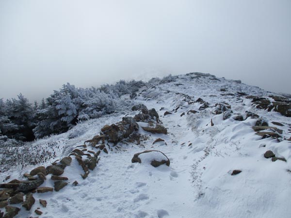
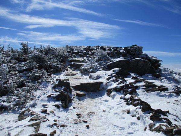
This morning, from the hut to the summit was a mixture of a dusting to an inch of snow, black ice, and blue ice. Some were using spikes, but we opted to bareboot with care. I think a lot melted this afternoon in the sunlight.
From Lafayette to Little Haystack there was a lot of patchy ice and some snow, all of which was melting as the sun hit it. Some wore spikes, we booted with care. Staggering number of people trampling around off trail with no regard for the alpine growth. There's a parallel trail ascending the south slope of Lincoln now.
Some mud pits between Little Haystack and Liberty Spring, with the snow in the woods pretty much going by the latter junction. Some snow in the woods between Liberty and Flume, but not on the footbed. Fall hiking conditions from Flume to Lincoln Woods with some mud in places.
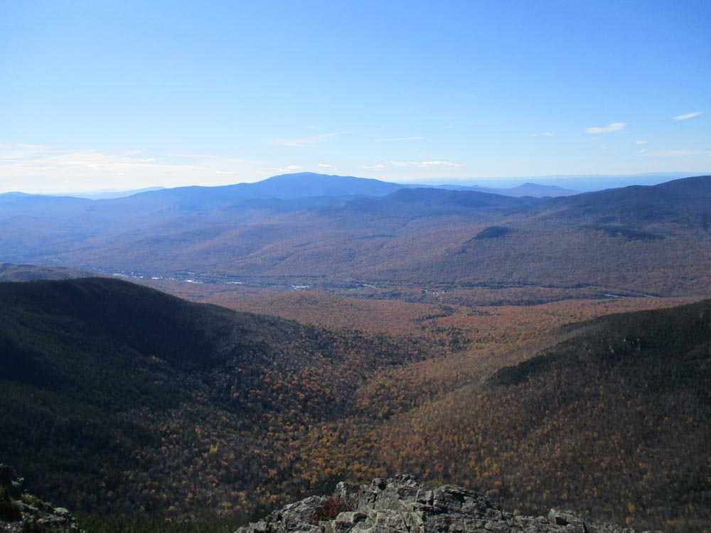
Foliage past peak at the base, but still decent. Pretty much everything above the valley has dropped.
Apart from lower Greenleaf, the trails were packed. Early winter conditions on the ridge with below freezing wind chills, but mild by the time we hit lower Osseo.
| Hike Ratings |
|
Getting To Trailhead: |
Easy |
| Destination: |
Mt. Lafayette |
|
Length: |
Moderate |
|
Steepness: |
Difficult |
|
Navigation: |
Moderate |
|
Views: |
Minimal (due to weather) |
|
Crowds: |
Heavy |
| Destination: |
Mt. Truman |
|
Length: |
Moderate |
|
Steepness: |
Moderate |
|
Navigation: |
Moderate |
|
Views: |
Minimal (due to weather) |
|
Crowds: |
Heavy |
| Destination: |
Mt. Lincoln |
|
Length: |
Moderate |
|
Steepness: |
Very Difficult |
|
Navigation: |
Easy |
|
Views: |
Excellent |
|
Crowds: |
Heavy |
| Destination: |
Little Haystack Mountain |
|
Length: |
Difficult |
|
Steepness: |
Very Difficult |
|
Navigation: |
Easy |
|
Views: |
Excellent |
|
Crowds: |
Heavy |
| Destination: |
Mt. Liberty |
|
Length: |
Difficult |
|
Steepness: |
Very Difficult |
|
Navigation: |
Moderate |
|
Views: |
Excellent |
|
Crowds: |
Heavy |
| Destination: |
Mt. Flume |
|
Length: |
Difficult |
|
Steepness: |
Difficult |
|
Navigation: |
Easy |
|
Views: |
Excellent |
|
Crowds: |
Heavy |
|
| Hike Stats |
|
Date Hiked: |
Sunday, October 14, 2018 |
| Parking Elevation: |
1,965' |
| Destination: |
Mt. Lafayette |
| Time Elapsed: |
02:45 |
| Trailhead Elevation: |
1,980' |
| Summit Elevation: |
5,260' |
| Distance: |
3.7 miles |
| Vertical Gain: |
3,450' |
| Destination: |
Mt. Truman |
| Time Elapsed: |
00:18 |
| Trailhead Elevation: |
5,260' |
| Summit Elevation: |
5,000' |
| Vertical Gain: |
120' |
| Destination: |
Mt. Lincoln |
| Time Elapsed: |
00:10 |
| Trailhead Elevation: |
5,000' |
| Summit Elevation: |
5,089' |
| Vertical Gain: |
219' |
| Destination: |
Little Haystack Mountain |
| Time Elapsed: |
00:27 |
| Trailhead Elevation: |
5,089' |
| Summit Elevation: |
4,780' |
| Vertical Gain: |
150' |
| Destination: |
Mt. Liberty |
| Time Elapsed: |
01:00 |
| Trailhead Elevation: |
4,780' |
| Summit Elevation: |
4,459' |
| Vertical Gain: |
459' |
| Destination: |
Mt. Flume |
| Time Elapsed: |
00:39 |
| Trailhead Elevation: |
4,459' |
| Summit Elevation: |
4,328' |
| Vertical Gain: |
438' |
|
|
| Hike Time Elapsed: |
9:26 |
| Hike Vertical Gain: |
5,026' |
|

The Greenleaf Trail trailhead near I-93

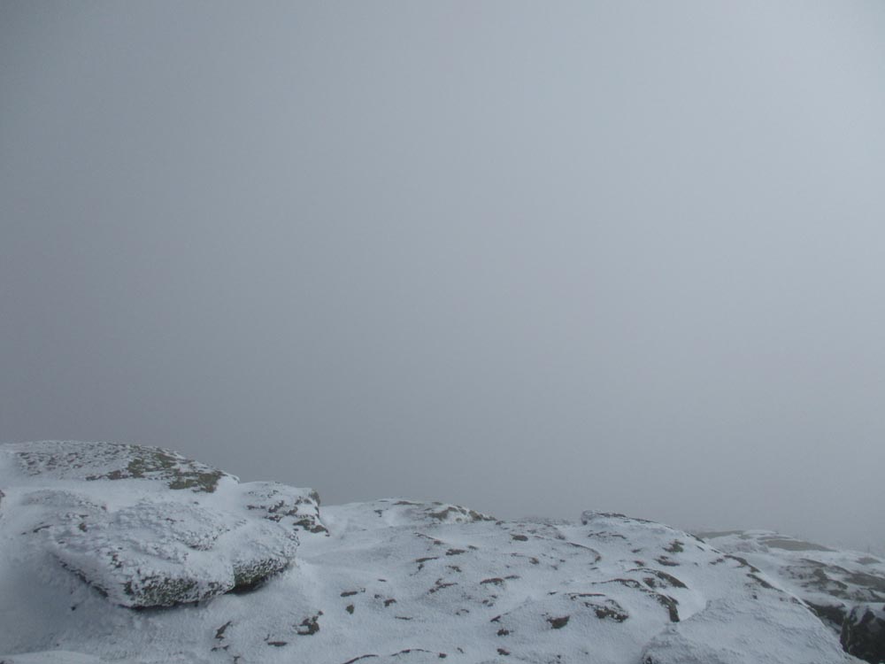
Fog from the Mt. Lafayette summit

The Franconia Ridge Trail on the way to Mt. Truman

Fog on Mt. Truman
The Franconia Ridge Trail on the way to Mt. Lincoln

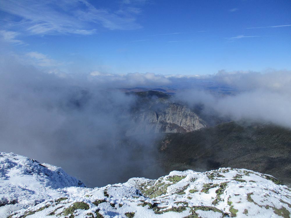
Looking at Cannon Mountain from Mt. Lincoln
The Franconia Ridge Trail between Mt. Lincoln and Little Haystack

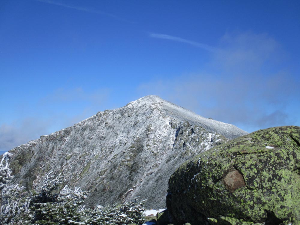
Looking at Mt. Lincoln from near the summit of Little Haystack Mountain

The Franconia Ridge Trail on the way to Mt. Liberty

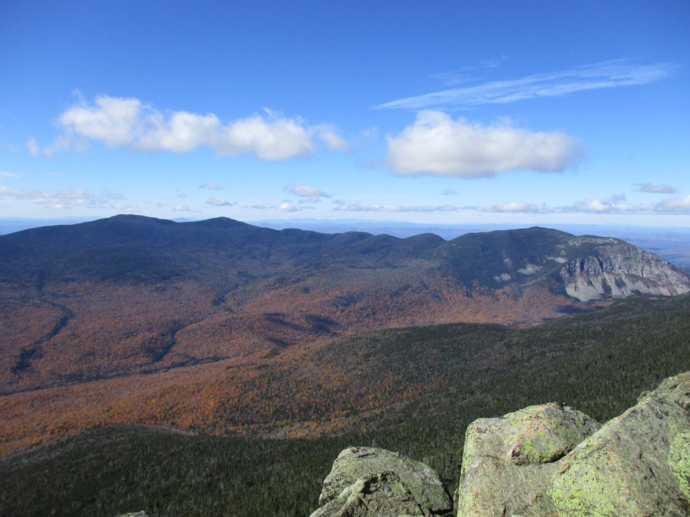
Looking at the Kinsmans and Cannon from Mt. Liberty

The eroded Franconia Ridge Trail between Mt. Liberty and Mt. Flume

Looking at Mt. Moosilauke from Mt. Flume
Directions to trailhead: Take I-93 North to the Cannon Mountain Tramway exit, parking in the Tramway parking area. Walk back under the overpass, taking a left and walking partway up the onramp. The Greenleaf Trail trailhead will be on the right. The Lincoln Woods WMNF fee parking area is located east of Loon ski area off Route 112.
Back to Mt. Lafayette Profile
Back to Mt. Truman Profile
Back to Mt. Lincoln Profile
Back to Little Haystack Mountain Profile
Back to Mt. Liberty Profile
Back to Mt. Flume Profile
|