Home
States
Colorado
Connecticut
Maine
Massachusetts
New Hampshire
New York
Rhode Island
Utah
Vermont
View All
Lists
NE 4,000 Footers
NE 100 Highest
NH 4,000 Footers
NH 100 Highest
NH 52 With A View
NH Belknap Range
NH Ossipee 10
Links
Trail Conditions
Trip Log
Sunrises
Sunsets
About
|
Mt. Mack, Mt. Klem, Rand Mountain
Gilford, NH
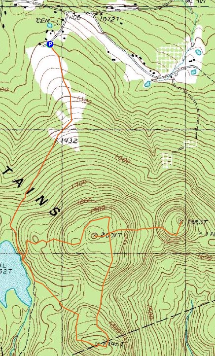
Trailheads, measurements, times, distances, and maps are all approximate and relative to the hike(s) as shown below.

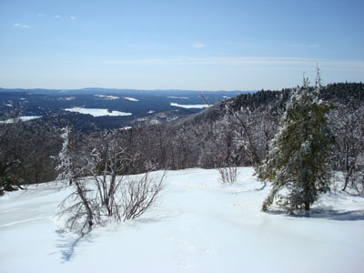
Looking up the trail on the way to the Mt. Mack summit
Route: Round Pond Trail, Red-Orange Trail, (Mt. Mack), Red Trail, bushwack, (Mt. Klem), bushwack, Quarry Trail, (Rand Mountain), Quarry Trail, Red Trail, Round Pond Trail
While high winds in the forecast, I decided to stay in the trees - a perfect time to hang out in the Belknaps.
Arriving at the Round Pond Trail trailhead, I was a bit worried to see logging equipment and a muddy road. In a few weeks, this will be a disaster! Fortunately, the logging operation only goes up the first portion of the trail, departing to the east at the start of the fields.
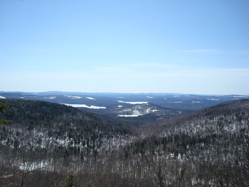
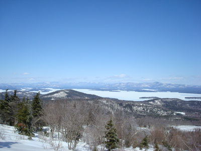
The trail was mostly packed by snowmobile, so I barebooted all the way past Round Pond and to Mt. Mack. The views from the outlooks around Mt. Mack were superb - even Mt. Monadnock was visible!
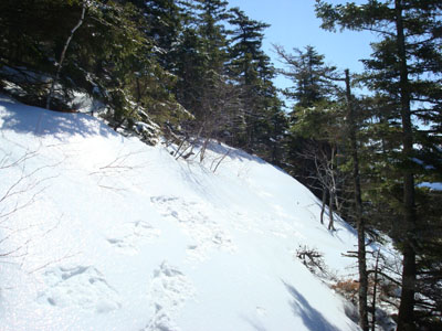
After putting on my new MSR snowshoes for traction, as the next stretch of trail wasn't broken had a glaze of ice over it, I headed downhill into the col, and then up to Mt. Klem.
After bushwacking to the summit of Mt. Klem, I headed toward Rand Mountain on the icy Quarry Trail. As I ascended up from the col, I had to pull out my ice axe, as I couldn't grip into the steep icy slope confidently enough.
The views from the Rand Mountain outlook were decent, but nowhere near as nice as those on Mt. Mack.
After reaching the wooded Rand Mountain summit, I turned around and headed back to Mt. Klem and to the northern vista.
The open slope was solid ice, so I had to anchor my backpack with my ice axe in order to stop for lunch. With the wide views of the lakes, this is possibly my favorite places in the Belknap Range.
I didn't see a single person until the descent - and didn't so much as hear a snowmobile the entire day.
| Hike Ratings |
|
Getting To Trailhead: |
Easy |
| Destination: |
Mt. Mack |
|
Length: |
Moderate |
|
Steepness: |
Moderate |
|
Navigation: |
Moderate |
|
Views: |
Excellent |
|
Crowds: |
Minimal |
| Destination: |
Mt. Klem |
|
Length: |
Moderate |
|
Steepness: |
Difficult |
|
Navigation: |
Moderate |
|
Views: |
Excellent |
|
Crowds: |
Minimal |
| Destination: |
Rand Mountain |
|
Length: |
Moderate |
|
Steepness: |
Difficult |
|
Navigation: |
Moderate |
|
Views: |
Excellent |
|
Crowds: |
Minimal |
|
| Hike Stats |
|
Date Hiked: |
Saturday, March 22, 2008 |
| Hike Commenced: |
10:01 AM |
| Parking Elevation: |
1,200' |
| Destination: |
Mt. Mack |
| Ascent Commenced: |
10:01 AM |
| Summit Reached: |
11:00 AM |
| Time Elapsed: |
00:59 |
| Trailhead Elevation: |
1,205' |
| Summit Elevation: |
1,945' |
| Vertical Gain: |
810' |
| Destination: |
Mt. Klem |
| Ascent Commenced: |
11:08 AM |
| Summit Reached: |
11:33 AM |
| Time Elapsed: |
00:25 |
| Trailhead Elevation: |
1,945' |
| Summit Elevation: |
2,001' |
| Vertical Gain: |
266' |
| Destination: |
Rand Mountain |
| Ascent Commenced: |
11:33 AM |
| Summit Reached: |
12:01 PM |
| Time Elapsed: |
00:28 |
| Trailhead Elevation: |
2,001' |
| Summit Elevation: |
1,883' |
| Vertical Gain: |
243' |
|
|
| Hike Ended: |
1:42 PM |
| Hike Time Elapsed: |
03:41 |
| Hike Vertical Gain: |
1,825' |
|
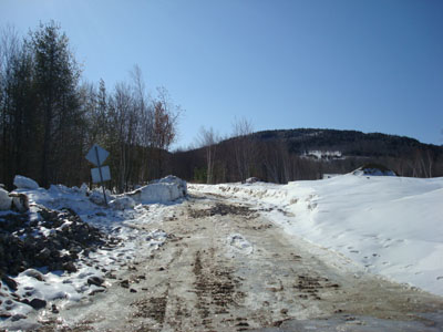
The Round Pond Trail trailhead off Grant Road
Looking at Piper Mountain from the ledges near the Mt. Mack summit
Looking down the trail between Mt. Mack and Mt. Klem
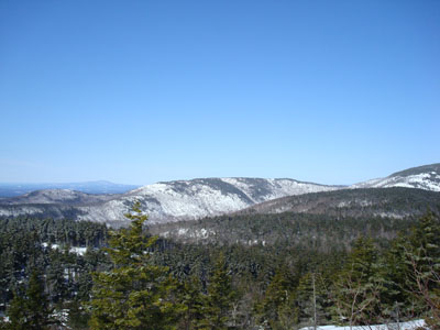
Looking north at the Sandwich Range and Ossipee Mountains from the viewpoint north of the Mt. Klem summit
The Quarry Trail on the way to Rand Mountain

Looking south from the ledges near the Rand Mountain summit


Directions to trailhead: ---Please note, as of Fall 2008, this trailhead is reportedly closed to hikers.--- From Alton, take Route 11 West to Route 11A West. Take a left onto Grant Road - the small parking area and trailhead are on the left, just before the signs warning of road barriers, etc.
Back to Mt. Mack Profile
Back to Mt. Klem Profile
Back to Rand Mountain Profile
|