Home
States
Colorado
Connecticut
Maine
Massachusetts
New Hampshire
New York
Rhode Island
Utah
Vermont
View All
Lists
NE 4,000 Footers
NE 100 Highest
NH 4,000 Footers
NH 100 Highest
NH 52 With A View
NH Belknap Range
NH Ossipee 10
Links
Trail Conditions
Trip Log
Sunrises
Sunsets
About
|
Mt. Mack, Mt. Klem
Gilmanton, NH, Gilford, NH
Trailheads, measurements, times, distances, and maps are all approximate and relative to the hike(s) as shown below.
Looking up Orange Trail on the Mack Ridge
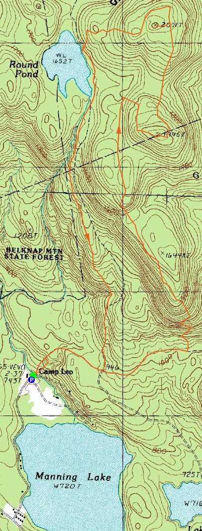
Route: Red/Blue Trail, Orange Trail, Red/Orange Trail, (Mt. Mack), Red Trail, bushwack, (Mt. Klem), bushwack, Red Trail, Red/Blue Trail
Since I had skipped the previous two days due to the weather, I decided I needed to get out and get some exercise, regardless of the rainy forecast. In my previous visits to the peaks around Round Pond, I had ascended via Grant Road. Unfortunately, this trailhead appears to be closed to hikers. Thus, I figured it wouldn't be a bad day to try out another approach.
Arriving at the trailhead in the rain, we quickly set foot across the bridge at the camp and up the dirt road of sorts. Seeing a trail going straight up the hill, I figured this might be the Red/Blue Trail. As we reached a height of land on that trail and it subsequently disappeared (without reaching any sort of view or other destination), I decided to bushwhack north toward the road again. Sure enough, the road was the Red/Blue Trail.
After awhile, we passed the Red Trail trailhead and decided to continue on to the Orange Trail, as to make the hike more of a loop.
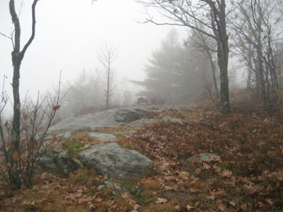
Once finding the trail after the somewhat confusing dirt road situation, it was pretty easy to follow - the foot bed was fairly well established, and there was an abundance of cairns and wooden trail markers. The rock slide at the beginning of the trail was somewhat steep (and the leaves slippery), but it seemed more like a random boulder field (a la the Bayle Mountain Trail) than a slide (a la Owl's Head, Tripyramid, etc.) in my opinion.
Soon, we were at the top of that ridge. From there, it was pretty gradual going - and likely quite scenic when things aren't completely socked in by fog and clouds.
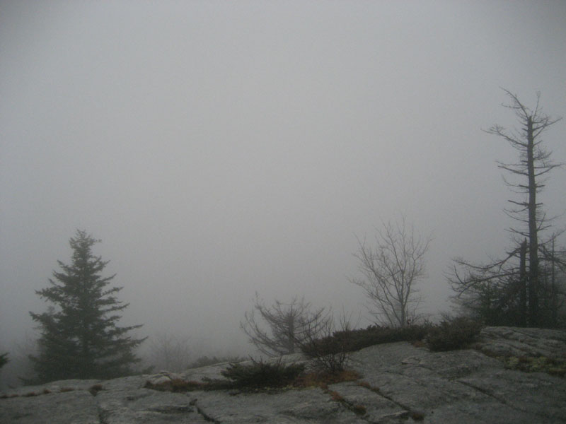
Soon, we were turning uphill at the next trail junction and heading to the Mt. Mack summit. While this is generally a scenic mountain, the views were non-existant due to the clouds and fog.
Our next stop was Mt. Klem. This section of trail seemed to pass by a lot faster than I had remember when I did it on snow shoes the previous winter.
After bushwhacking to the true summit of Klem, we went to the viewpoint (once again, fog and clouds), and then down to Round Pond.
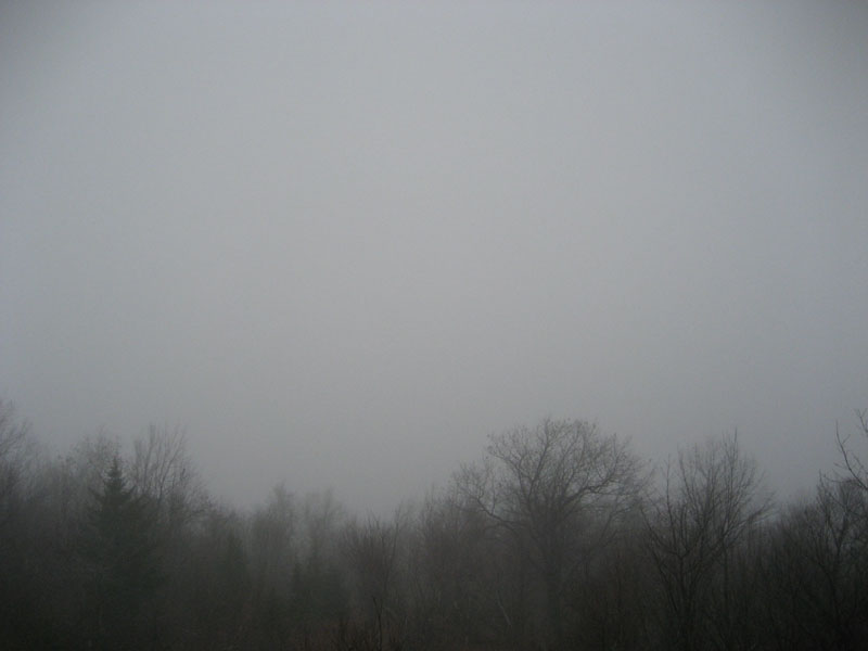
Round Pond was quite neat - the lack of visibility made the pond look endless.
From there, we headed down the Red Trail, which looks to have some great views on a nice day. Nearing the Red/Blue Trail, I found the dirt road situation once again a bit confusing, but nonetheless we found our way back to the camp with relative ease.
Despite the clouds, and at near the end of the hike rain, it was a nice hike. Depending upon the plowing situation, it could promise to be a nice snowshoe hike in the winter.
| Hike Ratings |
|
Getting To Trailhead: |
Easy |
| Destination: |
Mt. Mack |
|
Length: |
Moderate |
|
Steepness: |
Difficult |
|
Navigation: |
Moderate |
|
Views: |
Minimal (due to weather) |
|
Crowds: |
Minimal |
| Destination: |
Mt. Klem |
|
Length: |
Moderate |
|
Steepness: |
Difficult |
|
Navigation: |
Easy |
|
Views: |
Minimal (due to weather) |
|
Crowds: |
Minimal |
|
| Hike Stats |
|
Date Hiked: |
Saturday, November 15, 2008 |
| Hike Commenced: |
9:49 AM |
| Parking Elevation: |
740' |
| Destination: |
Mt. Mack |
| Ascent Commenced: |
9:50 AM |
| Summit Reached: |
11:12 AM |
| Time Elapsed: |
01:22 |
| Trailhead Elevation: |
740' |
| Summit Elevation: |
1,945' |
| Vertical Gain: |
1,365' |
| Destination: |
Mt. Klem |
| Ascent Commenced: |
11:18 AM |
| Summit Reached: |
11:37 AM |
| Time Elapsed: |
00:19 |
| Trailhead Elevation: |
1,945' |
| Summit Elevation: |
2,001' |
| Vertical Gain: |
266' |
|
|
| Hike Vertical Gain: |
1,781' |
|
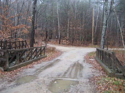
The Red-Blue Trail trailhead at Camp Bell

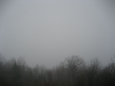
Looking at floating moisture from near the Mt. Mack summit
Looking up the trail between Mt. Mack and Mt. Klem
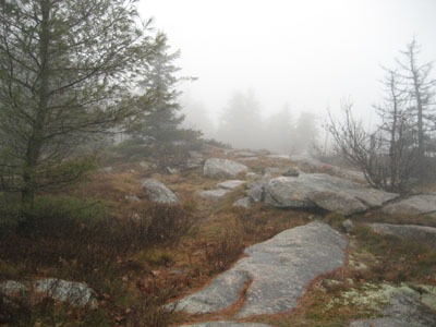
Looking at very scenic fog from near the Mt. Klem summit
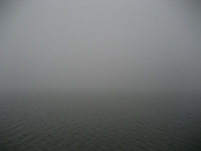
Round Pond in the mist


Directions to trailhead: From Route 107, take Route 140 east into Gilmanton. Take a left onto Crystal Lake Road, bearing left to stay on it (when Mountain Road goes straight). After passing Crystal Lake, the road turns into Guinea Ridge Road. Take a right next to some cabins onto Manning Lake Road (this is inaccurately labelled as Camp Leo Road and Moulton Road on some maps...the current road sign says Manning Lake Road). There is a small parking area on the left just before reaching the area with the camp buildings. The Red-Blue Trail starts at the bridge just beyond the main building, in the form of a dirt road.
Back to Mt. Mack Profile
Back to Mt. Klem Profile
|