Home
States
Colorado
Connecticut
Maine
Massachusetts
New Hampshire
New York
Rhode Island
Utah
Vermont
View All
Lists
NE 4,000 Footers
NE 100 Highest
NH 4,000 Footers
NH 100 Highest
NH 52 With A View
NH Belknap Range
NH Ossipee 10
Links
Trail Conditions
Trip Log
Sunrises
Sunsets
About
|
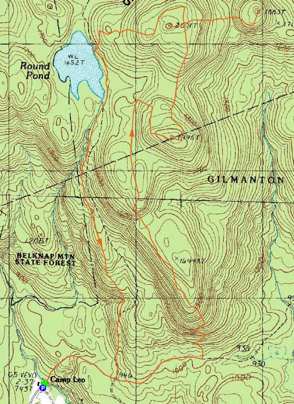
Mt. Mack, Mt. Klem, Rand Mountain
Gilmanton, NH, Gilford, NH
Trailheads, measurements, times, distances, and maps are all approximate and relative to the hike(s) as shown below.
The Orange Trail on the Mack Ridge
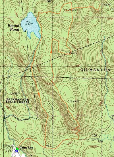
Route: Red/Blue Trail, Orange Trail, Red/Orange Trail, (Mt. Mack), Red Trail, bushwack, (Mt. Klem), bushwhack, Quarry Trail, (Rand Mountain), Quarry Trail, Red Trail, Red/Blue Trail
With shoulder season making hiking in the Whites a bit more tricky, we headed south to the Belknaps for hike in the middle of the range.
Starting at Camp Bell, we followed the dirt road past the Red Trail, to the Orange Trail (very easy to miss). From there, we climbed up the steep, rocky face of the Mack Ridge to the height of land, from where we had multiple nice views.
Reaching Mt. Mack, we had hazy but good views from two different viewpoints, then headed to Mt. Klem. After a short bushwhack to that summit, we headed down the Quarry Trail, steeply into the col then up to Rand Mountain. The descent and ascent were made a bit challenging due to slippery leaves and black ice. After taking in views from the near summit vista, we went to the highpoint, then headed back to Mt. Klem.
Back on the Red Trail on Mt. Klem, we headed north to the tremendous vista, from where we could see the lake, the nearer mountain ranges, and in the distance, a white Presidential Range.
After that, we headed down to Round Pond, then down the Red Trail to the dirt roads and eventually back to Camp Bell.
| Hike Ratings |
|
Getting To Trailhead: |
Easy |
| Destination: |
Mt. Mack |
|
Length: |
Moderate |
|
Steepness: |
Difficult |
|
Navigation: |
Moderate |
|
Views: |
Excellent |
|
Crowds: |
Minimal |
| Destination: |
Mt. Klem |
|
Length: |
Moderate |
|
Steepness: |
Difficult |
|
Navigation: |
Easy |
|
Views: |
Excellent |
|
Crowds: |
Minimal |
| Destination: |
Rand Mountain |
|
Length: |
Moderate |
|
Steepness: |
Difficult |
|
Navigation: |
Easy |
|
Views: |
Excellent |
|
Crowds: |
Minimal |
|
| Hike Stats |
|
Date Hiked: |
Sunday, November 21, 2010 |
| Hike Commenced: |
8:08 AM |
| Parking Elevation: |
740' |
| Destination: |
Mt. Mack |
| Ascent Commenced: |
8:08 AM |
| Summit Reached: |
10:04 AM |
| Time Elapsed: |
01:56 |
| Trailhead Elevation: |
740' |
| Summit Elevation: |
1,945' |
| Vertical Gain: |
1,365' |
| Destination: |
Mt. Klem |
| Ascent Commenced: |
10:15 AM |
| Summit Reached: |
10:39 AM |
| Time Elapsed: |
00:24 |
| Trailhead Elevation: |
1,945' |
| Summit Elevation: |
2,001' |
| Vertical Gain: |
266' |
| Destination: |
Rand Mountain |
| Ascent Commenced: |
10:44 AM |
| Summit Reached: |
11:10 AM |
| Time Elapsed: |
00:26 |
| Trailhead Elevation: |
2,001' |
| Summit Elevation: |
1,883' |
| Vertical Gain: |
243' |
|
|
| Hike Ended: |
1:36 PM |
| Hike Time Elapsed: |
05:28 |
| Hike Vertical Gain: |
2,236' |
|
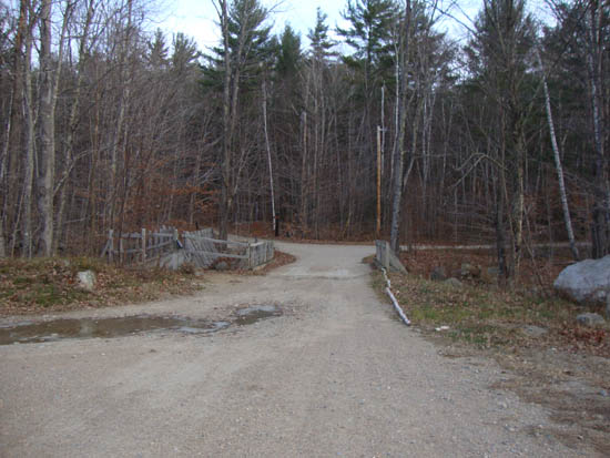
The Red-Blue Trail trailhead at Camp Bell
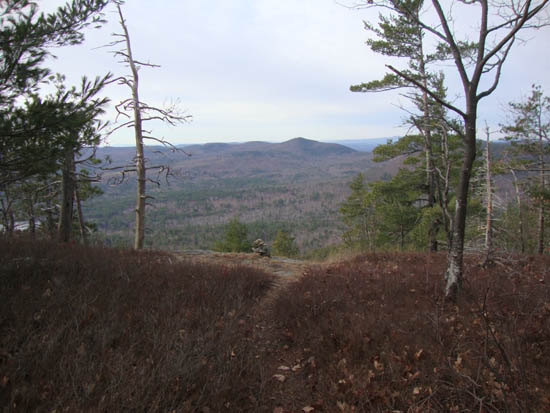
Straightback Mountain as seen from near the Mt. Mack summit

Looking up the trail between Mt. Mack and Mt. Klem
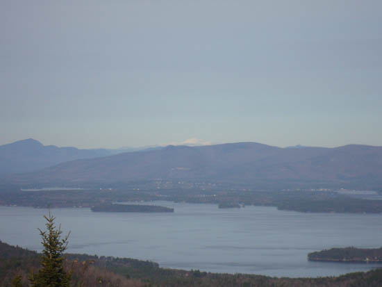
Looking Mt. Washington seen over the Ossipees from the Mt. Klem vista
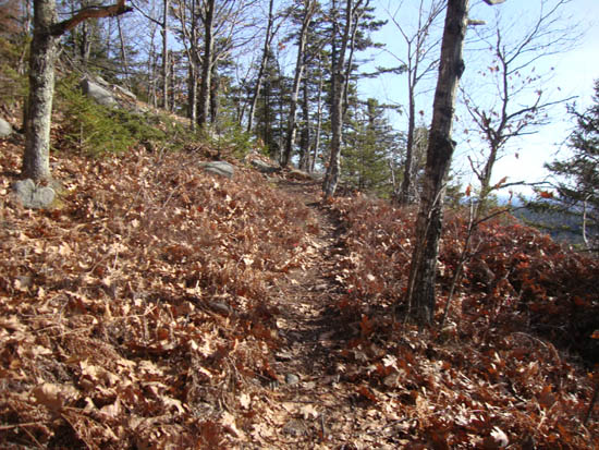
The Quarry Trail to Rand Mountain

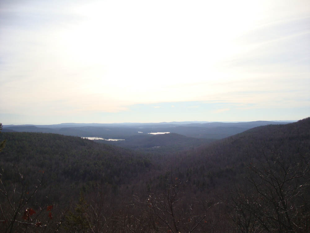
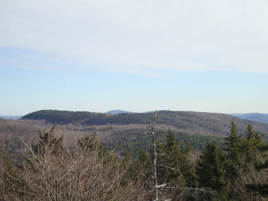
Looking southwest from near the summit of Rand Mountain

Directions to trailhead: From Route 107, take Route 140 east into Gilmanton. Take a left onto Crystal Lake Road, bearing left to stay on it (when Mountain Road goes straight). After passing Crystal Lake, the road turns into Guinea Ridge Road. Take a right next to some cabins onto Manning Lake Road (this is inaccurately labelled as Camp Leo Road and Moulton Road on some maps...the current road sign says Manning Lake Road). There is a small parking area on the left just before reaching the area with the camp buildings. The Red-Blue Trail starts at the bridge just beyond the main building, in the form of a dirt road.
Back to Mt. Mack Profile
Back to Mt. Klem Profile
Back to Rand Mountain Profile
|